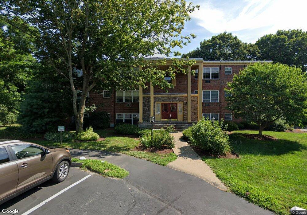
35 Woodsum Dr Unit 12 Braintree, MA 02184
North Braintree NeighborhoodEstimated Value: $338,000 - $462,000
2
Beds
1
Bath
803
Sq Ft
$463/Sq Ft
Est. Value
About This Home
This home is located at 35 Woodsum Dr Unit 12, Braintree, MA 02184 and is currently estimated at $371,809, approximately $463 per square foot. 35 Woodsum Dr Unit 12 is a home located in Norfolk County with nearby schools including Braintree High School, Meeting House Montessori School, and Thayer Academy.
Ownership History
Date
Name
Owned For
Owner Type
Purchase Details
Closed on
Aug 5, 2003
Sold by
Woodsum Dr Rt
Bought by
Schichtel Mary
Current Estimated Value
Home Financials for this Owner
Home Financials are based on the most recent Mortgage that was taken out on this home.
Original Mortgage
$165,600
Outstanding Balance
$71,116
Interest Rate
5.28%
Mortgage Type
Purchase Money Mortgage
Estimated Equity
$300,693
Purchase Details
Closed on
Oct 3, 1988
Sold by
Oriordan Rt
Bought by
Yudis Ruth E
Create a Home Valuation Report for This Property
The Home Valuation Report is an in-depth analysis detailing your home's value as well as a comparison with similar homes in the area
Home Values in the Area
Average Home Value in this Area
Purchase History
| Date | Buyer | Sale Price | Title Company |
|---|---|---|---|
| Schichtel Mary | $184,000 | -- | |
| Yudis Ruth E | $108,000 | -- |
Source: Public Records
Mortgage History
| Date | Status | Borrower | Loan Amount |
|---|---|---|---|
| Open | Yudis Ruth E | $165,600 |
Source: Public Records
Tax History Compared to Growth
Tax History
| Year | Tax Paid | Tax Assessment Tax Assessment Total Assessment is a certain percentage of the fair market value that is determined by local assessors to be the total taxable value of land and additions on the property. | Land | Improvement |
|---|---|---|---|---|
| 2025 | $3,238 | $324,400 | $0 | $324,400 |
| 2024 | $2,787 | $294,000 | $0 | $294,000 |
| 2023 | $2,948 | $302,100 | $0 | $302,100 |
| 2022 | $2,880 | $289,400 | $0 | $289,400 |
| 2021 | $2,880 | $289,400 | $0 | $289,400 |
| 2020 | $2,524 | $256,000 | $0 | $256,000 |
| 2019 | $2,394 | $237,300 | $0 | $237,300 |
| 2018 | $2,399 | $227,600 | $0 | $227,600 |
| 2017 | $2,159 | $201,000 | $0 | $201,000 |
| 2016 | $1,948 | $177,400 | $0 | $177,400 |
| 2015 | $1,802 | $162,800 | $0 | $162,800 |
| 2014 | $1,835 | $160,700 | $0 | $160,700 |
Source: Public Records
Map
Nearby Homes
- 491 Washington St Unit 1
- 37 Monatiquot Ave
- 29 Norton St
- 65 Tremont St
- 10 Cochato Rd
- 14-20 Randall Ave
- 175 West St
- 17 Judson St
- 6 Franklin St
- 305 Franklin St
- 605 Middle St Unit 38
- 78 Windemere Cir
- 8 Vinton Ave Unit 10
- 414 John Mahar Hwy Unit 312
- 418 John Mahar Hwy Unit 408
- 145 Hancock St Unit 214
- 42 Spring St
- 53 Parkside Ave
- 428 John Mahar Hwy Unit 301
- 422 John Mahar Hwy Unit 305
- 35 Woodsum Dr Unit 11
- 35 Woodsum Dr Unit 10
- 35 Woodsum Dr Unit 9
- 35 Woodsum Dr Unit 8
- 35 Woodsum Dr Unit 7
- 35 Woodsum Dr Unit 6
- 35 Woodsum Dr Unit 5
- 35 Woodsum Dr Unit 4
- 35 Woodsum Dr Unit 2
- 35 Woodsum Dr Unit 1
- 35 Woodsum Dr Unit 1,35
- 35 Woodsum Dr Unit 2 35
- 35 Woodsum Dr Unit One
- 42 Georganna St
- 38 Georganna St
- 5 Woodsum Dr Unit 12
- 5 Woodsum Dr Unit 11
- 5 Woodsum Dr Unit 10
- 5 Woodsum Dr Unit 9
- 5 Woodsum Dr Unit 8