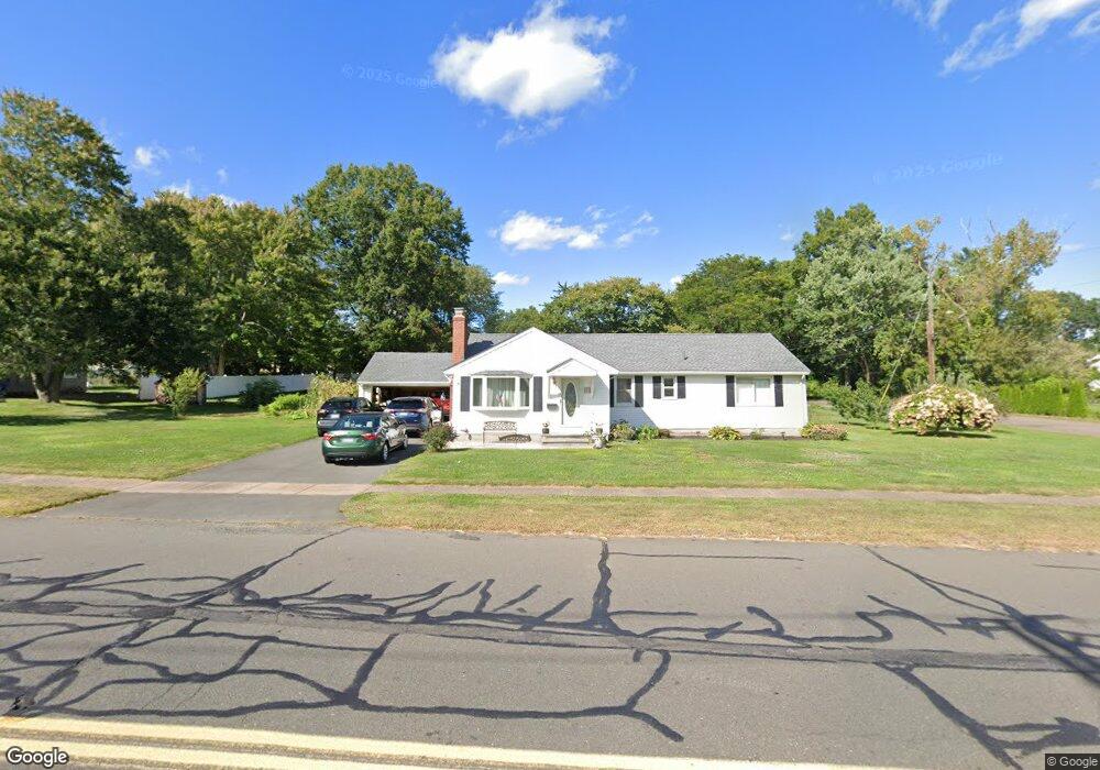
350 Griswold Rd Wethersfield, CT 06109
Estimated Value: $419,000 - $431,031
3
Beds
3
Baths
1,456
Sq Ft
$292/Sq Ft
Est. Value
About This Home
This home is located at 350 Griswold Rd, Wethersfield, CT 06109 and is currently estimated at $425,008, approximately $291 per square foot. 350 Griswold Rd is a home located in Hartford County with nearby schools including Highcrest School, Woodcrest Elementary School, and Silas Deane Middle School.
Ownership History
Date
Name
Owned For
Owner Type
Purchase Details
Closed on
Mar 1, 2001
Sold by
Malec Janis
Bought by
Puzzo Janice A and Puzzo Frank J
Current Estimated Value
Home Financials for this Owner
Home Financials are based on the most recent Mortgage that was taken out on this home.
Original Mortgage
$148,000
Interest Rate
7%
Purchase Details
Closed on
Sep 11, 1991
Sold by
Renstrom Richard R and Renstrom Doreen G
Bought by
Malec Janis K
Create a Home Valuation Report for This Property
The Home Valuation Report is an in-depth analysis detailing your home's value as well as a comparison with similar homes in the area
Home Values in the Area
Average Home Value in this Area
Purchase History
| Date | Buyer | Sale Price | Title Company |
|---|---|---|---|
| Puzzo Janice A | $185,000 | -- | |
| Malec Janis K | $151,500 | -- |
Source: Public Records
Mortgage History
| Date | Status | Borrower | Loan Amount |
|---|---|---|---|
| Closed | Malec Janis K | $148,000 | |
| Closed | Malec Janis K | $148,000 | |
| Previous Owner | Malec Janis K | $174,500 | |
| Previous Owner | Malec Janis K | $140,400 |
Source: Public Records
Tax History Compared to Growth
Tax History
| Year | Tax Paid | Tax Assessment Tax Assessment Total Assessment is a certain percentage of the fair market value that is determined by local assessors to be the total taxable value of land and additions on the property. | Land | Improvement |
|---|---|---|---|---|
| 2025 | $9,983 | $242,190 | $90,850 | $151,340 |
| 2024 | $7,253 | $167,820 | $69,300 | $98,520 |
| 2023 | $7,012 | $167,820 | $69,300 | $98,520 |
| 2022 | $6,531 | $158,980 | $69,300 | $89,680 |
| 2021 | $6,466 | $158,980 | $69,300 | $89,680 |
| 2020 | $6,469 | $158,980 | $69,300 | $89,680 |
| 2019 | $6,477 | $158,980 | $69,300 | $89,680 |
| 2018 | $6,207 | $152,200 | $63,600 | $88,600 |
| 2017 | $6,053 | $152,200 | $63,600 | $88,600 |
| 2016 | $5,866 | $152,200 | $63,600 | $88,600 |
| 2015 | $5,813 | $152,200 | $63,600 | $88,600 |
| 2014 | $5,592 | $152,200 | $63,600 | $88,600 |
Source: Public Records
Map
Nearby Homes
- 15 Cheston Cir
- 355 Griswold Rd
- 345 Griswold Rd
- 332 Griswold Rd
- 23 Cheston Cir
- 364 Griswold Rd
- 326 Griswold Rd
- 335 Griswold Rd
- 33 Cheston Cir
- 372 Griswold Rd
- 323 Griswold Rd
- 375 Griswold Rd
- 41 Cheston Cir
- 300 Griswold Rd
- 30 Dorlen Cir
- 34 Dorlen Cir
- 315 Griswold Rd
- 15 Fairlane Dr
- 20 Dorlen Cir
- 388 Griswold Rd