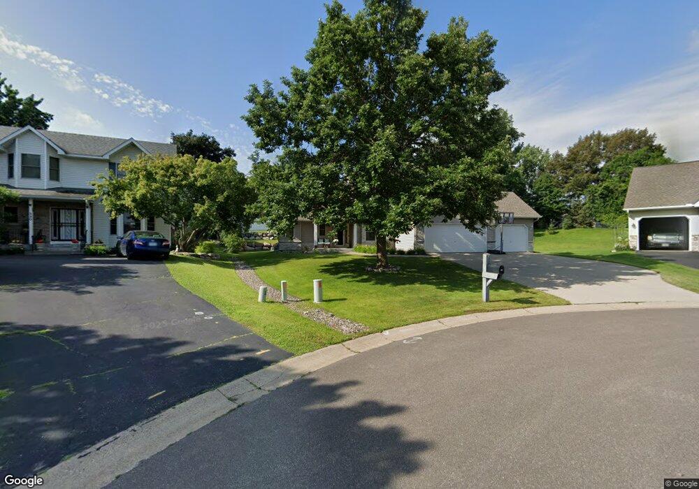
350 Stanbridge Cir Saint Paul, MN 55113
South Owasso NeighborhoodEstimated Value: $585,000 - $729,000
5
Beds
3
Baths
2,020
Sq Ft
$324/Sq Ft
Est. Value
About This Home
This home is located at 350 Stanbridge Cir, Saint Paul, MN 55113 and is currently estimated at $653,934, approximately $323 per square foot. 350 Stanbridge Cir is a home located in Ramsey County with nearby schools including Emmet D. Williams Elementary School, Roseville Area Middle School, and Roseville Area Senior High School.
Ownership History
Date
Name
Owned For
Owner Type
Purchase Details
Closed on
May 28, 2003
Sold by
Okazaki Ian and Gaskill Lorena
Bought by
Gebrielli Dave and Gebrielli Debra
Current Estimated Value
Purchase Details
Closed on
Nov 30, 1998
Sold by
Phillips Norine and Phillips Paul
Bought by
Okazaki Ian and Gaskill Lorena
Purchase Details
Closed on
Dec 31, 1996
Sold by
Kettler Construction Inc
Bought by
Phillips Norine M
Create a Home Valuation Report for This Property
The Home Valuation Report is an in-depth analysis detailing your home's value as well as a comparison with similar homes in the area
Home Values in the Area
Average Home Value in this Area
Purchase History
| Date | Buyer | Sale Price | Title Company |
|---|---|---|---|
| Gebrielli Dave | $402,000 | -- | |
| Okazaki Ian | $235,000 | -- | |
| Phillips Norine M | $219,939 | -- |
Source: Public Records
Tax History Compared to Growth
Tax History
| Year | Tax Paid | Tax Assessment Tax Assessment Total Assessment is a certain percentage of the fair market value that is determined by local assessors to be the total taxable value of land and additions on the property. | Land | Improvement |
|---|---|---|---|---|
| 2025 | $7,006 | $565,700 | $105,000 | $460,700 |
| 2023 | $7,006 | $495,200 | $94,500 | $400,700 |
| 2022 | $6,600 | $501,300 | $94,500 | $406,800 |
| 2021 | $6,200 | $435,800 | $90,000 | $345,800 |
| 2020 | $6,218 | $437,000 | $80,000 | $357,000 |
| 2019 | $6,386 | $410,500 | $80,000 | $330,500 |
| 2018 | $6,262 | $409,900 | $84,100 | $325,800 |
| 2017 | $6,174 | $392,200 | $84,100 | $308,100 |
| 2016 | $6,088 | $0 | $0 | $0 |
| 2015 | $6,760 | $398,400 | $81,700 | $316,700 |
| 2014 | $6,338 | $0 | $0 | $0 |
Source: Public Records
Map
Nearby Homes
- 2970 Western Ave N
- 2841 Galtier St
- 405 Judith Ave
- 2814 Matilda St
- 2821 Galtier St
- 387 Iona Ln
- 2802 Marion St
- 2687 Galtier St
- 2720 MacKubin St
- 540 Woodhill Dr Unit 71
- 2730 Dale St N Unit D101
- 2720 Dale St N Unit C208
- 2710 Dale St N Unit B212
- 417 W Horseshoe Dr
- 556 County Road C W
- 667 County Road C W
- 2939 W Owasso Blvd
- 405 Brooks Ave W
- 111 Yorkton Ridge
- 2507 Woodbridge St
- 360 Stanbridge Cir
- 340 Stanbridge Cir
- 355 Millwood Ave
- 363 Millwood Ave
- 343 Millwood Ave
- 2942 Western Ave N
- 361 Stanbridge Cir
- 2949 Farrington St
- 2955 Farrington St
- 2960 Western Ave N
- 371 Millwood Ave
- 333 Millwood Ave
- 351 Stanbridge Cir
- 341 Stanbridge Cir
- 2973 Farrington St
- 350 Millwood Ave
- 340 Millwood Ave
- 360 Millwood Ave
- 2980 Western Ave N
- 330 Millwood St