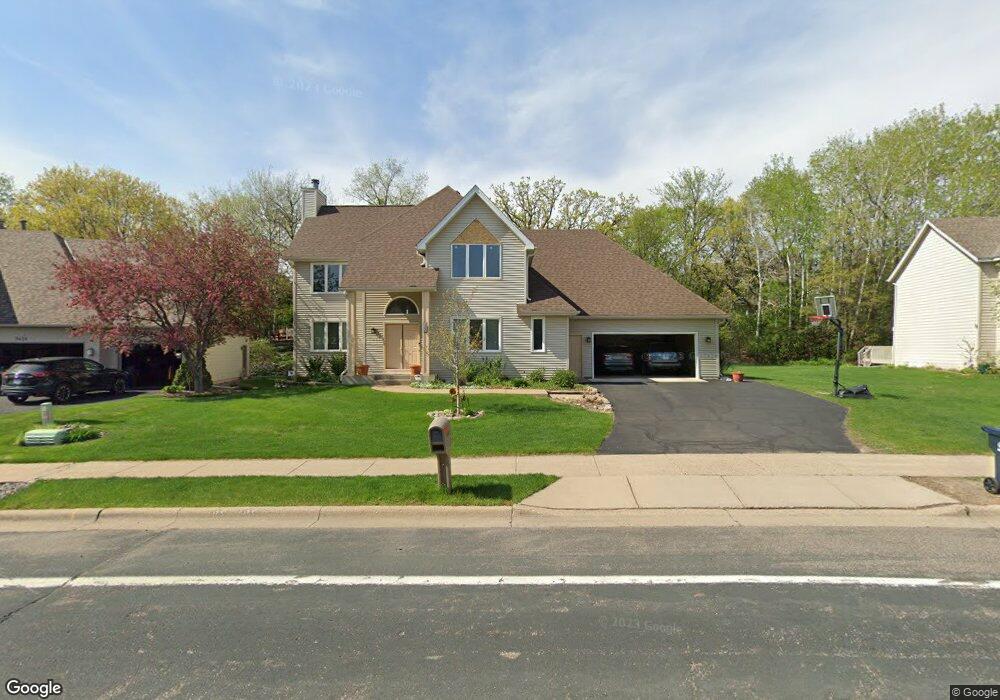
3500 E Burnsville Pkwy Burnsville, MN 55337
Estimated Value: $517,000 - $567,000
3
Beds
3
Baths
2,987
Sq Ft
$179/Sq Ft
Est. Value
About This Home
This home is located at 3500 E Burnsville Pkwy, Burnsville, MN 55337 and is currently estimated at $534,348, approximately $178 per square foot. 3500 E Burnsville Pkwy is a home located in Dakota County with nearby schools including Oak Ridge Elementary School, Black Hawk Middle School, and Eastview Senior High School.
Ownership History
Date
Name
Owned For
Owner Type
Purchase Details
Closed on
Aug 12, 2019
Sold by
Brennan Kathleen Annastacia
Bought by
Maisa Abuhamed Suhail and Maisa Algaddoumi
Current Estimated Value
Home Financials for this Owner
Home Financials are based on the most recent Mortgage that was taken out on this home.
Original Mortgage
$331,000
Outstanding Balance
$289,895
Interest Rate
3.7%
Mortgage Type
New Conventional
Estimated Equity
$244,453
Create a Home Valuation Report for This Property
The Home Valuation Report is an in-depth analysis detailing your home's value as well as a comparison with similar homes in the area
Home Values in the Area
Average Home Value in this Area
Purchase History
| Date | Buyer | Sale Price | Title Company |
|---|---|---|---|
| Maisa Abuhamed Suhail | $381,000 | Burnet Title |
Source: Public Records
Mortgage History
| Date | Status | Borrower | Loan Amount |
|---|---|---|---|
| Open | Maisa Abuhamed Suhail | $331,000 |
Source: Public Records
Tax History Compared to Growth
Tax History
| Year | Tax Paid | Tax Assessment Tax Assessment Total Assessment is a certain percentage of the fair market value that is determined by local assessors to be the total taxable value of land and additions on the property. | Land | Improvement |
|---|---|---|---|---|
| 2024 | $5,568 | $476,300 | $149,000 | $327,300 |
| 2023 | $5,568 | $469,400 | $149,100 | $320,300 |
| 2022 | $5,066 | $462,400 | $148,800 | $313,600 |
| 2021 | $4,796 | $423,300 | $145,600 | $277,700 |
| 2020 | $4,854 | $394,200 | $138,700 | $255,500 |
| 2019 | $4,555 | $389,000 | $132,100 | $256,900 |
| 2018 | $4,667 | $373,800 | $125,800 | $248,000 |
| 2017 | $4,516 | $374,900 | $119,800 | $255,100 |
| 2016 | $4,588 | $343,600 | $114,100 | $229,500 |
| 2015 | $4,421 | $339,246 | $108,728 | $230,518 |
| 2014 | -- | $334,559 | $106,616 | $227,943 |
| 2013 | -- | $310,143 | $96,926 | $213,217 |
Source: Public Records
Map
Nearby Homes
- 12640 Tiffany Ct
- 12625 Sable Dr
- 101 Hidden Meadow Ct
- 188 River Woods Ln
- 247 River Woods Ln
- 108 Hidden Meadow Rd
- 109 Cimarron Ct
- 221 River Woods Ln
- 146 River Woods Ln
- 145 River Woods Ln
- 3017 Rainier Ct
- 319 River Woods Ln
- 55 River Woods Ln
- 72 River Woods Ln
- 12068 Gantry Ln
- 2708 Lassen Ct
- 4774 Slater Rd
- 12044 Gantry Ln
- 2400 E 125th St
- 2107 Kings Rd
- 3504 E Burnsville Pkwy
- 3424 E Burnsville Pkwy
- 2240 Estates Dr
- 2236 Estates Dr
- 3508 E Burnsville Pkwy
- 2244 Estates Dr
- 3420 E Burnsville Pkwy
- 3501 E Burnsville Pkwy
- 2232 Estates Dr
- 3505 E Burnsville Pkwy
- 3421 E Burnsville Pkwy
- 3416 E Burnsville Pkwy
- 3512 E Burnsville Pkwy
- 2248 Estates Dr
- 2228 Estates Dr
- 12625 Tiffany Ct
- 3509 E Burnsville Pkwy
- 12624 Tiffany Ct
- 2239 Estates Dr
- 3412 E Burnsville Pkwy