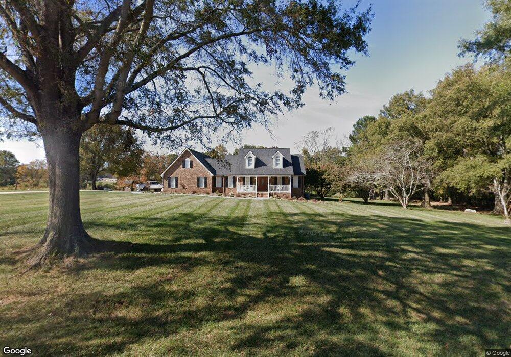
3502 Nesbit Rd Monroe, NC 28112
Estimated Value: $624,000 - $1,639,000
--
Bed
--
Bath
--
Sq Ft
71.67
Acres
About This Home
This home is located at 3502 Nesbit Rd, Monroe, NC 28112 and is currently estimated at $955,752. 3502 Nesbit Rd is a home located in Union County with nearby schools including Western Union Elementary School, Parkwood Middle School, and Parkwood High School.
Ownership History
Date
Name
Owned For
Owner Type
Purchase Details
Closed on
Dec 21, 2004
Sold by
Helms Tyson Jr Frank A and Helms Tyson Rachael
Bought by
Tyson Frank A
Current Estimated Value
Purchase Details
Closed on
May 9, 2001
Sold by
Cook Ray T and Cook Violet T
Bought by
Tyson Frank A
Purchase Details
Closed on
Nov 20, 2000
Sold by
Helms Tyson Jr Frank A and Helms Tyson Rachel
Bought by
Tyson Frank A
Purchase Details
Closed on
Apr 30, 1999
Sold by
Tyson Karin B
Bought by
Tyson Scott Aaron
Create a Home Valuation Report for This Property
The Home Valuation Report is an in-depth analysis detailing your home's value as well as a comparison with similar homes in the area
Home Values in the Area
Average Home Value in this Area
Purchase History
| Date | Buyer | Sale Price | Title Company |
|---|---|---|---|
| Tyson Frank A | -- | -- | |
| Tyson Frank A | $15,000 | -- | |
| Tyson Frank A | -- | -- | |
| Tyson Scott Aaron | -- | -- |
Source: Public Records
Tax History Compared to Growth
Tax History
| Year | Tax Paid | Tax Assessment Tax Assessment Total Assessment is a certain percentage of the fair market value that is determined by local assessors to be the total taxable value of land and additions on the property. | Land | Improvement |
|---|---|---|---|---|
| 2024 | $622 | $431,500 | $369,600 | $61,900 |
| 2023 | $613 | $431,500 | $369,600 | $61,900 |
| 2022 | $613 | $431,500 | $369,600 | $61,900 |
| 2021 | $609 | $431,500 | $369,600 | $61,900 |
| 2020 | $529 | $387,030 | $350,530 | $36,500 |
| 2019 | $539 | $387,030 | $350,530 | $36,500 |
| 2018 | $485 | $384,630 | $350,530 | $34,100 |
| 2017 | $517 | $384,600 | $350,500 | $34,100 |
| 2016 | $500 | $384,630 | $350,530 | $34,100 |
| 2015 | $508 | $384,630 | $350,530 | $34,100 |
| 2014 | $199 | $62,200 | $25,800 | $36,400 |
Source: Public Records
Map
Nearby Homes
- 5904 Mcwhorter Rd
- 0 Nesbit Rd Unit CAR4290917
- 0 Parkwood School Rd
- 219 Barra Dr Unit 4
- 219 Barra Dr
- 6918 My Lady's Way
- 4807 John Craig Rd
- 110 Serenity Creek Dr
- 106 Serenity Creek Dr
- 6815 Old Waxhaw Monroe Rd Unit 1
- 6807 Old Waxhaw Monroe Rd Unit 2
- 4805 Nesbit Rd
- 7517 Lancaster Hwy Unit 5
- 7517 Lancaster Hwy
- Roanoke Plan at Lancaster Hwy
- Charleston Plan at Lancaster Hwy
- 7513 Lancaster Hwy Unit 6
- 7513 Lancaster Hwy
- 6419 Lancaster Hwy Unit 9, 19
- 5105 Tom Starnes Rd
- 3605 Nesbit Rd
- 3524 Nesbit Rd
- 3522 Nesbit Rd
- 3811 Nesbit Rd
- 5405 Potter Rd S
- 30ac Nesbit Rd
- 54ac Nesbit Rd
- #2 Nesbit Rd
- 5308 Potter Rd S
- 5506 Potter Rd S
- 6104 Potter Rd S
- 00 Nesbit Rd
- 6024 Mcwhorter Rd
- 5615 Potter Rd S
- 5619 Potter Rd S
- 4603 Parkwood School Rd
- 5703 Potter Rd S
- 003 Nesbit Rd
- 002 Nesbit Rd
- 001 Nesbit Rd