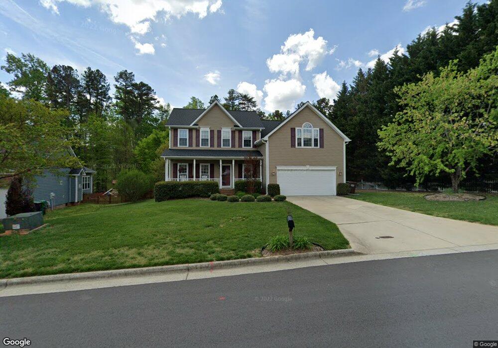
3512 Dairy Point Dr High Point, NC 27265
Sandy Ridge NeighborhoodEstimated Value: $382,000 - $416,000
4
Beds
3
Baths
2,604
Sq Ft
$153/Sq Ft
Est. Value
About This Home
This home is located at 3512 Dairy Point Dr, High Point, NC 27265 and is currently estimated at $398,213, approximately $152 per square foot. 3512 Dairy Point Dr is a home located in Guilford County with nearby schools including Colfax Elementary School, Southwest Guilford Middle School, and Southwest Guilford High School.
Ownership History
Date
Name
Owned For
Owner Type
Purchase Details
Closed on
Jun 12, 2007
Sold by
Hunt Robert G and Hunt Kimberly M
Bought by
Calhoun Wendell D and Calhoun Adrienne G
Current Estimated Value
Home Financials for this Owner
Home Financials are based on the most recent Mortgage that was taken out on this home.
Original Mortgage
$215,650
Outstanding Balance
$134,296
Interest Rate
6.52%
Mortgage Type
Purchase Money Mortgage
Estimated Equity
$263,917
Purchase Details
Closed on
Feb 17, 2000
Sold by
Westminster Homes Inc
Bought by
Hunt Robert G and Hunt Kimberly M
Home Financials for this Owner
Home Financials are based on the most recent Mortgage that was taken out on this home.
Original Mortgage
$171,800
Interest Rate
7.5%
Create a Home Valuation Report for This Property
The Home Valuation Report is an in-depth analysis detailing your home's value as well as a comparison with similar homes in the area
Home Values in the Area
Average Home Value in this Area
Purchase History
| Date | Buyer | Sale Price | Title Company |
|---|---|---|---|
| Calhoun Wendell D | $227,000 | None Available | |
| Hunt Robert G | $191,000 | -- |
Source: Public Records
Mortgage History
| Date | Status | Borrower | Loan Amount |
|---|---|---|---|
| Open | Calhoun Wendell D | $215,650 | |
| Previous Owner | Hunt Robert G | $171,800 |
Source: Public Records
Tax History Compared to Growth
Tax History
| Year | Tax Paid | Tax Assessment Tax Assessment Total Assessment is a certain percentage of the fair market value that is determined by local assessors to be the total taxable value of land and additions on the property. | Land | Improvement |
|---|---|---|---|---|
| 2025 | $7,085 | $259,900 | $65,000 | $194,900 |
| 2024 | $7,085 | $259,900 | $65,000 | $194,900 |
| 2023 | $7,085 | $259,900 | $65,000 | $194,900 |
| 2022 | $3,503 | $259,900 | $65,000 | $194,900 |
| 2021 | $2,957 | $214,600 | $40,000 | $174,600 |
| 2020 | $2,957 | $214,600 | $40,000 | $174,600 |
| 2019 | $2,957 | $214,600 | $0 | $0 |
| 2018 | $2,942 | $214,600 | $0 | $0 |
| 2017 | $2,957 | $214,600 | $0 | $0 |
| 2016 | $2,861 | $204,000 | $0 | $0 |
| 2015 | $2,876 | $204,000 | $0 | $0 |
| 2014 | $2,925 | $204,000 | $0 | $0 |
Source: Public Records
Map
Nearby Homes
- 4603 Owls View Ct
- 4728 Sandy Camp Rd
- 1341 Grant Haven Ct
- 2150 Alamar Dr
- 5012 Rosemont Ct
- 2156 Rosemont Dr
- 1350 Grant Haven Ct
- 1351 Grant Haven Ct
- 8774 Bame Rd
- Devon Plan at Trellises
- Greenwich Plan at Trellises
- Franklin Plan at Trellises
- Bermuda Plan at Trellises
- Cayman X Plan at Trellises
- Cayman Plan at Trellises
- Essex Plan at Trellises
- Kingston Plan at Trellises
- 2403 Hammock Dr
- 4743 Willowstone Dr
- 4741 Willowstone Dr
- 3516 Dairy Point Dr
- 4908 Erica Marie Ct
- 4904 Erica Marie Ct
- 4911 Kacey Elaine Ct
- 3501 Dairy Point Dr
- 4910 Kacey Elaine Ct
- 3520 Dairy Point Dr
- 4915 Kacey Elaine Ct
- 4900 Erica Marie Ct
- 4914 Kacey Elaine Ct
- 3417 Dairy Point Dr
- 4918 Kacey Elaine Ct
- 3413 Dairy Point Dr
- 4903 Erica Marie Ct
- 4911 Caitlin Nicole Ct
- 3600 Dairy Point Dr
- 4907 Erica Marie Ct
- 3409 Dairy Point Dr
- 4915 Caitlin Nicole Ct
- 3604 Dairy Point Dr