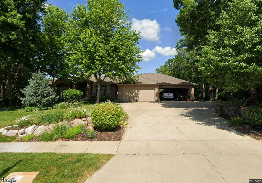
3516 133rd Way Urbandale, IA 50323
Estimated Value: $663,000 - $1,071,350
1
Bed
4
Baths
3,104
Sq Ft
$298/Sq Ft
Est. Value
About This Home
This home is located at 3516 133rd Way, Urbandale, IA 50323 and is currently estimated at $923,783, approximately $297 per square foot. 3516 133rd Way is a home located in Polk County with nearby schools including Webster Elementary School, Urbandale Middle School, and Urbandale High School.
Ownership History
Date
Name
Owned For
Owner Type
Purchase Details
Closed on
Dec 1, 2014
Sold by
Stamp John C and Stone Nancy F
Bought by
Revocab John and Revocab Nancy
Current Estimated Value
Purchase Details
Closed on
May 24, 2001
Sold by
Cosgrove Dan and Cosgrove Laurie
Bought by
Stamp John C and Stone Nancy F
Purchase Details
Closed on
Jan 14, 2000
Sold by
Knapp & Associates Ltd Partnership
Bought by
Cosgrove Dan and Cosgrove Laurie
Create a Home Valuation Report for This Property
The Home Valuation Report is an in-depth analysis detailing your home's value as well as a comparison with similar homes in the area
Home Values in the Area
Average Home Value in this Area
Purchase History
| Date | Buyer | Sale Price | Title Company |
|---|---|---|---|
| Revocab John | -- | None Available | |
| Stamp John C | $149,500 | -- | |
| Cosgrove Dan | $119,500 | -- |
Source: Public Records
Tax History Compared to Growth
Tax History
| Year | Tax Paid | Tax Assessment Tax Assessment Total Assessment is a certain percentage of the fair market value that is determined by local assessors to be the total taxable value of land and additions on the property. | Land | Improvement |
|---|---|---|---|---|
| 2025 | $16,554 | $1,038,000 | $187,900 | $850,100 |
| 2024 | $16,554 | $940,100 | $166,800 | $773,300 |
| 2023 | $15,846 | $940,100 | $166,800 | $773,300 |
| 2022 | $15,662 | $750,800 | $136,500 | $614,300 |
| 2021 | $16,888 | $750,800 | $136,500 | $614,300 |
| 2020 | $16,598 | $767,700 | $139,500 | $628,200 |
| 2019 | $17,074 | $767,700 | $139,500 | $628,200 |
| 2018 | $16,470 | $742,900 | $132,300 | $610,600 |
| 2017 | $15,654 | $742,900 | $132,300 | $610,600 |
| 2016 | $15,280 | $693,300 | $112,800 | $580,500 |
| 2015 | $15,280 | $693,300 | $112,800 | $580,500 |
| 2014 | $15,418 | $692,500 | $110,900 | $581,600 |
Source: Public Records
Map
Nearby Homes
- 13282 Oak Brook Dr
- 14130 Wilden Dr
- 13425 Ridgeview Dr
- 14134 Wilden Dr
- 14136 Wilden Dr
- 12993 Oak Brook Dr
- 12926 Timberline Dr
- 14111 Oak Brook Dr
- 13504 Sheridan Ave
- 13208 Rocklyn Dr
- 2216 NW 136th St
- 3943 NW 181st St
- 4010 NW 181st St
- 3997 NW 181st St
- 13165 Pinecrest Ln
- 3837 NW 183rd St
- 2094 NW 137th St
- 4111 140th St
- 14405 Holcomb Ave
- 12723 Sunflower Dr
- 3510 133rd Way
- 3522 133rd Way
- 3604 134th St
- 3504 133rd Way
- 3515 133rd Way
- 3610 134th St
- 3509 133rd Way
- 3521 133rd Way
- 3503 133rd Way
- 13217 Beechwood Dr
- 13543 Oak Brook Dr
- 3605 134th St
- 3512 132nd Ct
- 3702 134th St
- 13211 Beechwood Dr
- 13206 Beechwood Dr
- 13525 Oak Brook Dr
- 3506 132nd Ct
- 13205 Beechwood Dr
- 13304 Timberline Dr