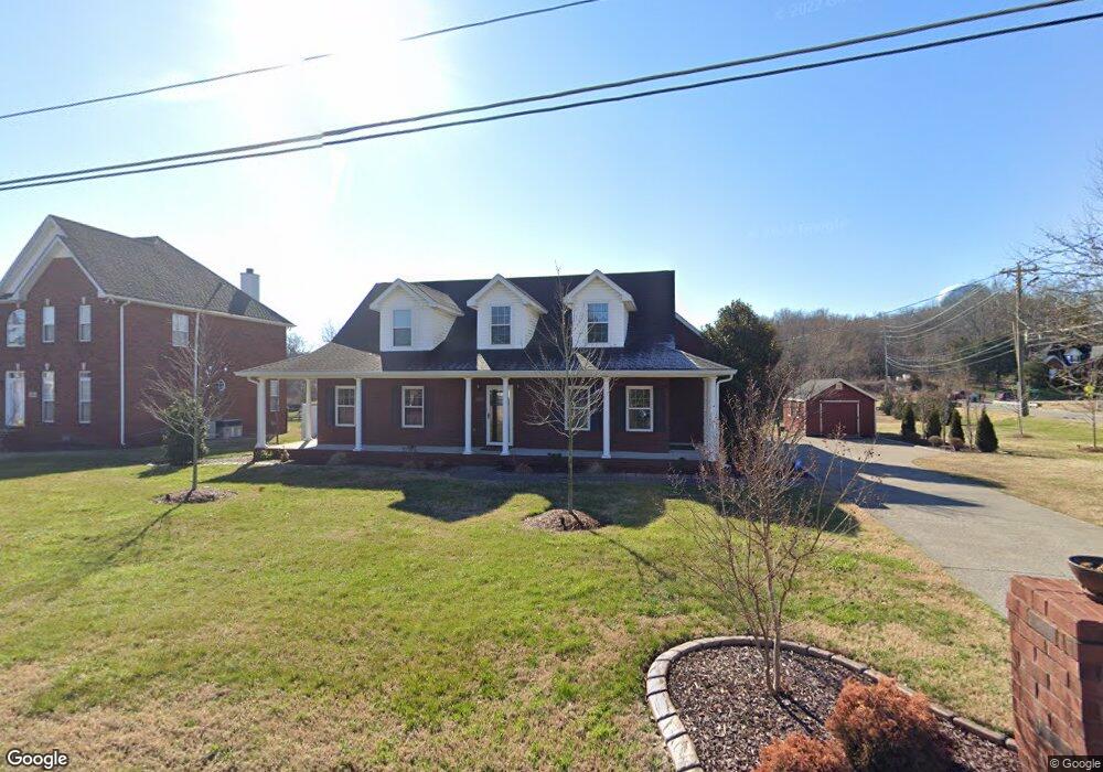
352 Clarkston Dr Smyrna, TN 37167
Estimated Value: $486,000 - $534,660
--
Bed
3
Baths
2,340
Sq Ft
$215/Sq Ft
Est. Value
About This Home
This home is located at 352 Clarkston Dr, Smyrna, TN 37167 and is currently estimated at $503,665, approximately $215 per square foot. 352 Clarkston Dr is a home located in Rutherford County with nearby schools including Rock Springs Elementary School, Rock Springs Middle School, and Stewarts Creek High School.
Ownership History
Date
Name
Owned For
Owner Type
Purchase Details
Closed on
Jun 12, 2012
Sold by
Bancorp South Bank
Bought by
Parish Dennis Jenny
Current Estimated Value
Home Financials for this Owner
Home Financials are based on the most recent Mortgage that was taken out on this home.
Original Mortgage
$141,520
Outstanding Balance
$98,078
Interest Rate
3.83%
Mortgage Type
Commercial
Estimated Equity
$405,587
Purchase Details
Closed on
Mar 5, 2012
Sold by
Doran James M
Bought by
Bancorp South Bank
Purchase Details
Closed on
Apr 5, 2004
Sold by
Rick Bratcher
Bought by
Doran James M and Doran Donna G
Home Financials for this Owner
Home Financials are based on the most recent Mortgage that was taken out on this home.
Original Mortgage
$116,000
Interest Rate
5.54%
Purchase Details
Closed on
Dec 16, 2002
Sold by
Clarkridge Partnership
Bought by
Rick Bratcher
Create a Home Valuation Report for This Property
The Home Valuation Report is an in-depth analysis detailing your home's value as well as a comparison with similar homes in the area
Home Values in the Area
Average Home Value in this Area
Purchase History
| Date | Buyer | Sale Price | Title Company |
|---|---|---|---|
| Parish Dennis Jenny | $176,900 | -- | |
| Bancorp South Bank | $145,500 | -- | |
| Doran James M | $212,900 | -- | |
| Rick Bratcher | $29,000 | -- |
Source: Public Records
Mortgage History
| Date | Status | Borrower | Loan Amount |
|---|---|---|---|
| Open | Parish Dennis Jenny | $141,520 | |
| Previous Owner | Rick Bratcher | $116,000 |
Source: Public Records
Tax History Compared to Growth
Tax History
| Year | Tax Paid | Tax Assessment Tax Assessment Total Assessment is a certain percentage of the fair market value that is determined by local assessors to be the total taxable value of land and additions on the property. | Land | Improvement |
|---|---|---|---|---|
| 2025 | $2,731 | $113,700 | $19,250 | $94,450 |
| 2024 | $2,731 | $113,700 | $19,250 | $94,450 |
| 2023 | $2,731 | $113,700 | $19,250 | $94,450 |
| 2022 | $2,436 | $113,700 | $19,250 | $94,450 |
| 2021 | $2,366 | $81,025 | $17,500 | $63,525 |
| 2020 | $2,366 | $81,025 | $17,500 | $63,525 |
| 2019 | $2,366 | $81,025 | $17,500 | $63,525 |
| 2018 | $2,269 | $81,025 | $0 | $0 |
| 2017 | $1,859 | $52,175 | $0 | $0 |
| 2016 | $1,859 | $52,175 | $0 | $0 |
| 2015 | $1,859 | $52,175 | $0 | $0 |
| 2014 | $1,297 | $52,175 | $0 | $0 |
| 2013 | -- | $51,825 | $0 | $0 |
Source: Public Records
Map
Nearby Homes
- 3704 Henricks Hill Dr
- 4009 Maggie Ct
- 4000 Claude Dr
- 5024 Mary Ellen Cir
- STONEBROOK II Plan at Pottsview
- MILFORD A Plan at Pottsview
- HAYDEN Plan at Pottsview
- SALEM Plan at Pottsview
- 342 Zen Ct
- 4015 Wisdom Way
- 327 Zen Ct
- 323 Zen Ct
- 319 Zen Ct
- Johnson Plan at Woodmont
- Northbrook Plan at Woodmont
- Sherwood Plan at Woodmont
- Rockwell Plan at Woodmont
- Newport Plan at Woodmont
- Manchester Plan at Woodmont
- 6009 Inglenook Dr
- 354 Clarkston Dr
- 356 Clarkston Dr
- 361 Clarkston Dr
- 363 Clarkston Dr
- 358 Clarkston Dr
- 693 Blair Rd
- 365 Clarkston Dr
- 360 Clarkston Dr
- 691 Blair Rd
- 367 Clarkston Dr
- 362 Clarkston Dr
- 438 Addie Dr
- 369 Clarkston Dr
- 3543 Rock Springs Rd
- 364 Clarkston Dr
- 371 Clarkston Dr
- 436 Addie Dr
- 431 Addie Dr
- 3545 Rock Springs Rd
- 366 Clarkston Dr