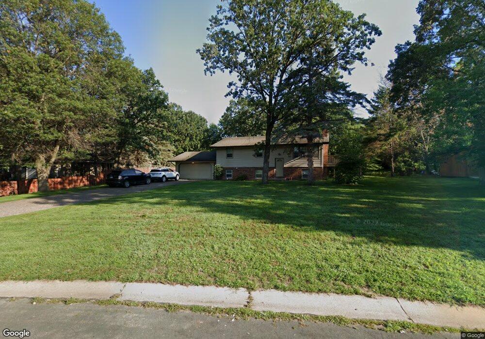
3527 142nd Ln NW Andover, MN 55304
Estimated Value: $301,000 - $376,000
5
Beds
2
Baths
1,040
Sq Ft
$337/Sq Ft
Est. Value
About This Home
This home is located at 3527 142nd Ln NW, Andover, MN 55304 and is currently estimated at $350,299, approximately $336 per square foot. 3527 142nd Ln NW is a home located in Anoka County with nearby schools including Crooked Lake Elementary School, Oak View Middle School, and Andover Senior High School.
Ownership History
Date
Name
Owned For
Owner Type
Purchase Details
Closed on
Sep 23, 2024
Sold by
Fyr Sfr Trs Llc
Bought by
Cag Minnesota Fund Ll Llc
Current Estimated Value
Purchase Details
Closed on
Aug 8, 2018
Sold by
Rha 3 Llc
Bought by
Fyr Sfr Borrower Llc
Home Financials for this Owner
Home Financials are based on the most recent Mortgage that was taken out on this home.
Original Mortgage
$508,700
Interest Rate
4.5%
Mortgage Type
Construction
Purchase Details
Closed on
Jul 6, 2015
Sold by
Streetar Timothy P and Streetar Jodi L
Bought by
Rha 3 Llc
Purchase Details
Closed on
Sep 19, 2005
Sold by
Bank Of New York
Bought by
Streetar Timothy P and Streetar Jodi L
Create a Home Valuation Report for This Property
The Home Valuation Report is an in-depth analysis detailing your home's value as well as a comparison with similar homes in the area
Home Values in the Area
Average Home Value in this Area
Purchase History
| Date | Buyer | Sale Price | Title Company |
|---|---|---|---|
| Cag Minnesota Fund Ll Llc | $1,549,075 | -- | |
| Fyr Sfr Borrower Llc | $3,656,751 | Premium Title | |
| Fyr Sfr Borrower Llc | $3,656,751 | Premium Title | |
| Rha 3 Llc | $182,000 | Titlesmart Inc | |
| Streetar Timothy P | $167,000 | -- |
Source: Public Records
Mortgage History
| Date | Status | Borrower | Loan Amount |
|---|---|---|---|
| Previous Owner | Fyr Sfr Borrower Llc | $508,700 | |
| Previous Owner | Fyr Sfr Borrower Llc | $508,700,000 |
Source: Public Records
Tax History Compared to Growth
Tax History
| Year | Tax Paid | Tax Assessment Tax Assessment Total Assessment is a certain percentage of the fair market value that is determined by local assessors to be the total taxable value of land and additions on the property. | Land | Improvement |
|---|---|---|---|---|
| 2025 | $3,189 | $336,300 | $122,000 | $214,300 |
| 2024 | $3,189 | $307,400 | $102,900 | $204,500 |
| 2023 | $2,967 | $318,300 | $102,900 | $215,400 |
| 2022 | $2,727 | $317,900 | $93,500 | $224,400 |
| 2021 | $2,632 | $251,600 | $78,600 | $173,000 |
| 2020 | $2,636 | $236,900 | $74,900 | $162,000 |
| 2019 | $2,475 | $229,700 | $71,400 | $158,300 |
| 2018 | $2,356 | $210,900 | $0 | $0 |
| 2017 | $2,082 | $196,400 | $0 | $0 |
| 2016 | $2,261 | $170,600 | $0 | $0 |
| 2015 | -- | $170,600 | $59,900 | $110,700 |
| 2014 | -- | $137,700 | $39,000 | $98,700 |
Source: Public Records
Map
Nearby Homes
- 3740 143rd Ave NW
- 14545 Round Lake Blvd NW
- 3996 145th Ave NW
- 3300 138th Ave NW
- 4212 141st Ln NW
- 13871 Eidelweiss St NW
- 926 38th Ave
- 13565 Jonquil St NW
- 805 9th Ave
- 4356 141st Ln NW
- TBD Gladiola St NW
- Lot 5 Gladiola St NW
- 956 Blackoaks Ln
- 13414 Jonquil St NW
- 948 Norwood Ave
- 3860 7th Ave
- 13334 Silverod Ct NW
- 1410 Cleveland St
- 13230 Meadowood Trail NW Unit 102
- 3857 & 3861 9th Ln
- 3519 142nd Ln NW
- 3551 142nd Ln NW
- 3511 142nd Ln NW
- 3530 142nd Ln NW
- 14267 Round Lake Blvd NW
- 3518 142nd Ln NW
- 3544 142nd Ln NW
- 3560 142nd Ln NW
- 3510 142nd Ln NW
- 3503 142nd Ln NW
- 14311 Round Lake Blvd NW
- 3502 142nd Ln NW
- 3491 142nd Ln NW
- 14232 Silverod St NW
- 14223 Silverod St NW
- 14325 Round Lake Blvd NW
- 14230 Rose St NW
- 3490 142nd Ln NW
- 14240 Rose St NW
- 3479 142nd Ln NW