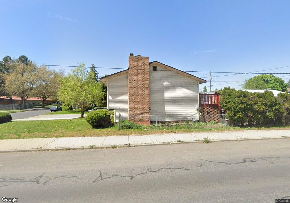
3527 E Bridgeport Ave Spokane, WA 99217
Minnehaha NeighborhoodEstimated Value: $333,000 - $404,000
4
Beds
2
Baths
1,880
Sq Ft
$195/Sq Ft
Est. Value
About This Home
This home is located at 3527 E Bridgeport Ave, Spokane, WA 99217 and is currently estimated at $365,821, approximately $194 per square foot. 3527 E Bridgeport Ave is a home located in Spokane County with nearby schools including Cooper Elementary School, Shaw Middle School, and Rogers High School.
Ownership History
Date
Name
Owned For
Owner Type
Purchase Details
Closed on
Jun 25, 2008
Sold by
Lawson John E
Bought by
Torres Jose and Torres Maria
Current Estimated Value
Home Financials for this Owner
Home Financials are based on the most recent Mortgage that was taken out on this home.
Original Mortgage
$146,972
Outstanding Balance
$94,431
Interest Rate
5.99%
Mortgage Type
FHA
Estimated Equity
$271,390
Purchase Details
Closed on
Sep 22, 2005
Sold by
Lawson Christina
Bought by
Lawson John E
Home Financials for this Owner
Home Financials are based on the most recent Mortgage that was taken out on this home.
Original Mortgage
$150,000
Interest Rate
5.72%
Mortgage Type
Fannie Mae Freddie Mac
Create a Home Valuation Report for This Property
The Home Valuation Report is an in-depth analysis detailing your home's value as well as a comparison with similar homes in the area
Home Values in the Area
Average Home Value in this Area
Purchase History
| Date | Buyer | Sale Price | Title Company |
|---|---|---|---|
| Torres Jose | $164,800 | Spokane County Title Co | |
| Lawson John E | -- | Spokane County Title Co | |
| Lawson John E | $150,000 | Spokane County Title Co |
Source: Public Records
Mortgage History
| Date | Status | Borrower | Loan Amount |
|---|---|---|---|
| Open | Torres Jose | $146,972 | |
| Previous Owner | Lawson John E | $150,000 |
Source: Public Records
Tax History Compared to Growth
Tax History
| Year | Tax Paid | Tax Assessment Tax Assessment Total Assessment is a certain percentage of the fair market value that is determined by local assessors to be the total taxable value of land and additions on the property. | Land | Improvement |
|---|---|---|---|---|
| 2025 | $3,160 | $313,600 | $90,000 | $223,600 |
| 2024 | $3,160 | $318,200 | $70,000 | $248,200 |
| 2023 | $3,117 | $328,500 | $70,000 | $258,500 |
| 2022 | $2,753 | $318,500 | $60,000 | $258,500 |
| 2021 | $2,455 | $206,100 | $35,000 | $171,100 |
| 2020 | $2,215 | $179,100 | $28,000 | $151,100 |
| 2019 | $1,921 | $160,500 | $21,500 | $139,000 |
| 2018 | $2,060 | $147,900 | $21,500 | $126,400 |
| 2017 | $1,813 | $132,500 | $21,500 | $111,000 |
| 2016 | $1,762 | $126,000 | $21,500 | $104,500 |
| 2015 | $1,685 | $117,900 | $21,500 | $96,400 |
| 2014 | -- | $117,900 | $21,500 | $96,400 |
| 2013 | -- | $0 | $0 | $0 |
Source: Public Records
Map
Nearby Homes
- 16802 E Frederick Ave
- 3423 E Fairview Ave
- 3518 N Ralph St
- 3811 E Euclid Ave
- 3702 N Gordon Ct
- 3628 E Fairview Ave
- 5248 E Liberty Ave
- 3904 E Frederick Ave
- 3504 E Cleveland Ave
- 3421 E Grace Ave
- 3306 E Cleveland Ave
- 3615 E Buckeye Ct
- 4017 E Cleveland Ave
- 3517 E Marietta Ave
- 2911 E Fairview Ave
- 3211 N Regal St
- 4201 E Cleveland Ave
- 4017 E Buckeye Ave
- 2516 N Rebecca St
- 2920 N Regal St
- 3521 E Bridgeport Ave
- 3517 E Bridgeport Ave
- 3603 E Bridgeport Ave
- 3526 E Courtland Ave
- 3522 E Courtland Ave
- 3518 E Courtland Ave
- 3513 E Bridgeport Ave
- 3607 E Bridgeport Ave
- 3509 E Bridgeport Ave
- 3611 E Bridgeport Ave
- 3514 E Courtland Ave
- 3614 E Courtland Ave
- 3602 E Bridgeport Ave
- 3608 E Bridgeport Ave
- 3505 E Bridgeport Ave
- 3617 E Bridgeport Ave
- 3420 N Ferrall St
- 3614 E Bridgeport Ave
- 3620 E Courtland Ave
- 3525 E Courtland Ave