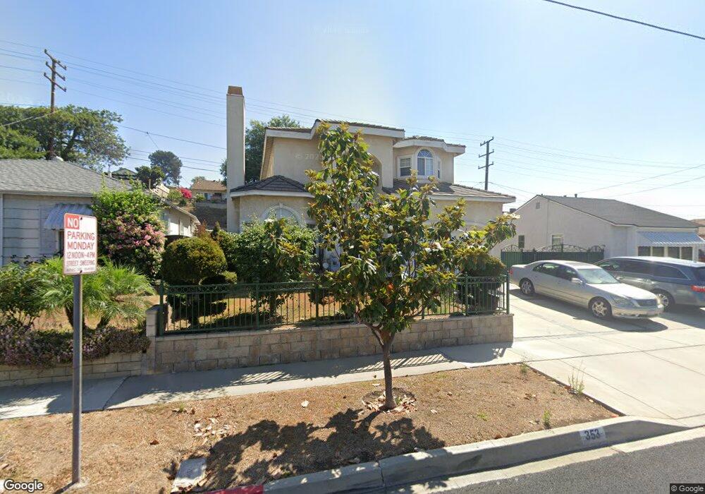
353 E Andrix St Monterey Park, CA 91755
Estimated Value: $1,165,000 - $1,442,000
4
Beds
4
Baths
2,654
Sq Ft
$479/Sq Ft
Est. Value
About This Home
This home is located at 353 E Andrix St, Monterey Park, CA 91755 and is currently estimated at $1,272,247, approximately $479 per square foot. 353 E Andrix St is a home located in Los Angeles County with nearby schools including Bella Vista Elementary School, Macy Intermediate School, and Schurr High School.
Ownership History
Date
Name
Owned For
Owner Type
Purchase Details
Closed on
Mar 31, 2023
Sold by
Lam Michael Hang Chan and Cheuk Ying
Bought by
Lam Family Living Trust
Current Estimated Value
Purchase Details
Closed on
Apr 27, 2005
Sold by
Ho Sin Ching
Bought by
Lam Michael Hang Chan and Chan Cheuk Ying
Home Financials for this Owner
Home Financials are based on the most recent Mortgage that was taken out on this home.
Original Mortgage
$330,000
Interest Rate
5.92%
Mortgage Type
Fannie Mae Freddie Mac
Purchase Details
Closed on
Jun 20, 2000
Sold by
Tam Do W
Bought by
Ho Sin Ching
Purchase Details
Closed on
Jan 28, 1994
Sold by
Cushing Frank J
Bought by
Tam Do Wing and Tam Wai Kwan Cheung
Home Financials for this Owner
Home Financials are based on the most recent Mortgage that was taken out on this home.
Original Mortgage
$68,000
Interest Rate
7.1%
Create a Home Valuation Report for This Property
The Home Valuation Report is an in-depth analysis detailing your home's value as well as a comparison with similar homes in the area
Home Values in the Area
Average Home Value in this Area
Purchase History
| Date | Buyer | Sale Price | Title Company |
|---|---|---|---|
| Lam Family Living Trust | -- | None Listed On Document | |
| Lam Michael Hang Chan | $680,000 | Ticor Title Company | |
| Ho Sin Ching | $178,000 | Investors Title Company | |
| Tam Do Wing | $168,000 | Title Land Company |
Source: Public Records
Mortgage History
| Date | Status | Borrower | Loan Amount |
|---|---|---|---|
| Previous Owner | Lam Michael Hang Chan | $330,000 | |
| Previous Owner | Tam Do Wing | $68,000 |
Source: Public Records
Tax History
| Year | Tax Paid | Tax Assessment Tax Assessment Total Assessment is a certain percentage of the fair market value that is determined by local assessors to be the total taxable value of land and additions on the property. | Land | Improvement |
|---|---|---|---|---|
| 2025 | $12,204 | $947,840 | $530,514 | $417,326 |
| 2024 | $12,204 | $929,256 | $520,112 | $409,144 |
| 2023 | $12,238 | $911,036 | $509,914 | $401,122 |
| 2022 | $11,817 | $893,173 | $499,916 | $393,257 |
| 2021 | $11,409 | $875,661 | $490,114 | $385,547 |
| 2019 | $10,959 | $849,690 | $475,578 | $374,112 |
| 2018 | $11,200 | $833,030 | $466,253 | $366,777 |
| 2016 | $10,680 | $800,685 | $448,149 | $352,536 |
| 2015 | $10,010 | $788,659 | $441,418 | $347,241 |
| 2014 | $9,863 | $773,212 | $432,772 | $340,440 |
Source: Public Records
Map
Nearby Homes
- 2005 Heather Dr
- 1963 Lupine Ave
- 1862 Hendron Way
- 301 E Riggin St
- 305 Bluffdale St
- 2012 S Garfield Ave
- 1740 Fulton Ave
- 105 E Floral Dr
- 551 Taylor Dr
- 2001 Fernbank Ave
- 273 Starbird Dr
- 1800 Fernbank Ave
- 247 W Arlight St
- 1042 S Garfield Ave
- 1516 Appian Way
- 905 Brighton Way
- 748 S Garfield Ave
- 701 S Garfield Ave
- 938 Mira Valle St
- 7210 Tegner Dr
- 357 E Andrix St
- 349 E Andrix St
- 2039 Heather Dr
- 2043 Heather Dr
- 345 E Andrix St
- 2035 Heather Dr
- 2045 Heather Dr
- 365 E Andrix St
- 340 E Andrix St
- 349 E Arlight St
- 2031 Heather Dr
- 2049 Heather Dr
- 345 E Arlight St
- 341 E Andrix St
- 2029 Heather Dr
- 2053 Heather Dr
- 341 E Arlight St
- 336 E Andrix St
- 373 E Andrix St
- 2025 Heather Dr
Your Personal Tour Guide
Ask me questions while you tour the home.