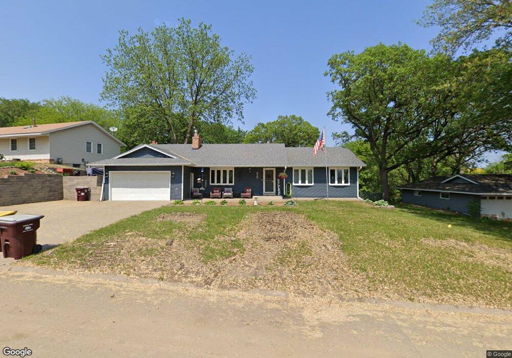
353 Walnut Ln Saint Paul, MN 55124
Redwood NeighborhoodEstimated Value: $373,000 - $407,000
5
Beds
3
Baths
1,468
Sq Ft
$269/Sq Ft
Est. Value
About This Home
This home is located at 353 Walnut Ln, Saint Paul, MN 55124 and is currently estimated at $394,964, approximately $269 per square foot. 353 Walnut Ln is a home located in Dakota County with nearby schools including Westview Elementary School, Valley Middle School, and Apple Valley Senior High School.
Ownership History
Date
Name
Owned For
Owner Type
Purchase Details
Closed on
Aug 18, 2016
Sold by
Renovision Llc
Bought by
Nipp Adam and Nipp Stefanie
Current Estimated Value
Home Financials for this Owner
Home Financials are based on the most recent Mortgage that was taken out on this home.
Original Mortgage
$265,010
Outstanding Balance
$209,863
Interest Rate
3.25%
Mortgage Type
FHA
Estimated Equity
$185,101
Purchase Details
Closed on
Apr 6, 2016
Sold by
Olberding George George
Home Financials for this Owner
Home Financials are based on the most recent Mortgage that was taken out on this home.
Original Mortgage
$175,000
Interest Rate
3.71%
Create a Home Valuation Report for This Property
The Home Valuation Report is an in-depth analysis detailing your home's value as well as a comparison with similar homes in the area
Home Values in the Area
Average Home Value in this Area
Purchase History
| Date | Buyer | Sale Price | Title Company |
|---|---|---|---|
| Nipp Adam | $269,900 | Liberty Title Inc | |
| -- | $175,000 | -- |
Source: Public Records
Mortgage History
| Date | Status | Borrower | Loan Amount |
|---|---|---|---|
| Open | Nipp Adam | $265,010 | |
| Previous Owner | -- | $175,000 |
Source: Public Records
Tax History Compared to Growth
Tax History
| Year | Tax Paid | Tax Assessment Tax Assessment Total Assessment is a certain percentage of the fair market value that is determined by local assessors to be the total taxable value of land and additions on the property. | Land | Improvement |
|---|---|---|---|---|
| 2024 | $3,864 | $353,100 | $85,400 | $267,700 |
| 2023 | $3,864 | $345,800 | $85,600 | $260,200 |
| 2022 | $3,318 | $341,400 | $85,300 | $256,100 |
| 2021 | $3,168 | $293,500 | $74,200 | $219,300 |
| 2020 | $3,168 | $275,600 | $72,200 | $203,400 |
| 2019 | $2,761 | $268,100 | $68,700 | $199,400 |
| 2018 | $2,720 | $246,800 | $65,400 | $181,400 |
| 2017 | $2,702 | $233,900 | $62,300 | $171,600 |
| 2016 | $2,704 | $221,800 | $59,400 | $162,400 |
| 2015 | $2,580 | $202,233 | $53,573 | $148,660 |
| 2014 | -- | $194,167 | $51,308 | $142,859 |
| 2013 | -- | $177,381 | $46,665 | $130,716 |
Source: Public Records
Map
Nearby Homes
- 14709 White Oak Dr
- 148 Spruce Dr
- 249 Elm Dr
- 441 Walnut Ln
- 8681 144th Street Ct
- 1312 Summit Oaks Dr
- 14350 Hickory Way
- 1516 Rushmore Dr
- 14208 Heritage Ln
- 1023 E 145th St
- 1101 Lavon Ln
- 801 Southcross Dr E
- 14786 Hallmark Dr
- 14132 Heywood Path
- 14659 Sherwood Place
- 14231 E 143rd Ln
- 921 Cortland Dr S
- 13761 Hollybrook Cir
- 13751 Hollybrook Cir
- The Magnolia Plan at Eagle Pointe - Townhomes