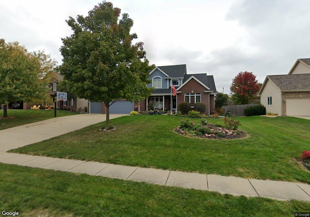
3531 129th St Urbandale, IA 50323
Estimated Value: $601,199 - $733,000
4
Beds
4
Baths
2,817
Sq Ft
$234/Sq Ft
Est. Value
About This Home
This home is located at 3531 129th St, Urbandale, IA 50323 and is currently estimated at $657,800, approximately $233 per square foot. 3531 129th St is a home located in Polk County with nearby schools including Webster Elementary School, Urbandale Middle School, and Urbandale High School.
Ownership History
Date
Name
Owned For
Owner Type
Purchase Details
Closed on
Nov 20, 2003
Sold by
Accurate Development Inc
Bought by
Millsap Mark and Millsap Lori
Current Estimated Value
Home Financials for this Owner
Home Financials are based on the most recent Mortgage that was taken out on this home.
Original Mortgage
$309,600
Outstanding Balance
$143,631
Interest Rate
6.01%
Mortgage Type
Purchase Money Mortgage
Estimated Equity
$514,169
Purchase Details
Closed on
Nov 10, 2003
Sold by
J & K Partners
Bought by
Accurate Development Inc
Home Financials for this Owner
Home Financials are based on the most recent Mortgage that was taken out on this home.
Original Mortgage
$309,600
Outstanding Balance
$143,631
Interest Rate
6.01%
Mortgage Type
Purchase Money Mortgage
Estimated Equity
$514,169
Create a Home Valuation Report for This Property
The Home Valuation Report is an in-depth analysis detailing your home's value as well as a comparison with similar homes in the area
Home Values in the Area
Average Home Value in this Area
Purchase History
| Date | Buyer | Sale Price | Title Company |
|---|---|---|---|
| Millsap Mark | $386,500 | -- | |
| Accurate Development Inc | -- | -- |
Source: Public Records
Mortgage History
| Date | Status | Borrower | Loan Amount |
|---|---|---|---|
| Open | Millsap Mark | $309,600 | |
| Closed | Millsap Mark | $58,050 |
Source: Public Records
Tax History Compared to Growth
Tax History
| Year | Tax Paid | Tax Assessment Tax Assessment Total Assessment is a certain percentage of the fair market value that is determined by local assessors to be the total taxable value of land and additions on the property. | Land | Improvement |
|---|---|---|---|---|
| 2025 | $9,206 | $579,000 | $144,900 | $434,100 |
| 2024 | $9,206 | $518,700 | $128,700 | $390,000 |
| 2023 | $8,634 | $518,700 | $128,700 | $390,000 |
| 2022 | $8,534 | $411,300 | $105,300 | $306,000 |
| 2021 | $9,226 | $411,300 | $105,300 | $306,000 |
| 2020 | $9,066 | $421,500 | $107,600 | $313,900 |
| 2019 | $9,498 | $421,500 | $107,600 | $313,900 |
| 2018 | $9,160 | $415,200 | $102,000 | $313,200 |
| 2017 | $8,886 | $415,200 | $102,000 | $313,200 |
| 2016 | $8,674 | $395,400 | $95,700 | $299,700 |
| 2015 | $8,674 | $395,400 | $95,700 | $299,700 |
| 2014 | $8,440 | $381,200 | $91,000 | $290,200 |
Source: Public Records
Map
Nearby Homes
- 12926 Timberline Dr
- 12993 Oak Brook Dr
- 13282 Oak Brook Dr
- 12614 Ridgeview Dr
- 12723 Sunflower Dr
- 12324 Sunflower Dr
- 12202 Madison Ave
- 12220 Horton Ave
- 13208 Rocklyn Dr
- 12527 Airline Ave
- 12515 Airline Ave
- 4016 127th St
- 13425 Ridgeview Dr
- 3837 NW 183rd St
- 12510 Prairie Dr
- 14311 Catalpa Dr
- 14212 Catalpa Dr
- 14216 Catalpa Dr
- 13165 Pinecrest Ln
- 13504 Sheridan Ave