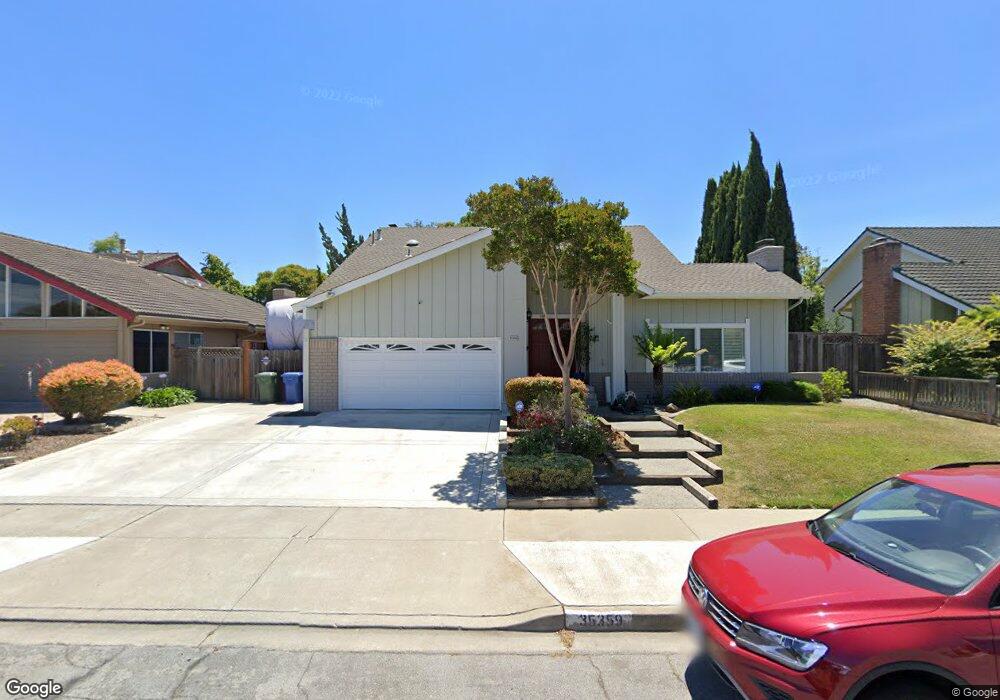
35359 Rutland Ct Newark, CA 94560
Estimated Value: $1,599,000 - $1,743,000
4
Beds
3
Baths
2,197
Sq Ft
$765/Sq Ft
Est. Value
About This Home
This home is located at 35359 Rutland Ct, Newark, CA 94560 and is currently estimated at $1,681,708, approximately $765 per square foot. 35359 Rutland Ct is a home located in Alameda County with nearby schools including John F. Kennedy Elementary School, Newark Junior High School, and Newark Memorial High School.
Ownership History
Date
Name
Owned For
Owner Type
Purchase Details
Closed on
Mar 17, 1997
Sold by
Sutherland Robert A and Sutherland Jeanette R
Bought by
Ward Jeffrey T and Ward Christina M
Current Estimated Value
Home Financials for this Owner
Home Financials are based on the most recent Mortgage that was taken out on this home.
Original Mortgage
$248,000
Outstanding Balance
$29,780
Interest Rate
7.63%
Estimated Equity
$1,651,928
Purchase Details
Closed on
Dec 1, 1993
Sold by
Sutherland Linda L
Bought by
Sutherland Robert A
Create a Home Valuation Report for This Property
The Home Valuation Report is an in-depth analysis detailing your home's value as well as a comparison with similar homes in the area
Home Values in the Area
Average Home Value in this Area
Purchase History
| Date | Buyer | Sale Price | Title Company |
|---|---|---|---|
| Ward Jeffrey T | $310,000 | Fidelity National Title Co | |
| Sutherland Robert A | -- | World Title Company |
Source: Public Records
Mortgage History
| Date | Status | Borrower | Loan Amount |
|---|---|---|---|
| Open | Ward Jeffrey T | $248,000 |
Source: Public Records
Tax History Compared to Growth
Tax History
| Year | Tax Paid | Tax Assessment Tax Assessment Total Assessment is a certain percentage of the fair market value that is determined by local assessors to be the total taxable value of land and additions on the property. | Land | Improvement |
|---|---|---|---|---|
| 2025 | $6,410 | $497,862 | $151,458 | $353,404 |
| 2024 | $6,410 | $487,964 | $148,489 | $346,475 |
| 2023 | $6,230 | $485,261 | $145,578 | $339,683 |
| 2022 | $6,137 | $468,747 | $142,724 | $333,023 |
| 2021 | $5,986 | $459,418 | $139,925 | $326,493 |
| 2020 | $5,880 | $461,638 | $138,491 | $323,147 |
| 2019 | $5,797 | $452,590 | $135,777 | $316,813 |
| 2018 | $5,708 | $443,717 | $133,115 | $310,602 |
| 2017 | $5,562 | $435,018 | $130,505 | $304,513 |
| 2016 | $5,500 | $426,491 | $127,947 | $298,544 |
| 2015 | $5,480 | $420,087 | $126,026 | $294,061 |
| 2014 | $5,330 | $411,858 | $123,557 | $288,301 |
Source: Public Records
Map
Nearby Homes
- 5303 Stirling Ct
- 35220 Cornwall Place
- 35605 Scarborough Dr
- 5093 Dorking Ct
- 4987 Winchester Place
- 5139 Dryden Ct
- 35345 Cabral Dr
- 4955 Swindon Place
- 35794 Cabral Dr
- 36202 Worthing Dr
- 35936 Magellan Dr
- 34771 Tuxedo Common Unit 52
- 36139 San Pedro Dr
- 35856 Adobe Dr
- 36288 Saxon Ct
- 6220 Jarvis Ave
- 5176 Tacoma Common
- 35978 Magellan Dr
- 4626 Alhambra Dr
- 6354 Jarvis Ave
- 35355 Rutland Ct
- 35383 Rutland Ct
- 35420 Lake Blvd
- 35402 Lake Blvd
- 35343 Rutland Ct
- 35438 Lake Blvd
- 35368 Rutland Ct
- 35378 Lake Blvd
- 35380 Rutland Ct
- 35331 Rutland Ct
- 35336 Rutland Ct
- 35360 Lake Blvd
- 5250 Ramsgate Dr
- 5258 Ramsgate Dr
- 35363 Cheviot Ct
- 35328 Rutland Ct
- 35385 Cheviot Ct
- 5266 Ramsgate Dr
- 35351 Cheviot Ct
- 5238 Ramsgate Dr