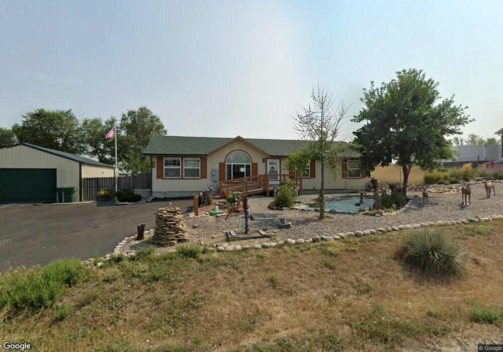
3537 Clint Rd Billings, MT 59105
Billings Heights NeighborhoodEstimated Value: $386,000 - $432,000
3
Beds
2
Baths
1,512
Sq Ft
$269/Sq Ft
Est. Value
About This Home
This home is located at 3537 Clint Rd, Billings, MT 59105 and is currently estimated at $407,279, approximately $269 per square foot. 3537 Clint Rd is a home located in Yellowstone County with nearby schools including Independent Elementary School, Castle Rock Junior High School, and Skyview High School.
Ownership History
Date
Name
Owned For
Owner Type
Purchase Details
Closed on
Mar 11, 2009
Sold by
Clawson Marshell F
Bought by
Clawson Marshell F and Clawson Anna M
Current Estimated Value
Home Financials for this Owner
Home Financials are based on the most recent Mortgage that was taken out on this home.
Original Mortgage
$280,500
Outstanding Balance
$164,236
Interest Rate
3.68%
Mortgage Type
Reverse Mortgage Home Equity Conversion Mortgage
Estimated Equity
$243,043
Purchase Details
Closed on
Nov 14, 2005
Sold by
Ritz Eddie M
Bought by
Clawson Marshell F and Clawson Anne M
Home Financials for this Owner
Home Financials are based on the most recent Mortgage that was taken out on this home.
Original Mortgage
$105,000
Interest Rate
5.93%
Mortgage Type
New Conventional
Create a Home Valuation Report for This Property
The Home Valuation Report is an in-depth analysis detailing your home's value as well as a comparison with similar homes in the area
Home Values in the Area
Average Home Value in this Area
Purchase History
| Date | Buyer | Sale Price | Title Company |
|---|---|---|---|
| Clawson Marshell F | -- | Chicago Title Insurance Co | |
| Clawson Marshell F | -- | Ctic | |
| Clawson Marshell F | -- | None Available |
Source: Public Records
Mortgage History
| Date | Status | Borrower | Loan Amount |
|---|---|---|---|
| Open | Clawson Marshell F | $280,500 | |
| Closed | Clawson Marshell F | $105,000 |
Source: Public Records
Tax History Compared to Growth
Tax History
| Year | Tax Paid | Tax Assessment Tax Assessment Total Assessment is a certain percentage of the fair market value that is determined by local assessors to be the total taxable value of land and additions on the property. | Land | Improvement |
|---|---|---|---|---|
| 2025 | $522 | $370,100 | $71,712 | $298,388 |
| 2024 | $522 | $332,200 | $57,308 | $274,892 |
| 2023 | $2,557 | $332,200 | $57,308 | $274,892 |
| 2022 | $2,313 | $254,900 | $68,391 | $186,509 |
| 2021 | $2,318 | $254,900 | $0 | $0 |
| 2020 | $2,032 | $237,400 | $0 | $0 |
| 2019 | $2,042 | $237,400 | $0 | $0 |
| 2018 | $1,961 | $208,700 | $0 | $0 |
| 2017 | $1,949 | $208,700 | $0 | $0 |
| 2016 | $1,813 | $206,700 | $0 | $0 |
| 2015 | $1,715 | $206,700 | $0 | $0 |
| 2014 | $1,638 | $100,594 | $0 | $0 |
Source: Public Records
Map
Nearby Homes
- 2719 Strapper Ln
- 2737 Strapper Ln
- 2738 Strapper Ln
- 2743 Strapper Ln
- 2731 Strapper Ln
- 1363 Kelsey Ln
- 1368 Kelsey Ln
- 1408 Eugene Ave
- 1375 Kelsey Ln
- 1369 Kelsey Ln
- 1362 Kelsey Ln
- 3415 Cherylon St
- 3520 Cherylon St
- 1364 W Eugene Ave
- 2612 Palmer Ln
- 1395 W Eugene Ave
- 2647 Palmer Ln
- 2635 Palmer Ln
- 2641 Palmer Ln
- 2623 Palmer Ln
- 3527 Clint Rd
- 3555 Clint Rd
- 3536 Clint Rd
- 3526 Clint Rd
- 3550 Clint Rd
- 3507 Us Highway 312
- 3570 Clint Rd
- 1800 Wagon Wheel Rd
- 3537 Broken Yoke Dr
- 1728 Wagon Wheel Rd
- LT 7 BLK 2 Clint Rd
- LOT 5 Block 3 Clint Rd
- LT 1 BLK 3 Clint Rd
- 1904 Brian Ln
- 3477 Us Highway 312
- 1819 Wagon Wheel Rd
- 3608 Clint Rd
- 1801 Wagon Wheel Rd
- 3526 Broken Yoke Dr
- 3532 Broken Yoke Dr