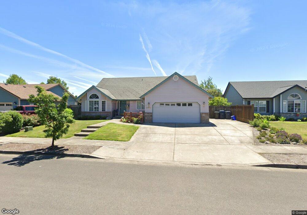
3540 Berkshire St Eugene, OR 97401
Harlow NeighborhoodEstimated Value: $575,000 - $602,000
3
Beds
2
Baths
1,835
Sq Ft
$320/Sq Ft
Est. Value
About This Home
This home is located at 3540 Berkshire St, Eugene, OR 97401 and is currently estimated at $586,634, approximately $319 per square foot. 3540 Berkshire St is a home located in Lane County with nearby schools including Holt Elementary School, Monroe Middle School, and Sheldon High School.
Ownership History
Date
Name
Owned For
Owner Type
Purchase Details
Closed on
Apr 23, 2015
Sold by
Harris Barbara Hill
Bought by
Harris Milton Albert and Harr Jill Harr
Current Estimated Value
Purchase Details
Closed on
Jun 17, 2014
Sold by
Barsanti Janis Lee and Harris Barbara Jill
Bought by
Harris Barbara Jill
Purchase Details
Closed on
Aug 13, 1998
Sold by
Ray Morgan Billy and Ray Linda J
Bought by
Johnson George Erek and Johnson Dorothy Alice
Create a Home Valuation Report for This Property
The Home Valuation Report is an in-depth analysis detailing your home's value as well as a comparison with similar homes in the area
Home Values in the Area
Average Home Value in this Area
Purchase History
| Date | Buyer | Sale Price | Title Company |
|---|---|---|---|
| Harris Milton Albert | -- | None Available | |
| Harris Barbara Jill | -- | None Available | |
| Johnson George Erek | $180,000 | Fidelity National Title Co |
Source: Public Records
Tax History Compared to Growth
Tax History
| Year | Tax Paid | Tax Assessment Tax Assessment Total Assessment is a certain percentage of the fair market value that is determined by local assessors to be the total taxable value of land and additions on the property. | Land | Improvement |
|---|---|---|---|---|
| 2024 | $6,330 | $319,401 | -- | -- |
| 2023 | $6,330 | $310,099 | $0 | $0 |
| 2022 | $5,930 | $301,067 | $0 | $0 |
| 2021 | $5,570 | $292,299 | $0 | $0 |
| 2020 | $5,480 | $283,786 | $0 | $0 |
| 2019 | $5,248 | $275,521 | $0 | $0 |
| 2018 | $4,911 | $259,706 | $0 | $0 |
| 2017 | $4,638 | $259,706 | $0 | $0 |
| 2016 | $4,419 | $252,142 | $0 | $0 |
| 2015 | $4,269 | $244,798 | $0 | $0 |
| 2014 | $4,188 | $237,668 | $0 | $0 |
Source: Public Records
Map
Nearby Homes
- 1643 Westfall Ct
- 3387 Winchester Way
- 1683 Victorian Way
- 1564 Regency Dr
- 3639 Elwing Ave
- 3583 Elwing Ave
- 1491 Victorian Way
- 1333 Victorian Way
- 1176 Arcadia Dr
- 3700 Babcock Ln Unit SP 28
- 3700 Babcock Ln Unit 140
- 3700 Babcock Ln Unit SP150
- 3700 Babcock Ln Unit 144
- 3700 Babcock Ln Unit 113
- 1190 President St
- 1755 Kings St N
- 3684 Babcock Ln
- 0 Sprig Ln Unit Lot 3 766109892
- 0 Sprig Ln Unit Lot 6 156455067
- 3090 Willakenzie Rd
- 3548 Berkshire St
- 3534 Berkshire St
- 3555 Preston St
- 3561 Preston St
- 3528 Berkshire St
- 3543 Berkshire St
- 3570 Berkshire St
- 3541 Preston St
- 3537 Berkshire St
- 3551 Berkshire St
- 3620 Berkshire St
- 3525 Berkshire St
- 3565 Berkshire St
- 3628 Berkshire St
- 1533 Manchester Dr
- 1521 Manchester Dr
- 3535 Preston St
- 1517 Manchester Dr
- 3505 Berkshire St
- 3577 Berkshire St