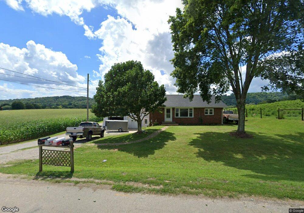
355 Laurel Ridge Rd Lowell, OH 45744
Estimated Value: $89,000 - $133,000
2
Beds
1
Bath
1,015
Sq Ft
$118/Sq Ft
Est. Value
About This Home
This home is located at 355 Laurel Ridge Rd, Lowell, OH 45744 and is currently estimated at $119,604, approximately $117 per square foot. 355 Laurel Ridge Rd is a home with nearby schools including Fort Frye High School.
Ownership History
Date
Name
Owned For
Owner Type
Purchase Details
Closed on
Sep 30, 2015
Sold by
Lent Bruce A and Lent Diana Lynn
Bought by
Weckbacher Cameron
Current Estimated Value
Home Financials for this Owner
Home Financials are based on the most recent Mortgage that was taken out on this home.
Original Mortgage
$91,935
Outstanding Balance
$71,936
Interest Rate
3.88%
Mortgage Type
VA
Estimated Equity
$47,668
Purchase Details
Closed on
Aug 25, 1993
Bought by
Lent Bruce A
Create a Home Valuation Report for This Property
The Home Valuation Report is an in-depth analysis detailing your home's value as well as a comparison with similar homes in the area
Home Values in the Area
Average Home Value in this Area
Purchase History
| Date | Buyer | Sale Price | Title Company |
|---|---|---|---|
| Weckbacher Cameron | $90,000 | Title First Agency Inc | |
| Lent Bruce A | $42,000 | -- | |
| Lent Bruce A | $42,000 | -- |
Source: Public Records
Mortgage History
| Date | Status | Borrower | Loan Amount |
|---|---|---|---|
| Open | Weckbacher Cameron | $91,935 |
Source: Public Records
Tax History Compared to Growth
Tax History
| Year | Tax Paid | Tax Assessment Tax Assessment Total Assessment is a certain percentage of the fair market value that is determined by local assessors to be the total taxable value of land and additions on the property. | Land | Improvement |
|---|---|---|---|---|
| 2024 | $1,014 | $33,780 | $2,620 | $31,160 |
| 2023 | $1,014 | $33,780 | $2,620 | $31,160 |
| 2022 | $1,013 | $33,780 | $2,620 | $31,160 |
| 2021 | $986 | $32,050 | $5,150 | $26,900 |
| 2020 | $981 | $32,050 | $5,150 | $26,900 |
| 2019 | $986 | $32,050 | $5,150 | $26,900 |
| 2018 | $903 | $28,640 | $4,480 | $24,160 |
| 2017 | $906 | $28,640 | $4,480 | $24,160 |
| 2016 | $1,733 | $28,640 | $4,480 | $24,160 |
| 2015 | $781 | $23,650 | $4,560 | $19,090 |
| 2014 | $1,423 | $23,650 | $4,560 | $19,090 |
| 2013 | $783 | $23,650 | $4,560 | $19,090 |
Source: Public Records
Map
Nearby Homes
- 323 5th St
- 310 5th St
- 208 Main St
- 0 State Route 530 Unit Lowell OH 45744
- 0 Ohio 530
- 360 E Henniger Rd
- 627 Strahler Rd
- 570 Coal Run Dr
- 4595 Ohio 530
- 0 Dixon Ridge Rd Unit 5164097
- 40 Masonic Park Ln
- 3275 Highland Ridge Rd
- 0 Highland Ridge Rd
- 111 Bohl Dr
- 200 Bohl Dr
- 402 Keeler Dr
- 00 Marshall Rd
- 102 Woodrow St
- 106 Marshall Rd
- 101 Ellsworth Dr
- 365 Laurel Ridge Rd
- 370 Laurel Ridge Rd
- 380 Laurel Ridge Rd
- 240 Laurel Ridge Rd
- 245 Laurel Ridge Rd
- 195 Laurel Ridge Rd
- 175 Laurel Ridge Rd
- 88 Laurel Ridge Rd
- 125 Laurel Ridge Rd
- 515 Laurel Ridge Rd
- 200 Laurel Ridge Rd
- 10 Greenlawn Ln
- 115 Laurel Ridge Rd
- 150 Laurel Ridge Rd
- 95 Laurel Ridge Rd
- 95 Greenlawn Ln
- 11856 State Route 60
- 15 Laurel Ridge Rd
- 11860 State Route 60
- 140 Laurel Ridge Rd