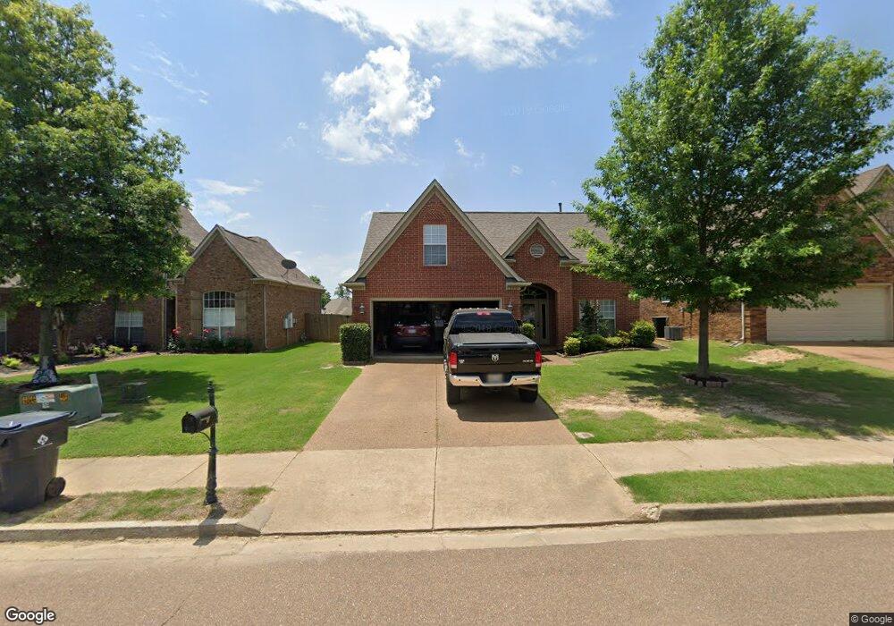
355 Vaiden Ridge Dr N Hernando, MS 38632
Estimated Value: $286,000 - $326,000
3
Beds
3
Baths
2,277
Sq Ft
$137/Sq Ft
Est. Value
About This Home
This home is located at 355 Vaiden Ridge Dr N, Hernando, MS 38632 and is currently estimated at $311,749, approximately $136 per square foot. 355 Vaiden Ridge Dr N is a home located in DeSoto County with nearby schools including Oak Grove Central Elementary School, Hernando Elementary School, and Hernando Hills Elementary.
Ownership History
Date
Name
Owned For
Owner Type
Purchase Details
Closed on
Dec 4, 2009
Sold by
Daniels Robert T
Bought by
Daniels Robert T and Daniels Crystal Woods
Current Estimated Value
Purchase Details
Closed on
Jul 2, 2009
Sold by
Community Mortgage Corporation
Bought by
Daniels Robert T
Home Financials for this Owner
Home Financials are based on the most recent Mortgage that was taken out on this home.
Original Mortgage
$113,500
Outstanding Balance
$72,095
Interest Rate
4.79%
Mortgage Type
Purchase Money Mortgage
Estimated Equity
$239,654
Purchase Details
Closed on
May 13, 2009
Sold by
Trust Homes Llc
Bought by
Community Mortgage Corporation
Home Financials for this Owner
Home Financials are based on the most recent Mortgage that was taken out on this home.
Original Mortgage
$113,500
Outstanding Balance
$72,095
Interest Rate
4.79%
Mortgage Type
Purchase Money Mortgage
Estimated Equity
$239,654
Create a Home Valuation Report for This Property
The Home Valuation Report is an in-depth analysis detailing your home's value as well as a comparison with similar homes in the area
Home Values in the Area
Average Home Value in this Area
Purchase History
| Date | Buyer | Sale Price | Title Company |
|---|---|---|---|
| Daniels Robert T | -- | None Available | |
| Daniels Robert T | -- | None Available | |
| Community Mortgage Corporation | $174,121 | None Available |
Source: Public Records
Mortgage History
| Date | Status | Borrower | Loan Amount |
|---|---|---|---|
| Open | Daniels Robert T | $113,500 | |
| Previous Owner | Community Mortgage Corporation | $157,000 |
Source: Public Records
Tax History Compared to Growth
Tax History
| Year | Tax Paid | Tax Assessment Tax Assessment Total Assessment is a certain percentage of the fair market value that is determined by local assessors to be the total taxable value of land and additions on the property. | Land | Improvement |
|---|---|---|---|---|
| 2024 | $1,862 | $15,583 | $3,000 | $12,583 |
| 2023 | $1,862 | $15,583 | $0 | $0 |
| 2022 | $1,862 | $15,583 | $3,000 | $12,583 |
| 2021 | $1,862 | $15,583 | $3,000 | $12,583 |
| 2020 | $1,718 | $14,548 | $0 | $0 |
| 2019 | $1,718 | $14,548 | $3,000 | $11,548 |
| 2017 | $1,693 | $25,582 | $14,291 | $11,291 |
| 2016 | $1,610 | $14,291 | $3,000 | $11,291 |
| 2015 | $1,910 | $25,582 | $14,291 | $11,291 |
| 2014 | $1,564 | $14,291 | $0 | $0 |
| 2013 | $1,611 | $14,291 | $0 | $0 |
Source: Public Records
Map
Nearby Homes
- 450 Vaiden Dr
- 1 E Oak Grove Rd
- 5 W Commerce St
- 0 E Commerce St
- 255 Magnolia Gardens Dr
- 4770 Mccracken Rd
- 1102 Greenwich Dr
- 1335 Creekside Blvd
- 0 Monteith Ave Unit 4060654
- 587 Walkers Way
- 2615 Jaxon Dr
- 2035 Highway 51 S
- 2483 Tragg Ave
- 1406 Koby Ln
- 280 Northwood Hills Dr
- 1990 McIngvale Rd
- 1495 Holly Springs Rd
- 280 Byhalia Cove
- 665 Cedar Grove Cove
- 400 Timber Way S
- 375 Vaiden Ridge Dr N
- 365 Vaiden Dr
- 349 Vaiden Ridge Dr N
- 349 Vaiden Ridge Dr N
- 347 Vaiden Ridge Dr N
- 335 Vaiden Ridge
- 335 Vaiden Ridge Dr N
- 372 Vaiden Ridge Dr N
- 360 Vaiden Ridge Dr N
- 389 Vaiden Ridge Dr N
- 356 Vaiden Ridge Dr S
- 350 Vaiden Ridge Dr N
- 370 Vaiden Ridge Dr S
- 390 Vaiden Ridge Dr N
- 342 Vaiden Ridge Dr S
- 386 Vaiden Ridge Dr S
- 338 Vaiden Ridge Dr N
- 328 Vaiden Ridge Dr S
- 402 Vaiden Ridge Dr N
- 314 Vaiden Ridge Dr S