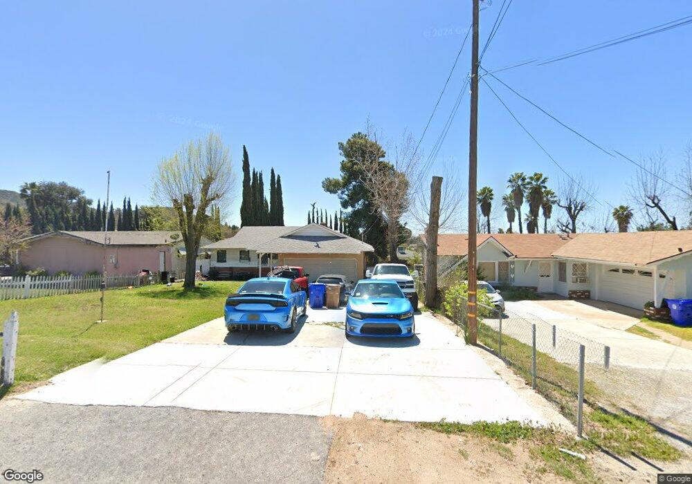
35545 Date St Yucaipa, CA 92399
3
Beds
2
Baths
1,260
Sq Ft
0.28
Acres
About This Home
This home is located at 35545 Date St, Yucaipa, CA 92399. 35545 Date St is a home located in San Bernardino County with nearby schools including Ridgeview Elementary School, Park View Middle School, and Yucaipa High School.
Create a Home Valuation Report for This Property
The Home Valuation Report is an in-depth analysis detailing your home's value as well as a comparison with similar homes in the area
Home Values in the Area
Average Home Value in this Area
Tax History
| Year | Tax Paid | Tax Assessment Tax Assessment Total Assessment is a certain percentage of the fair market value that is determined by local assessors to be the total taxable value of land and additions on the property. | Land | Improvement |
|---|---|---|---|---|
| 2025 | $3,675 | $267,362 | $80,209 | $187,153 |
| 2024 | $3,571 | $262,119 | $78,636 | $183,483 |
| 2023 | $3,467 | $256,979 | $77,094 | $179,885 |
| 2022 | $3,411 | $251,940 | $75,582 | $176,358 |
| 2021 | $2,316 | $166,558 | $43,450 | $123,108 |
| 2020 | $1,964 | $164,850 | $43,004 | $121,846 |
| 2019 | $2,244 | $161,618 | $42,161 | $119,457 |
| 2018 | $1,865 | $158,449 | $41,334 | $117,115 |
| 2017 | $1,823 | $155,343 | $40,524 | $114,819 |
| 2016 | $1,798 | $152,297 | $39,729 | $112,568 |
| 2015 | $1,778 | $150,009 | $39,132 | $110,877 |
| 2014 | $1,741 | $147,070 | $38,365 | $108,705 |
Source: Public Records
Map
Nearby Homes
- 11675 Calvin St
- 11630 Lennox St
- 35688 Date Ave
- 35688 Date St
- 11757 Auburn Ave
- 11636 Madison St
- 11616 Madison St
- 11606 Madison St
- 9813 Fremont St
- 11963 Berkeley Dr
- 35850 Cornell Dr
- 11765 Holmes St
- 35263 Beech Ave
- 0 Pendleton Unit SW24186609
- 11537 Pendleton Rd
- 35225 Acacia Ave
- 12142 Bryant St
- 34972 S Serrano Square
- 36041 Highland Ave
- 12199 Bryant St
Your Personal Tour Guide
Ask me questions while you tour the home.