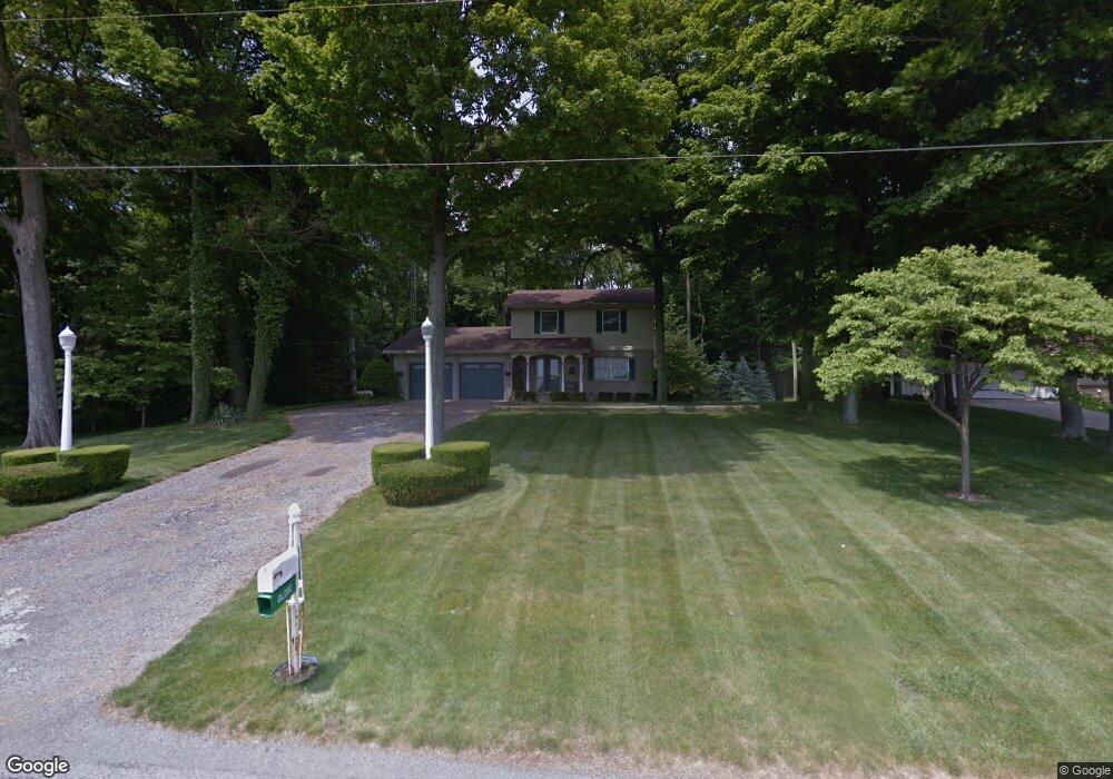
3566 Stine Rd Shelby, OH 44875
Estimated Value: $228,000 - $306,000
4
Beds
2
Baths
1,737
Sq Ft
$156/Sq Ft
Est. Value
About This Home
This home is located at 3566 Stine Rd, Shelby, OH 44875 and is currently estimated at $271,000, approximately $156 per square foot. 3566 Stine Rd is a home located in Richland County.
Ownership History
Date
Name
Owned For
Owner Type
Purchase Details
Closed on
Oct 22, 2021
Sold by
Hartings Karli A and Blevins Dylan J
Bought by
Blevins Dylan J and Blevins Karli A
Current Estimated Value
Home Financials for this Owner
Home Financials are based on the most recent Mortgage that was taken out on this home.
Original Mortgage
$196,000
Outstanding Balance
$149,608
Interest Rate
2.1%
Mortgage Type
Future Advance Clause Open End Mortgage
Estimated Equity
$121,392
Purchase Details
Closed on
Sep 27, 2013
Sold by
Clark Ray E and Clark Carolyn A
Bought by
Hartings Karli A
Create a Home Valuation Report for This Property
The Home Valuation Report is an in-depth analysis detailing your home's value as well as a comparison with similar homes in the area
Purchase History
| Date | Buyer | Sale Price | Title Company |
|---|---|---|---|
| Blevins Dylan J | -- | None Available | |
| Hartings Karli A | $125,000 | Attorney |
Source: Public Records
Mortgage History
| Date | Status | Borrower | Loan Amount |
|---|---|---|---|
| Open | Blevins Dylan J | $196,000 |
Source: Public Records
Tax History
| Year | Tax Paid | Tax Assessment Tax Assessment Total Assessment is a certain percentage of the fair market value that is determined by local assessors to be the total taxable value of land and additions on the property. | Land | Improvement |
|---|---|---|---|---|
| 2024 | $2,070 | $55,900 | $8,070 | $47,830 |
| 2023 | $2,121 | $55,900 | $8,070 | $47,830 |
| 2022 | $2,045 | $48,050 | $7,790 | $40,260 |
| 2021 | $2,046 | $48,050 | $7,790 | $40,260 |
| 2020 | $2,048 | $48,050 | $7,790 | $40,260 |
| 2019 | $1,901 | $41,070 | $6,600 | $34,470 |
| 2018 | $1,863 | $41,070 | $6,600 | $34,470 |
| 2017 | $1,845 | $41,070 | $6,600 | $34,470 |
| 2016 | $1,889 | $42,440 | $5,550 | $36,890 |
| 2015 | $1,889 | $42,440 | $5,550 | $36,890 |
| 2014 | $1,813 | $42,440 | $5,550 | $36,890 |
| 2012 | $712 | $42,440 | $5,550 | $36,890 |
Source: Public Records
Map
Nearby Homes
- 3566 Stein Rd
- 3062 Myers Rd
- 3400 Rock Rd
- 0 Rock Rd
- 3767 Cookton Grange Rd
- 1689 Ohio 314
- 1689 State Route 314
- 671 Bendle Ave
- 572 Bendle Ave
- 2690 Taylortown Rd
- 67 Sherman Ave
- 23 Chestnut Ct
- 104 Chestnut Ct
- 14 W Maxwell Dr
- 3872 Snodgrass Rd
- 23 W Gaylord Ave
- 1129 Bogey Dr
- 1105 Bogey Dr Unit 1105
- 1114 Bogey Dr Unit 1114
- 1111 Bogey Dr
- 3538 Stein Rd
- 3530 Stein Rd
- 3509 Stein Rd
- 3522 Stein Rd
- 3505 Stein Rd
- 3576 Stein Rd
- 3599 Stein Rd
- 3515 Stiving Rd
- 3470 Stein Rd
- 3479 Stiving Rd
- 3450 Stein Rd Unit 3452
- 3465 Stiving Rd
- 3503 Stiving Rd
- 3449 Stiving Rd
- 3440 Stein Rd Unit 3442
- 3492 Stiving Rd
- 3430 Stein Rd
- 3516 Stiving Rd
- 3535 Stiving Rd
- 3429 Stein Rd
Your Personal Tour Guide
Ask me questions while you tour the home.