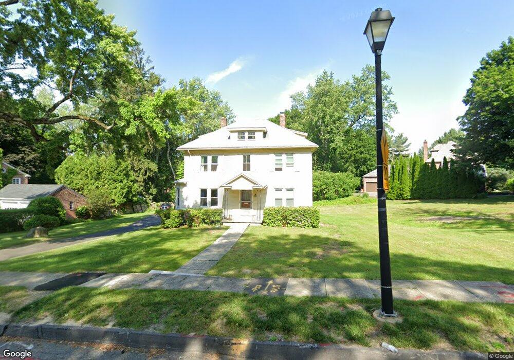
357 Salisbury St Worcester, MA 01609
Salisbury Street NeighborhoodEstimated Value: $553,063 - $630,000
4
Beds
2
Baths
2,331
Sq Ft
$259/Sq Ft
Est. Value
About This Home
This home is located at 357 Salisbury St, Worcester, MA 01609 and is currently estimated at $603,266, approximately $258 per square foot. 357 Salisbury St is a home located in Worcester County with nearby schools including Chandler Magnet, Jacob Hiatt Magnet School, and Flagg Street School.
Ownership History
Date
Name
Owned For
Owner Type
Purchase Details
Closed on
Sep 29, 2020
Sold by
Welcom Seth A
Bought by
Welcom Seth A and Welcom Mei L
Current Estimated Value
Home Financials for this Owner
Home Financials are based on the most recent Mortgage that was taken out on this home.
Original Mortgage
$22,000
Outstanding Balance
$19,479
Interest Rate
2.9%
Mortgage Type
Balloon
Estimated Equity
$583,787
Purchase Details
Closed on
Nov 13, 2012
Sold by
Welcom Donald R
Bought by
Sullivan Sandra A and Welcom Seth A
Create a Home Valuation Report for This Property
The Home Valuation Report is an in-depth analysis detailing your home's value as well as a comparison with similar homes in the area
Home Values in the Area
Average Home Value in this Area
Purchase History
| Date | Buyer | Sale Price | Title Company |
|---|---|---|---|
| Welcom Seth A | -- | None Available | |
| Welcome Seth A | -- | None Available | |
| Sullivan Sandra A | -- | -- |
Source: Public Records
Mortgage History
| Date | Status | Borrower | Loan Amount |
|---|---|---|---|
| Open | Welcom Seth A | $22,000 | |
| Open | Welcom Seth A | $225,500 |
Source: Public Records
Tax History
| Year | Tax Paid | Tax Assessment Tax Assessment Total Assessment is a certain percentage of the fair market value that is determined by local assessors to be the total taxable value of land and additions on the property. | Land | Improvement |
|---|---|---|---|---|
| 2025 | $6,300 | $477,600 | $125,600 | $352,000 |
| 2024 | $6,064 | $441,000 | $125,600 | $315,400 |
| 2023 | $5,650 | $394,000 | $108,300 | $285,700 |
| 2022 | $5,428 | $356,900 | $86,900 | $270,000 |
| 2021 | $4,581 | $281,400 | $69,800 | $211,600 |
| 2020 | $4,323 | $254,300 | $69,600 | $184,700 |
| 2019 | $4,529 | $251,600 | $67,400 | $184,200 |
| 2018 | $4,457 | $235,700 | $67,400 | $168,300 |
| 2017 | $4,248 | $221,000 | $67,400 | $153,600 |
| 2016 | $4,277 | $207,500 | $57,100 | $150,400 |
| 2015 | $4,165 | $207,500 | $57,100 | $150,400 |
| 2014 | $4,072 | $208,400 | $57,100 | $151,300 |
Source: Public Records
Map
Nearby Homes
- 59 Beechmont St
- 8 Old Colony Rd
- 49 Metcalf St
- 40 Westwood Dr
- 6 Paul Revere Rd
- 93 Newton Ave N
- 83 Newton Ave N
- 7 Longworth Rd
- 9 Dennison Rd
- 493 Salisbury St
- 14 Balder Rd
- 31 Lenox St
- 22 Audubon Rd
- 19 Highland Terrace
- 3A Chalmers Rd
- 32 Aylesbury Rd
- 3 Suburban Rd
- 577 Grove St
- 6 Newton Ave
- 322 Highland St
- 361 Salisbury St
- 147 Newton Ave N
- 145 Newton Ave N
- 353 Salisbury St
- 353 Salisbury St Unit 1
- 363 Salisbury St
- 50 Terrace Dr
- 9 Ellis Dr
- 11 Ellis Dr
- 48 Terrace Dr
- 356 Salisbury St
- 351 Salisbury St
- 360 Salisbury St
- 3 Ellis Dr
- 46 Terrace Dr
- 15 Ellis Dr
- 140 Newton Ave N
- 352 Salisbury St
- 139 Newton Ave N
- 12 Ellis Dr
Your Personal Tour Guide
Ask me questions while you tour the home.