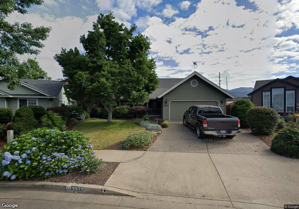
3577 Berkshire St Eugene, OR 97401
Harlow NeighborhoodEstimated Value: $522,460 - $573,000
3
Beds
2
Baths
1,574
Sq Ft
$350/Sq Ft
Est. Value
About This Home
This home is located at 3577 Berkshire St, Eugene, OR 97401 and is currently estimated at $551,365, approximately $350 per square foot. 3577 Berkshire St is a home located in Lane County with nearby schools including Holt Elementary School, Monroe Middle School, and Sheldon High School.
Ownership History
Date
Name
Owned For
Owner Type
Purchase Details
Closed on
Oct 4, 2011
Sold by
Nowack Scott Obrien
Bought by
Myers Ronald C
Current Estimated Value
Home Financials for this Owner
Home Financials are based on the most recent Mortgage that was taken out on this home.
Original Mortgage
$110,000
Outstanding Balance
$74,691
Interest Rate
4.16%
Mortgage Type
New Conventional
Estimated Equity
$476,674
Create a Home Valuation Report for This Property
The Home Valuation Report is an in-depth analysis detailing your home's value as well as a comparison with similar homes in the area
Home Values in the Area
Average Home Value in this Area
Purchase History
| Date | Buyer | Sale Price | Title Company |
|---|---|---|---|
| Myers Ronald C | $198,000 | Fidelity National Title Insu |
Source: Public Records
Mortgage History
| Date | Status | Borrower | Loan Amount |
|---|---|---|---|
| Open | Myers Ronald C | $110,000 |
Source: Public Records
Tax History
| Year | Tax Paid | Tax Assessment Tax Assessment Total Assessment is a certain percentage of the fair market value that is determined by local assessors to be the total taxable value of land and additions on the property. | Land | Improvement |
|---|---|---|---|---|
| 2025 | $5,671 | $291,038 | -- | -- |
| 2024 | $5,600 | $282,562 | -- | -- |
| 2023 | $5,600 | $274,333 | $0 | $0 |
| 2022 | $5,246 | $266,343 | $0 | $0 |
| 2021 | $4,928 | $258,586 | $0 | $0 |
| 2020 | $4,945 | $251,055 | $0 | $0 |
| 2019 | $4,776 | $243,743 | $0 | $0 |
| 2018 | $4,445 | $229,751 | $0 | $0 |
| 2017 | $4,176 | $229,751 | $0 | $0 |
| 2016 | $4,008 | $223,059 | $0 | $0 |
| 2015 | $3,881 | $216,562 | $0 | $0 |
| 2014 | $3,800 | $210,254 | $0 | $0 |
Source: Public Records
Map
Nearby Homes
- 1564 Regency Dr
- 1271 Arcadia Dr
- 1491 Victorian Way
- 1270 Calvin St
- 3700 Babcock Ln Unit 119
- 3700 Babcock Ln Unit 106
- 1794 Kings St N
- 3090 Willakenzie Rd
- 0 Sprig Ln Unit Lot 3
- 0 Sprig Ln Unit Lot 3 766109892
- 3155 Oriole St
- 1038 President St
- 3227 Partridge Way
- 624 Tinamou Ln
- 2846 El Toro Ct
- 2727 Gateway St Unit 27
- 3198 Pheasant Blvd
- 3215 Pheasant Blvd
- 3025 Bailey Ln
- 590 Flamingo Ave
- 3583 Berkshire St
- 3565 Berkshire St
- 3595 Berkshire St
- 3551 Berkshire St
- 3570 Berkshire St
- 3611 Berkshire St
- 3548 Berkshire St
- 3543 Berkshire St
- 3620 Berkshire St
- 3540 Berkshire St
- 3627 Berkshire St
- 3537 Berkshire St
- 3561 Preston St
- 3628 Berkshire St
- 3534 Berkshire St
- 3633 Berkshire St
- 3555 Preston St
- 3525 Berkshire St
- 3642 Berkshire St
- 1591 Manchester Dr
Your Personal Tour Guide
Ask me questions while you tour the home.