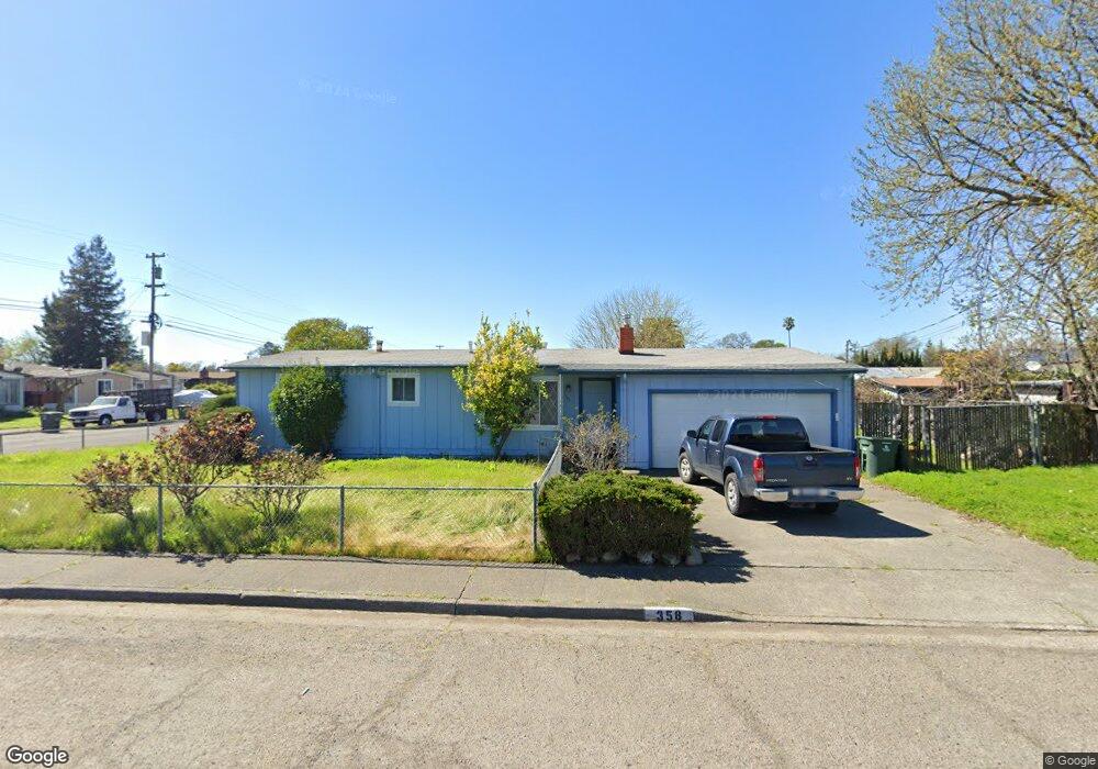
358 Ashwood Dr Santa Rosa, CA 95407
Estimated Value: $476,000 - $505,000
2
Beds
1
Bath
928
Sq Ft
$535/Sq Ft
Est. Value
About This Home
This home is located at 358 Ashwood Dr, Santa Rosa, CA 95407 and is currently estimated at $496,255, approximately $534 per square foot. 358 Ashwood Dr is a home located in Sonoma County with nearby schools including Elsie Allen High School.
Ownership History
Date
Name
Owned For
Owner Type
Purchase Details
Closed on
Jun 27, 2018
Sold by
Azarvand Darius Eugene
Bought by
The Darius Eugene Azarvand Revocable Liv
Current Estimated Value
Purchase Details
Closed on
Dec 24, 2015
Sold by
Azarvand Louise A
Bought by
Azarvand Darius Eugene
Purchase Details
Closed on
Sep 29, 1989
Bought by
Azarvand Darius Eugene
Create a Home Valuation Report for This Property
The Home Valuation Report is an in-depth analysis detailing your home's value as well as a comparison with similar homes in the area
Home Values in the Area
Average Home Value in this Area
Purchase History
| Date | Buyer | Sale Price | Title Company |
|---|---|---|---|
| The Darius Eugene Azarvand Revocable Liv | -- | None Available | |
| Azarvand Darius Eugene | -- | None Available | |
| Azarvand Darius Eugene | $127,500 | -- |
Source: Public Records
Tax History Compared to Growth
Tax History
| Year | Tax Paid | Tax Assessment Tax Assessment Total Assessment is a certain percentage of the fair market value that is determined by local assessors to be the total taxable value of land and additions on the property. | Land | Improvement |
|---|---|---|---|---|
| 2025 | $3,229 | $234,547 | $110,374 | $124,173 |
| 2024 | $3,229 | $229,949 | $108,210 | $121,739 |
| 2023 | $3,229 | $225,441 | $106,089 | $119,352 |
| 2022 | $3,224 | $221,021 | $104,009 | $117,012 |
| 2021 | $3,269 | $216,688 | $101,970 | $114,718 |
| 2020 | $2,986 | $214,467 | $100,925 | $113,542 |
| 2019 | $3,074 | $210,263 | $98,947 | $111,316 |
| 2018 | $3,267 | $206,141 | $97,007 | $109,134 |
| 2017 | $3,285 | $202,100 | $95,105 | $106,995 |
| 2016 | $3,216 | $198,139 | $93,241 | $104,898 |
| 2015 | $3,111 | $195,164 | $91,841 | $103,323 |
| 2014 | $3,010 | $191,342 | $90,042 | $101,300 |
Source: Public Records
Map
Nearby Homes
- 2154 Corby Ave
- 444 Pueblo Bonito Place
- 487 Hearn Ave
- 1911 Corby Ave
- 101 Colgan Ave Unit 25
- 101 Colgan Ave Unit 24
- 101 Colgan Ave Unit 2
- 1447 Beachwood Dr
- 1630 Mathwig Dr
- 2323 Calico Ln
- 2302 Squire Ln Unit 40
- 2721 Victoria Dr
- 2727 Victoria Dr
- 1245 Olive St
- 1260 Aloise Ave
- 1501 La Esplanada Place Unit 326
- 0 West Ave Unit 325019616
- 225 Burt St Unit 34
- 1855 Petaluma Hill Rd
- 109 Pear Ln Unit 109
- 443 Smokewood Dr
- 386 Ashwood Dr
- 385 Ashwood Dr
- 440 Ashwood Dr
- 447 Smokewood Dr
- 412 Smokewood Dr
- 406 Smokewood Dr
- 389 Ashwood Dr
- 484 Ashwood Dr
- 450 Smokewood Dr
- 390 Smokewood Dr
- 357 Smokewood Dr
- 511 Smokewood Dr
- 393 Ashwood Dr
- 478 Smokewood Dr
- 512 Ashwood Dr
- 368 Smokewood Dr
- 2129 Corby Ave
- 411 Cottonwood Dr
- 405 Cottonwood Dr