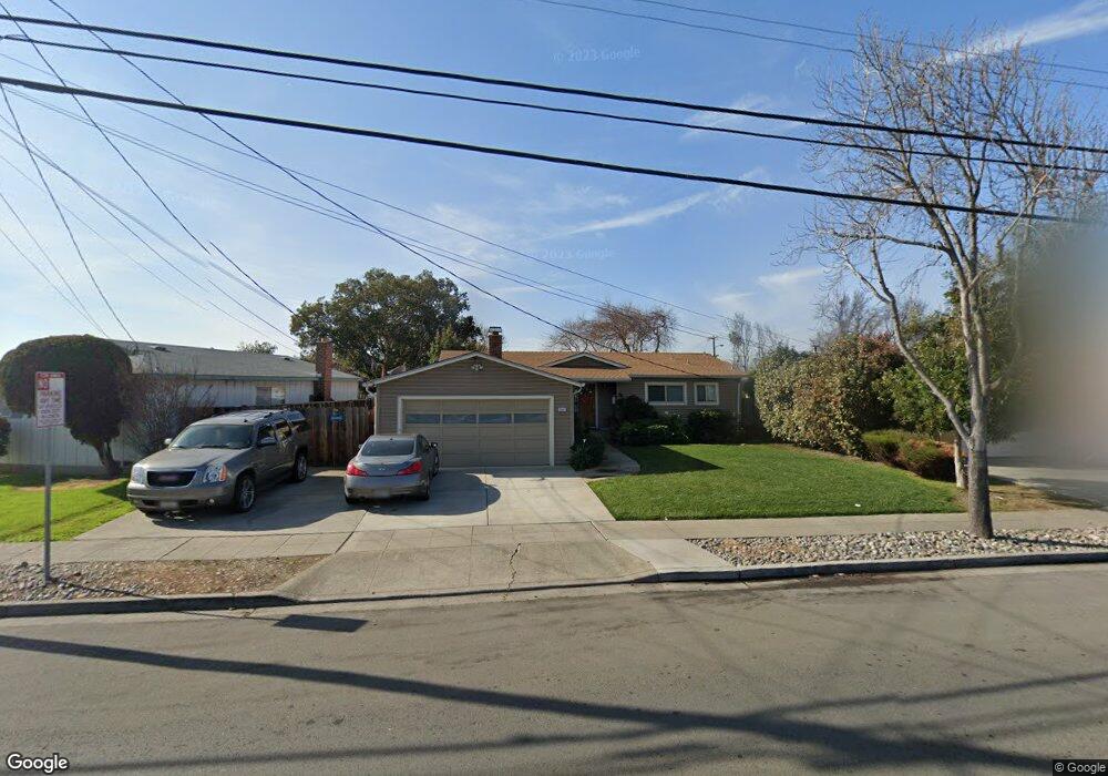
35841 Newark Blvd Newark, CA 94560
Estimated Value: $1,060,000 - $1,188,000
3
Beds
2
Baths
1,100
Sq Ft
$1,009/Sq Ft
Est. Value
About This Home
This home is located at 35841 Newark Blvd, Newark, CA 94560 and is currently estimated at $1,109,408, approximately $1,008 per square foot. 35841 Newark Blvd is a home located in Alameda County with nearby schools including Newark Junior High School, Newark Memorial High School, and Montessori School of Newark.
Ownership History
Date
Name
Owned For
Owner Type
Purchase Details
Closed on
Jul 19, 2012
Sold by
Watson Karol I and Watson Roger C
Bought by
Puamau Afifio and Puamau Diana Elena
Current Estimated Value
Home Financials for this Owner
Home Financials are based on the most recent Mortgage that was taken out on this home.
Original Mortgage
$373,117
Outstanding Balance
$255,475
Interest Rate
3.5%
Mortgage Type
FHA
Estimated Equity
$853,933
Create a Home Valuation Report for This Property
The Home Valuation Report is an in-depth analysis detailing your home's value as well as a comparison with similar homes in the area
Home Values in the Area
Average Home Value in this Area
Purchase History
| Date | Buyer | Sale Price | Title Company |
|---|---|---|---|
| Puamau Afifio | $380,000 | Old Republic Title Company |
Source: Public Records
Mortgage History
| Date | Status | Borrower | Loan Amount |
|---|---|---|---|
| Open | Puamau Afifio | $373,117 |
Source: Public Records
Tax History
| Year | Tax Paid | Tax Assessment Tax Assessment Total Assessment is a certain percentage of the fair market value that is determined by local assessors to be the total taxable value of land and additions on the property. | Land | Improvement |
|---|---|---|---|---|
| 2025 | $5,967 | $460,924 | $140,377 | $327,547 |
| 2024 | $5,967 | $451,750 | $137,625 | $321,125 |
| 2023 | $5,797 | $449,755 | $134,926 | $314,829 |
| 2022 | $5,711 | $433,940 | $132,282 | $308,658 |
| 2021 | $5,570 | $425,294 | $129,688 | $302,606 |
| 2020 | $5,464 | $427,864 | $128,359 | $299,505 |
| 2019 | $5,387 | $419,477 | $125,843 | $293,634 |
| 2018 | $5,303 | $411,254 | $123,376 | $287,878 |
| 2017 | $5,168 | $403,190 | $120,957 | $282,233 |
| 2016 | $5,108 | $395,287 | $118,586 | $276,701 |
| 2015 | $5,089 | $389,351 | $116,805 | $272,546 |
| 2014 | $4,948 | $381,724 | $114,517 | $267,207 |
Source: Public Records
Map
Nearby Homes
- 36057 Dalewood Dr
- 35952 Rosewood Dr
- 5879 Caleb Ct
- 5874 Caleb Ct
- 5585 Fernwood Dr
- 6252 Bennington Dr
- 6048 Bellhaven Ave
- 36255 Casey Ct
- 36465 Hafner St
- 6449 Cedar Blvd
- 35415 Blackburn Dr
- 35050 Lido Blvd Unit B
- 5298 Sussex Place
- 6328 Zulmida Ave
- 35421 Cleremont Dr
- 5228 Falmouth Place
- 5912 Mayhews Landing Rd
- 5311 Port Sailwood Dr
- 6435 Normandy Dr
- 36184 Toulouse St
- 35865 Newark Blvd
- 35815 Newark Blvd
- 6052 Madelaine Dr
- 35785 Newark Blvd
- 35893 Newark Blvd
- 6056 Madelaine Dr
- 35753 Newark Blvd
- 35908 Newark Blvd
- 35890 Newark Blvd
- 35942 Newark Blvd
- 6060 Madelaine Dr
- 6044 Madelaine Dr
- 35737 Newark Blvd
- 35872 Newark Blvd
- 35958 Newark Blvd
- 35976 Newark Blvd
- 6064 Madelaine Dr
- 35907 Dalewood Dr
- 35923 Dalewood Dr
- 6006 Brittany Ave
Your Personal Tour Guide
Ask me questions while you tour the home.