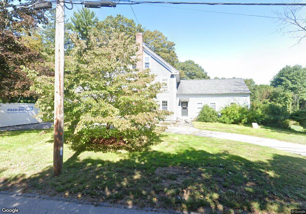
36 Causeway St Unit 1 Millis, MA 02054
Estimated Value: $839,157 - $1,024,000
4
Beds
1
Bath
2,188
Sq Ft
$423/Sq Ft
Est. Value
About This Home
This home is located at 36 Causeway St Unit 1, Millis, MA 02054 and is currently estimated at $924,789, approximately $422 per square foot. 36 Causeway St Unit 1 is a home located in Norfolk County with nearby schools including Clyde F Brown, Millis Middle School, and Millis High School.
Ownership History
Date
Name
Owned For
Owner Type
Purchase Details
Closed on
May 9, 2001
Sold by
Smith Philip H and Smith Bonny J
Bought by
Smith Philip H and Smith Kimberly
Current Estimated Value
Home Financials for this Owner
Home Financials are based on the most recent Mortgage that was taken out on this home.
Original Mortgage
$75,000
Interest Rate
7.14%
Create a Home Valuation Report for This Property
The Home Valuation Report is an in-depth analysis detailing your home's value as well as a comparison with similar homes in the area
Home Values in the Area
Average Home Value in this Area
Purchase History
| Date | Buyer | Sale Price | Title Company |
|---|---|---|---|
| Smith Philip H | $100,000 | -- |
Source: Public Records
Mortgage History
| Date | Status | Borrower | Loan Amount |
|---|---|---|---|
| Open | Smith Philip H | $115,300 | |
| Closed | Smith Philip H | $75,000 | |
| Previous Owner | Smith Philip H | $40,000 |
Source: Public Records
Tax History
| Year | Tax Paid | Tax Assessment Tax Assessment Total Assessment is a certain percentage of the fair market value that is determined by local assessors to be the total taxable value of land and additions on the property. | Land | Improvement |
|---|---|---|---|---|
| 2025 | $12,095 | $737,500 | $254,500 | $483,000 |
| 2024 | $11,862 | $722,400 | $254,500 | $467,900 |
| 2023 | $10,609 | $606,600 | $196,100 | $410,500 |
| 2022 | $11,549 | $611,700 | $177,100 | $434,600 |
| 2021 | $10,771 | $549,000 | $177,100 | $371,900 |
| 2020 | $10,503 | $521,500 | $165,500 | $356,000 |
| 2019 | $8,284 | $443,000 | $123,400 | $319,600 |
| 2018 | $7,983 | $443,000 | $123,400 | $319,600 |
| 2017 | $8,015 | $435,100 | $141,000 | $294,100 |
| 2016 | $7,281 | $417,500 | $141,000 | $276,500 |
| 2015 | $7,098 | $417,500 | $141,000 | $276,500 |
Source: Public Records
Map
Nearby Homes
- 6 Jameson Dr Unit 6
- 3 Jameson Dr Unit 3
- 8 Glen Ellen Blvd Unit 8
- 99 Goulding St
- 124 Glen Ellen Blvd Unit 124
- 9 Bogastow Cir
- 13 Hattie Ln Unit 13
- 86 Glen Ellen Blvd Unit 86
- 731 Norfolk St
- 11 Fairway Ln
- 50 Walnut St
- 17 Fairway Ln
- 0 Hill St
- 4 Brookview Rd
- 25 Howe St
- 66 Lakeshore Dr
- 204 Ridge St
- 14 April Way
- 33 Gorwin Dr
- 10 April Way
Your Personal Tour Guide
Ask me questions while you tour the home.