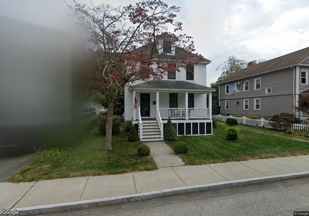
36 Sherman St New London, CT 06320
South New London NeighborhoodEstimated Value: $394,000 - $412,279
4
Beds
3
Baths
1,897
Sq Ft
$212/Sq Ft
Est. Value
About This Home
This home is located at 36 Sherman St, New London, CT 06320 and is currently estimated at $401,570, approximately $211 per square foot. 36 Sherman St is a home located in New London County with nearby schools including Harbor Elementary School, Bennie Dover Jackson Middle School, and New London High School.
Ownership History
Date
Name
Owned For
Owner Type
Purchase Details
Closed on
Dec 20, 2016
Sold by
Whiteway Roger
Bought by
Whiteway Preston A
Current Estimated Value
Home Financials for this Owner
Home Financials are based on the most recent Mortgage that was taken out on this home.
Original Mortgage
$126,850
Outstanding Balance
$104,416
Interest Rate
4.08%
Mortgage Type
Stand Alone Refi Refinance Of Original Loan
Estimated Equity
$297,154
Purchase Details
Closed on
May 23, 2005
Sold by
Lorking Bruce
Bought by
Whiteway Preston and Whiteway Roger
Home Financials for this Owner
Home Financials are based on the most recent Mortgage that was taken out on this home.
Original Mortgage
$150,000
Interest Rate
5.95%
Create a Home Valuation Report for This Property
The Home Valuation Report is an in-depth analysis detailing your home's value as well as a comparison with similar homes in the area
Home Values in the Area
Average Home Value in this Area
Purchase History
| Date | Buyer | Sale Price | Title Company |
|---|---|---|---|
| Whiteway Preston A | -- | -- | |
| Whiteway Preston A | -- | -- | |
| Whiteway Preston | $250,000 | -- | |
| Whiteway Preston | $250,000 | -- |
Source: Public Records
Mortgage History
| Date | Status | Borrower | Loan Amount |
|---|---|---|---|
| Open | Whiteway Preston | $126,850 | |
| Previous Owner | Whiteway Preston | $150,000 | |
| Previous Owner | Whiteway Preston | $15,000 |
Source: Public Records
Tax History Compared to Growth
Tax History
| Year | Tax Paid | Tax Assessment Tax Assessment Total Assessment is a certain percentage of the fair market value that is determined by local assessors to be the total taxable value of land and additions on the property. | Land | Improvement |
|---|---|---|---|---|
| 2025 | $6,090 | $223,900 | $72,700 | $151,200 |
| 2024 | $6,157 | $223,900 | $72,700 | $151,200 |
| 2023 | $4,982 | $133,770 | $45,220 | $88,550 |
| 2022 | $4,991 | $133,770 | $45,220 | $88,550 |
| 2021 | $5,077 | $133,770 | $45,220 | $88,550 |
| 2020 | $5,109 | $133,770 | $45,220 | $88,550 |
| 2019 | $5,337 | $133,770 | $45,220 | $88,550 |
| 2018 | $5,230 | $119,560 | $41,300 | $78,260 |
| 2017 | $5,292 | $119,560 | $41,300 | $78,260 |
| 2016 | $4,837 | $119,560 | $41,300 | $78,260 |
| 2015 | $4,721 | $119,560 | $41,300 | $78,260 |
| 2014 | $4,097 | $119,560 | $41,300 | $78,260 |
Source: Public Records
Map
Nearby Homes
- 51 Thames St
- 20 Harris Rd
- 19 Dart St
- 541 Montauk Ave
- 165 Plant St
- 25 Menghi St
- 35 Menghi St
- 184 Pequot Ave Unit 104
- 142 Plant St
- 214 Thames St
- 57 Farmington Ave
- 100 Pequot Ave Unit 3530
- 16 Bellevue Place
- 57 Westridge Rd Unit B2
- 72 Willetts Ave
- 22 Willetts Ave
- 163 Willetts Ave
- 152 Blydenburg Ave
- 41 Niles Hill Rd
- 142 Montauk Ave