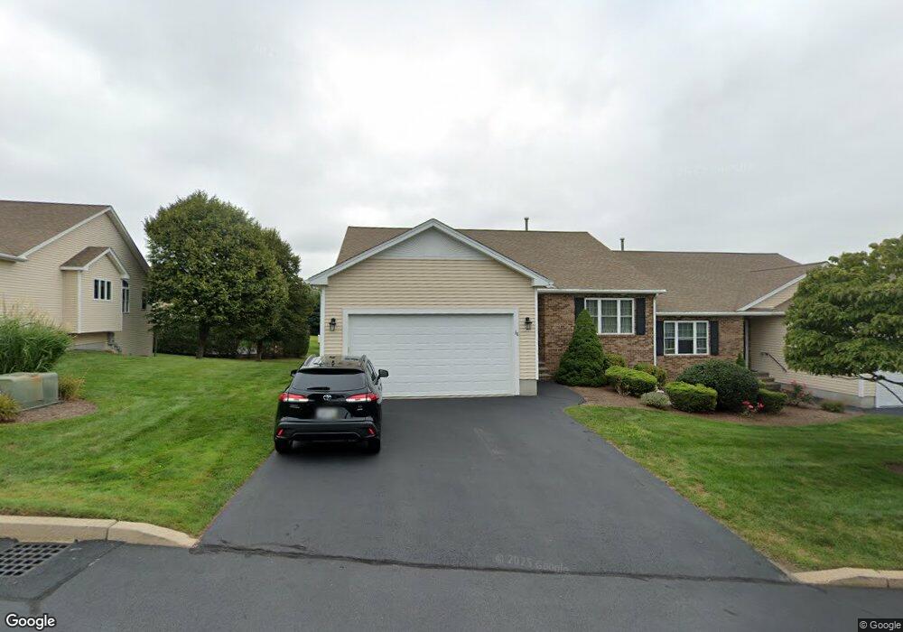
36 Sweet Pea Dr Cranston, RI 02921
Comstock Gardens NeighborhoodEstimated Value: $568,000 - $586,000
2
Beds
2
Baths
1,588
Sq Ft
$364/Sq Ft
Est. Value
About This Home
This home is located at 36 Sweet Pea Dr, Cranston, RI 02921 and is currently estimated at $577,454, approximately $363 per square foot. 36 Sweet Pea Dr is a home located in Providence County with nearby schools including Orchard Farms El. School, Western Hills Middle School, and Cranston High School West.
Ownership History
Date
Name
Owned For
Owner Type
Purchase Details
Closed on
Oct 1, 2004
Sold by
F Paolino Homes Inc
Bought by
Sarin Olivia
Current Estimated Value
Home Financials for this Owner
Home Financials are based on the most recent Mortgage that was taken out on this home.
Original Mortgage
$285,000
Interest Rate
5.81%
Mortgage Type
Purchase Money Mortgage
Create a Home Valuation Report for This Property
The Home Valuation Report is an in-depth analysis detailing your home's value as well as a comparison with similar homes in the area
Home Values in the Area
Average Home Value in this Area
Purchase History
| Date | Buyer | Sale Price | Title Company |
|---|---|---|---|
| Sarin Olivia | $380,000 | -- |
Source: Public Records
Mortgage History
| Date | Status | Borrower | Loan Amount |
|---|---|---|---|
| Open | Sarin Olivia | $29,000 | |
| Open | Sarin Olivia | $285,000 | |
| Closed | Sarin Olivia | $285,000 |
Source: Public Records
Tax History Compared to Growth
Tax History
| Year | Tax Paid | Tax Assessment Tax Assessment Total Assessment is a certain percentage of the fair market value that is determined by local assessors to be the total taxable value of land and additions on the property. | Land | Improvement |
|---|---|---|---|---|
| 2025 | $7,354 | $529,800 | $0 | $529,800 |
| 2024 | $7,211 | $529,800 | $0 | $529,800 |
| 2023 | $7,466 | $395,000 | $0 | $395,000 |
| 2022 | $7,311 | $395,000 | $0 | $395,000 |
| 2021 | $7,110 | $395,000 | $0 | $395,000 |
| 2020 | $8,042 | $387,200 | $0 | $387,200 |
| 2019 | $8,042 | $387,200 | $0 | $387,200 |
| 2018 | $7,856 | $387,200 | $0 | $387,200 |
| 2017 | $8,882 | $387,200 | $0 | $387,200 |
| 2016 | $8,693 | $387,200 | $0 | $387,200 |
| 2015 | $8,693 | $387,200 | $0 | $387,200 |
| 2014 | $6,809 | $298,100 | $0 | $298,100 |
Source: Public Records
Map
Nearby Homes
- 34 Sweet Pea Dr
- 2 Sweet Corn Dr
- 38 Sweet Pea Dr
- 40 Sweet Pea Dr
- 1 Sweet Corn Dr
- 3 Sweet Corn Dr
- 4 Sweet Corn Dr
- 12 Sweet Corn Dr
- 6 Sweet Corn Dr
- 7 Sweet Corn Dr
- 8 Sweet Corn Dr
- 190 Comstock Pkwy
- 10 Sweet Corn Dr
- 30 Sweet Pea Dr
- 85 Boylston Dr
- 201 Cheshire Dr
- 201 Cheshire Dr Unit 201
- 205 Cheshire Dr
- 89 Boylston Dr
- 89 Boylston Dr Unit 1