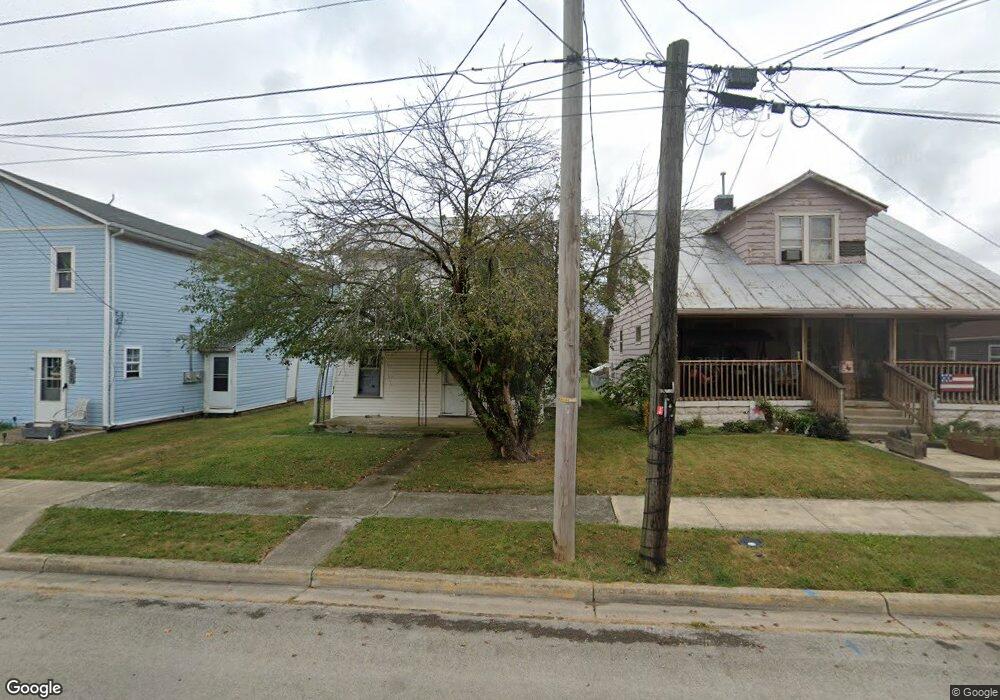
360 N Walnut St Union City, OH 45390
Estimated Value: $62,194 - $114,000
2
Beds
1
Bath
1,110
Sq Ft
$71/Sq Ft
Est. Value
About This Home
This home is located at 360 N Walnut St, Union City, OH 45390 and is currently estimated at $78,799, approximately $70 per square foot. 360 N Walnut St is a home located in Darke County with nearby schools including Mississinawa Valley Elementary School and Mississinawa Valley Junior/Senior High School.
Ownership History
Date
Name
Owned For
Owner Type
Purchase Details
Closed on
Dec 22, 2022
Sold by
Lewis Phyllis June
Bought by
Hannan & Lynch Inc
Current Estimated Value
Purchase Details
Closed on
Sep 19, 2018
Sold by
Lewis Willie T
Bought by
Lewis Phyllis June
Purchase Details
Closed on
Oct 31, 1994
Sold by
Williams Emos F
Bought by
Lewis Willie T and Lewis Phyllis
Create a Home Valuation Report for This Property
The Home Valuation Report is an in-depth analysis detailing your home's value as well as a comparison with similar homes in the area
Home Values in the Area
Average Home Value in this Area
Purchase History
| Date | Buyer | Sale Price | Title Company |
|---|---|---|---|
| Hannan & Lynch Inc | -- | -- | |
| Lewis Phyllis June | -- | -- | |
| Lewis Willie T | $11,000 | -- |
Source: Public Records
Tax History Compared to Growth
Tax History
| Year | Tax Paid | Tax Assessment Tax Assessment Total Assessment is a certain percentage of the fair market value that is determined by local assessors to be the total taxable value of land and additions on the property. | Land | Improvement |
|---|---|---|---|---|
| 2024 | $424 | $12,710 | $1,580 | $11,130 |
| 2023 | $446 | $12,710 | $1,580 | $11,130 |
| 2022 | $333 | $8,340 | $1,310 | $7,030 |
| 2021 | $339 | $8,340 | $1,310 | $7,030 |
| 2020 | $341 | $8,340 | $1,310 | $7,030 |
| 2019 | $293 | $7,420 | $1,310 | $6,110 |
| 2018 | $289 | $7,420 | $1,310 | $6,110 |
| 2017 | $260 | $7,420 | $1,310 | $6,110 |
| 2016 | $260 | $7,070 | $1,750 | $5,320 |
| 2015 | $260 | $7,070 | $1,750 | $5,320 |
| 2014 | $261 | $7,070 | $1,750 | $5,320 |
| 2013 | $270 | $7,070 | $1,750 | $5,320 |
Source: Public Records
Map
Nearby Homes
- 305 E North St
- 543 N Walnut St
- 504 N Union St
- 504 N Union St Unit Street
- 722 N Union St
- 230 NW Deerfield Rd
- 617 N Columbia St
- 207 Allen Dr
- 706 Lynwood Ct
- 612 N Howard St
- 507 N Howard St
- 718 Lynwood Ct
- 227 South St
- 720 E Main St
- 0 W Deerfield Rd Unit 23016117
- 0 W Deerfield Rd Unit 837795
- 0 W Deerfield Rd
- 508 N High St
- 103 S Wintergreen St
- 800 W Chestnut St
- 364 N Walnut St
- 356 N Walnut St
- 368 N Walnut St
- 350 N Walnut St
- 348 N Walnut St
- 349 N Walnut St
- 406 N Walnut St
- 365 N Walnut St
- 342 N Walnut St
- 345 N Walnut St
- 319 E Johnson St
- 410 N Walnut St
- 407 N Walnut St
- 401 E Johnson St
- 332 N Walnut St
- 416 N Walnut St
- 411 N Walnut St
- 331 N Walnut St
- 210 E Lower St
- 318 E Johnson St