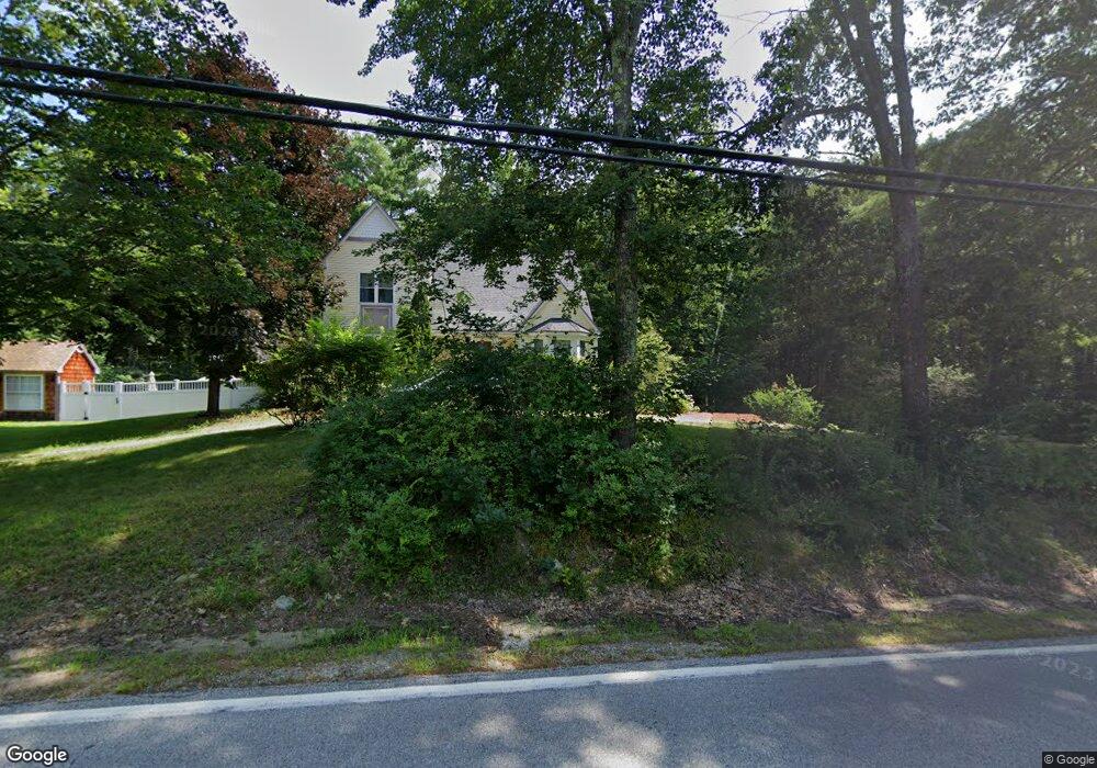
360 Rattlesnake Hill Rd Auburn, NH 03032
Estimated Value: $661,000 - $776,000
3
Beds
3
Baths
2,391
Sq Ft
$292/Sq Ft
Est. Value
About This Home
This home is located at 360 Rattlesnake Hill Rd, Auburn, NH 03032 and is currently estimated at $698,734, approximately $292 per square foot. 360 Rattlesnake Hill Rd is a home located in Rockingham County with nearby schools including Auburn Village School, Pinkerton Academy, and Mont Blanc Academy.
Ownership History
Date
Name
Owned For
Owner Type
Purchase Details
Closed on
Sep 17, 2020
Sold by
Bryk Jeffrey and Byrk Carolyn
Bought by
Bryk Ft
Current Estimated Value
Purchase Details
Closed on
Dec 23, 2009
Sold by
Jaynee M Middlemiss Re
Bought by
Bryk Jeffrey and Bryk Carolyn
Home Financials for this Owner
Home Financials are based on the most recent Mortgage that was taken out on this home.
Original Mortgage
$254,000
Interest Rate
4.92%
Mortgage Type
Purchase Money Mortgage
Create a Home Valuation Report for This Property
The Home Valuation Report is an in-depth analysis detailing your home's value as well as a comparison with similar homes in the area
Home Values in the Area
Average Home Value in this Area
Purchase History
| Date | Buyer | Sale Price | Title Company |
|---|---|---|---|
| Bryk Ft | -- | None Available | |
| Bryk Jeffrey | $317,500 | -- |
Source: Public Records
Mortgage History
| Date | Status | Borrower | Loan Amount |
|---|---|---|---|
| Previous Owner | Bryk Jeffrey | $254,000 |
Source: Public Records
Tax History Compared to Growth
Tax History
| Year | Tax Paid | Tax Assessment Tax Assessment Total Assessment is a certain percentage of the fair market value that is determined by local assessors to be the total taxable value of land and additions on the property. | Land | Improvement |
|---|---|---|---|---|
| 2024 | $7,779 | $577,500 | $189,500 | $388,000 |
| 2023 | $7,282 | $577,500 | $189,500 | $388,000 |
| 2022 | $6,956 | $389,700 | $162,400 | $227,300 |
| 2021 | $7,069 | $389,700 | $162,400 | $227,300 |
| 2020 | $7,202 | $389,700 | $162,400 | $227,300 |
| 2019 | $7,330 | $389,700 | $162,400 | $227,300 |
| 2018 | $6,648 | $389,700 | $162,400 | $227,300 |
| 2017 | $6,681 | $315,900 | $147,900 | $168,000 |
| 2016 | $6,397 | $315,900 | $147,900 | $168,000 |
| 2015 | $6,542 | $315,900 | $147,900 | $168,000 |
| 2014 | $6,732 | $315,900 | $147,900 | $168,000 |
| 2013 | $6,181 | $315,500 | $147,900 | $167,600 |
Source: Public Records
Map
Nearby Homes
- 45 Peach Tree Rd
- 628 Megan Dr
- 612 Megan Dr
- 40 Pinyon Place
- 55 Norwich Place
- 34 Conifer Place
- 193 Morning Glory Dr
- 22 Eastmeadow Way
- 1991 Bodwell Rd Unit 30
- #1 the Cliffs at Evergreen Dr
- 59 Hawthorne Dr
- 759 Cohas Ave
- 30 Bryant Rd
- 593 Cohas Ave
- 12 Forest Hill Way Unit 57
- 90 Forest Hill Way Unit 52
- 29 the Cliffs at Evergreen Cliffside Dr Unit 29
- 74 Nolls Farm Rd
- 54 Daniel Rd
- 50 Daniel Rd
- 350 Rattlesnake Hill Rd
- 355 Rattlesnake Hill Rd
- 371 Rattlesnake Hill Rd
- 357 Rattlesnake Hill Rd
- 25 Sonya Dr
- 376 Rattlesnake Hill Rd
- 11 Sonya Dr
- 58 Sonya Dr
- 672 Londonderry Turnpike
- 26 Sonya Dr
- 10 Sonya Dr
- 50 Sonya Dr
- 36 Sonya Dr
- 341 Rattlesnake Hill Rd
- 325 Rattlesnake Hill Rd
- 337 Rattlesnake Hill Rd
- 322 Rattlesnake Hill Rd
- 314 Rattlesnake Hill Rd
- 321 Rattlesnake Hill Rd