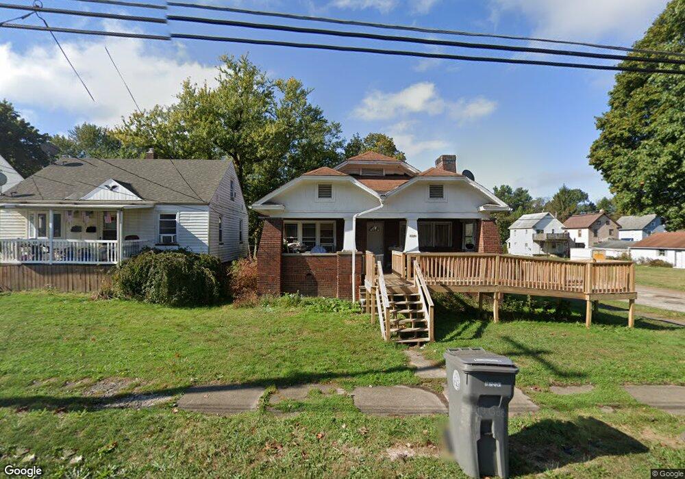
3602 Powers Way Youngstown, OH 44502
Buckeye Plat NeighborhoodEstimated Value: $63,857 - $75,000
3
Beds
1
Bath
1,107
Sq Ft
$62/Sq Ft
Est. Value
About This Home
This home is located at 3602 Powers Way, Youngstown, OH 44502 and is currently estimated at $68,214, approximately $61 per square foot. 3602 Powers Way is a home located in Mahoning County with nearby schools including Paul C. Bunn Elementary School, Chaney High School, and Summit Academy Secondary School - Youngstown.
Ownership History
Date
Name
Owned For
Owner Type
Purchase Details
Closed on
Jan 6, 2015
Sold by
Kennedy John F and Kennedy Susan
Bought by
Armored Capital Llc
Current Estimated Value
Purchase Details
Closed on
Dec 24, 2014
Sold by
Armored Capital Llc
Bought by
Rekdahl Mitchell
Purchase Details
Closed on
Dec 15, 2000
Sold by
Associates Financial Services Co Inc
Bought by
Kennedy John F and Kennedy Susan
Purchase Details
Closed on
Nov 6, 2000
Sold by
Troxell Steven G and Case #99Cv02208
Bought by
Associates Financial Services Corp
Purchase Details
Closed on
Oct 17, 1978
Bought by
Troxell Steven G and P A
Create a Home Valuation Report for This Property
The Home Valuation Report is an in-depth analysis detailing your home's value as well as a comparison with similar homes in the area
Home Values in the Area
Average Home Value in this Area
Purchase History
| Date | Buyer | Sale Price | Title Company |
|---|---|---|---|
| Armored Capital Llc | $3,000 | Attorney | |
| Rekdahl Mitchell | $7,000 | None Available | |
| Kennedy John F | $23,000 | -- | |
| Associates Financial Services Corp | $20,000 | -- | |
| Troxell Steven G | -- | -- |
Source: Public Records
Tax History Compared to Growth
Tax History
| Year | Tax Paid | Tax Assessment Tax Assessment Total Assessment is a certain percentage of the fair market value that is determined by local assessors to be the total taxable value of land and additions on the property. | Land | Improvement |
|---|---|---|---|---|
| 2024 | $394 | $8,010 | $1,040 | $6,970 |
| 2023 | $391 | $8,010 | $1,040 | $6,970 |
| 2022 | $302 | $4,750 | $1,040 | $3,710 |
| 2021 | $302 | $4,750 | $1,040 | $3,710 |
| 2020 | $303 | $4,750 | $1,040 | $3,710 |
| 2019 | $310 | $4,320 | $950 | $3,370 |
| 2018 | $313 | $4,320 | $950 | $3,370 |
| 2017 | $310 | $4,320 | $950 | $3,370 |
| 2016 | $364 | $5,460 | $950 | $4,510 |
| 2015 | $347 | $5,460 | $950 | $4,510 |
| 2014 | $344 | $5,460 | $950 | $4,510 |
| 2013 | $339 | $5,460 | $950 | $4,510 |
Source: Public Records
Map
Nearby Homes
- 2016 Pointview Ave
- 3448 Neilson Ave
- 3509 Lenox Ave
- 3337 Powers Way
- 2007 E Midlothian Blvd
- 1954 Everett Ave
- 0 Crescent Dr Unit 5124984
- 3222 Sheridan Rd
- 2510 E Midlothian Blvd
- 0 Weston Ave
- 1928 Medford Ave
- 2562 Mount Vernon Ave
- 2577 E Midlothian Blvd
- 2001 Brownlee Ave
- 3551 Shirley Rd
- 2743 Mount Vernon Ave
- 1447 Humbolt Ave
- 1653 Brownlee Ave
- 1654 Wakefield Ave
- 1633 Wakefield Ave
- 3606 Powers Way
- 3610 Powers Way
- 3616 Powers Way
- 3609 Neilson Ave
- 3548 Powers Way
- 3605 Neilson Ave
- 3611 Neilson Ave
- 3615 Neilson Ave
- 3557 Neilson Ave
- 3551 Neilson Ave
- 3603 Belden Ave
- 3621 Neilson Ave
- 3547 Neilson Ave
- 3615 Powers Way
- 3619 Powers Way
- 3549 Belden Ave
- 3623 Neilson Ave
- 3547 Belden Ave
- 3543 Neilson Ave
- 3540 Powers Way