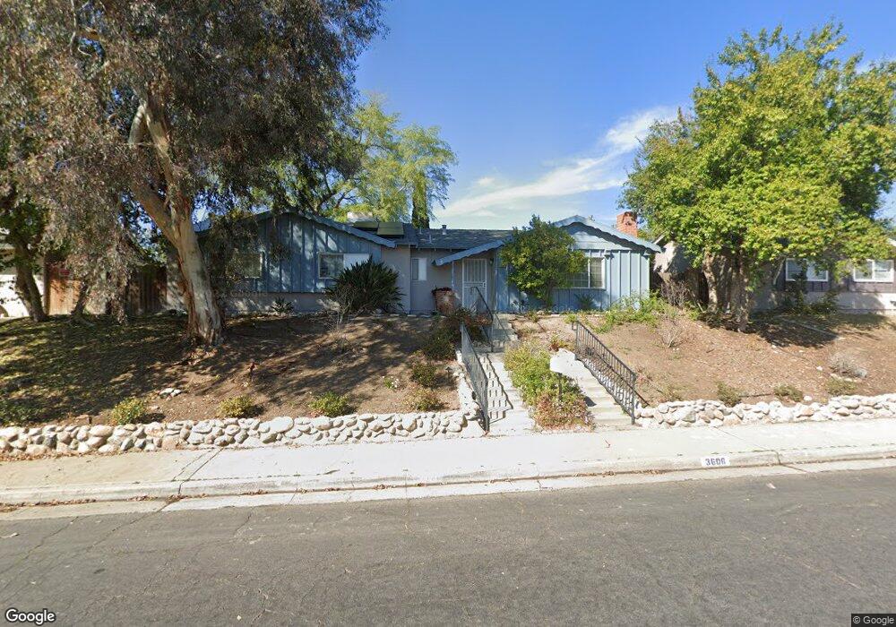
3606 Kaibab Ave Bakersfield, CA 93306
College Heights NeighborhoodEstimated Value: $353,855 - $386,000
4
Beds
2
Baths
1,619
Sq Ft
$227/Sq Ft
Est. Value
About This Home
This home is located at 3606 Kaibab Ave, Bakersfield, CA 93306 and is currently estimated at $368,214, approximately $227 per square foot. 3606 Kaibab Ave is a home located in Kern County with nearby schools including Colonel Howard Nichols Elementary School, Chipman Junior High School, and Highland High School.
Ownership History
Date
Name
Owned For
Owner Type
Purchase Details
Closed on
Oct 30, 2007
Sold by
Williams Edwina D
Bought by
Williams Edwina D and Stamoulis Sophie
Current Estimated Value
Home Financials for this Owner
Home Financials are based on the most recent Mortgage that was taken out on this home.
Original Mortgage
$420,375
Outstanding Balance
$246,021
Interest Rate
4.97%
Mortgage Type
Reverse Mortgage Home Equity Conversion Mortgage
Estimated Equity
$122,193
Purchase Details
Closed on
Oct 30, 1998
Sold by
Stamoulis Sophie
Bought by
Williams Edwina D
Home Financials for this Owner
Home Financials are based on the most recent Mortgage that was taken out on this home.
Original Mortgage
$80,800
Interest Rate
6.42%
Create a Home Valuation Report for This Property
The Home Valuation Report is an in-depth analysis detailing your home's value as well as a comparison with similar homes in the area
Home Values in the Area
Average Home Value in this Area
Purchase History
| Date | Buyer | Sale Price | Title Company |
|---|---|---|---|
| Williams Edwina D | $420,500 | Financial Title Co | |
| Williams Edwina D | -- | American Title Co |
Source: Public Records
Mortgage History
| Date | Status | Borrower | Loan Amount |
|---|---|---|---|
| Open | Williams Edwina D | $420,375 | |
| Previous Owner | Williams Edwina D | $80,800 |
Source: Public Records
Tax History
| Year | Tax Paid | Tax Assessment Tax Assessment Total Assessment is a certain percentage of the fair market value that is determined by local assessors to be the total taxable value of land and additions on the property. | Land | Improvement |
|---|---|---|---|---|
| 2025 | $2,725 | $182,002 | $60,660 | $121,342 |
| 2024 | $2,664 | $178,434 | $59,471 | $118,963 |
| 2023 | $2,664 | $174,936 | $58,305 | $116,631 |
| 2022 | $2,599 | $171,507 | $57,162 | $114,345 |
| 2021 | $2,487 | $168,145 | $56,042 | $112,103 |
| 2020 | $2,449 | $166,422 | $55,468 | $110,954 |
| 2019 | $2,400 | $166,422 | $55,468 | $110,954 |
| 2018 | $2,344 | $159,962 | $53,315 | $106,647 |
| 2017 | $2,329 | $156,826 | $52,270 | $104,556 |
| 2016 | $2,137 | $153,752 | $51,246 | $102,506 |
| 2015 | $2,123 | $151,444 | $50,477 | $100,967 |
| 2014 | $2,053 | $148,479 | $49,489 | $98,990 |
Source: Public Records
Map
Nearby Homes
- 3700 Redlands Dr
- 3623 Redlands Dr
- 3221 Colgate Ln
- 4001 Harvard Dr
- 3724 Harvard Dr
- 4019 Columbus St
- 3800 Columbus St
- 3413 Redlands Dr
- 3201 Apollo St
- 3804 Candlewood Dr
- 3616 Century Dr
- 3313 Century Dr
- 3206 Candlewood Dr
- 3516 Harmony Dr
- 3708 Harmony Dr
- 4121 Coronado Ave
- 3816 Miami St
- 4205 Coronado Ave
- 2801 Oswell St
- 3612 Christmas Tree Ln
- 3600 Kaibab Ave
- 3612 Kaibab Ave
- 3601 University Ave
- 3525 University Ave
- 3518 Kaibab Ave
- 3718 Redlands Dr
- 3325 Colgate Ln
- 3609 University Ave
- 3519 University Ave
- 3700 Kaibab Ave
- 3712 Redlands Dr
- 3319 Colgate Ln
- 3512 Kaibab Ave
- 3513 University Ave
- 3719 Redlands Dr
- 3324 Colgate Ln
- 3701 University Ave
- 3706 Kaibab Ave
- 3706 Redlands Dr
- 3313 Colgate Ln
Your Personal Tour Guide
Ask me questions while you tour the home.