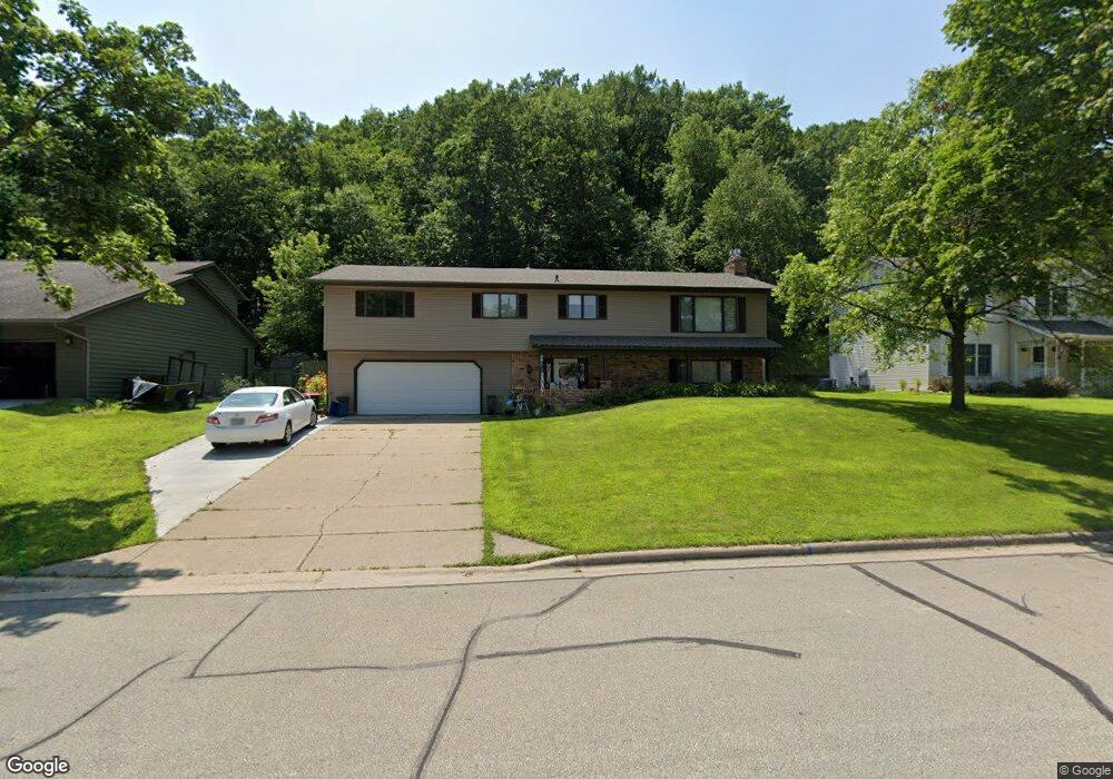
3607 Kosec Dr Red Wing, MN 55066
Estimated Value: $316,783 - $368,000
3
Beds
3
Baths
1,566
Sq Ft
$220/Sq Ft
Est. Value
About This Home
This home is located at 3607 Kosec Dr, Red Wing, MN 55066 and is currently estimated at $345,196, approximately $220 per square foot. 3607 Kosec Dr is a home located in Goodhue County with nearby schools including Burnside Elementary School, Sunnyside Elementary School, and Twin Bluff Middle School.
Ownership History
Date
Name
Owned For
Owner Type
Purchase Details
Closed on
Sep 1, 2017
Sold by
Waller Rodd W and Waller Michelle W
Bought by
Bonser Derek W and Bonser Sarah J
Current Estimated Value
Purchase Details
Closed on
Jul 20, 2012
Sold by
Vonrothkirch Susan L
Bought by
Waller Rodd W and Waller Michelle
Purchase Details
Closed on
May 31, 2011
Sold by
Ebert Laurie
Bought by
Vonrothkirch Susan
Purchase Details
Closed on
Mar 15, 2006
Sold by
Pendleburg John W
Bought by
Ebert Laurie
Purchase Details
Closed on
Jan 29, 2001
Sold by
Cullinan Gerald R and Cullinan Gail M
Bought by
Pendlebury John W and Pendlebury Shirley J
Create a Home Valuation Report for This Property
The Home Valuation Report is an in-depth analysis detailing your home's value as well as a comparison with similar homes in the area
Home Values in the Area
Average Home Value in this Area
Purchase History
| Date | Buyer | Sale Price | Title Company |
|---|---|---|---|
| Bonser Derek W | $215,000 | Goodhue County Abstract | |
| Waller Rodd W | $135,000 | -- | |
| Vonrothkirch Susan | $125,000 | -- | |
| Ebert Laurie | $200,000 | -- | |
| Pendlebury John W | $152,000 | -- |
Source: Public Records
Tax History
| Year | Tax Paid | Tax Assessment Tax Assessment Total Assessment is a certain percentage of the fair market value that is determined by local assessors to be the total taxable value of land and additions on the property. | Land | Improvement |
|---|---|---|---|---|
| 2025 | $3,826 | $305,800 | $59,700 | $246,100 |
| 2024 | $3,826 | $299,400 | $59,700 | $239,700 |
| 2023 | $1,899 | $281,700 | $59,700 | $222,000 |
| 2022 | $3,298 | $273,600 | $53,200 | $220,400 |
| 2021 | $3,040 | $234,300 | $53,200 | $181,100 |
| 2020 | $3,014 | $220,400 | $53,200 | $167,200 |
| 2019 | $3,018 | $205,800 | $53,200 | $152,600 |
| 2018 | $2,430 | $208,200 | $51,200 | $157,000 |
| 2017 | $2,358 | $183,100 | $51,200 | $131,900 |
| 2016 | $2,180 | $180,200 | $51,200 | $129,000 |
| 2015 | $2,092 | $175,500 | $51,200 | $124,300 |
| 2014 | -- | $169,400 | $51,200 | $118,200 |
Source: Public Records
Map
Nearby Homes
- 3560 Graves Dr
- 3557 Skyline Dr
- 3429 Helen Ln
- 128 Charles Ave
- 186 Sargent Dr
- 210 Sargent Dr Unit 103
- 113 Burnside Ave S
- 1125 Hewitt Blvd
- 2773 Ridgeview Dr
- 1181 Hewitt Blvd
- 980 Aurora Cir
- 912 Aurora Cir
- 853 Aurora Cir
- 135 Kingswood Dr
- 1056 Birch Ave
- 4739 Big Sky Ct
- 921 Snowbird Dr
- 910 Snowbird Dr
- 914 Snowbird Dr
- 4958 Chalet Ct
Your Personal Tour Guide
Ask me questions while you tour the home.