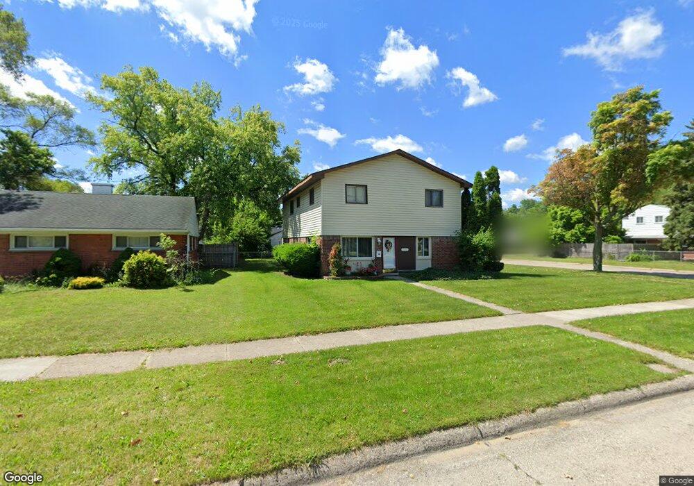
3608 Michael Ave Warren, MI 48091
Southwest Warren NeighborhoodEstimated Value: $189,000 - $220,000
6
Beds
3
Baths
2,184
Sq Ft
$94/Sq Ft
Est. Value
About This Home
This home is located at 3608 Michael Ave, Warren, MI 48091 and is currently estimated at $204,458, approximately $93 per square foot. 3608 Michael Ave is a home located in Macomb County with nearby schools including Schofield Elementary School, Mound Park Elementary School, and Westview Elementary School.
Ownership History
Date
Name
Owned For
Owner Type
Purchase Details
Closed on
Jan 4, 2008
Sold by
Wells Fargo Bank Na
Bought by
Seabrooks Shanta
Current Estimated Value
Purchase Details
Closed on
May 19, 2006
Sold by
Jones Sandra E
Bought by
Wells Fargo Bank Na and Imh Assets Corp Collateralized Asset Bac
Purchase Details
Closed on
Oct 14, 2004
Sold by
Jones Gordon C and Jones Sandra E
Bought by
Jones Sandra E
Create a Home Valuation Report for This Property
The Home Valuation Report is an in-depth analysis detailing your home's value as well as a comparison with similar homes in the area
Home Values in the Area
Average Home Value in this Area
Purchase History
| Date | Buyer | Sale Price | Title Company |
|---|---|---|---|
| Seabrooks Shanta | $63,000 | None Available | |
| Wells Fargo Bank Na | $117,833 | None Available | |
| Jones Sandra E | -- | American Titleworks |
Source: Public Records
Tax History
| Year | Tax Paid | Tax Assessment Tax Assessment Total Assessment is a certain percentage of the fair market value that is determined by local assessors to be the total taxable value of land and additions on the property. | Land | Improvement |
|---|---|---|---|---|
| 2025 | $2,200 | $111,090 | $0 | $0 |
| 2024 | $21 | $103,860 | $0 | $0 |
| 2023 | $2,029 | $102,880 | $0 | $0 |
| 2022 | $1,916 | $90,600 | $0 | $0 |
| 2021 | $1,992 | $85,260 | $0 | $0 |
| 2020 | $1,904 | $67,430 | $0 | $0 |
| 2019 | $1,790 | $45,270 | $0 | $0 |
| 2018 | $0 | $38,760 | $0 | $0 |
| 2017 | $1,696 | $37,860 | $3,250 | $34,610 |
| 2016 | $1,657 | $37,860 | $0 | $0 |
| 2015 | -- | $35,400 | $0 | $0 |
| 2012 | -- | $35,280 | $0 | $0 |
Source: Public Records
Map
Nearby Homes
- 3409 Jarvis Ave
- 3701 Berkshire Ave
- 3925 Toepfer Rd
- 3167 Berkshire Ave
- 3039 Pearl Ave
- 1936 Pearl Ave
- 3313 Dallas Ave
- 21857 Le Fever Ave
- 2746 John B Ave
- 21044 Sunset Ave
- 2195 Michael Ave
- 22200 Le Fever Ave
- 21840 Cunningham Ave
- 4061 E 8 Mile Rd
- 20506 Revere St
- 2615 Emmons Ave
- 2144 Pearl Ave
- 2135 Jarvis Ave
- 3571 Los Angeles Ave
- 3471 Los Angeles Ave
- 3620 Michael Ave Unit Bldg-Unit
- 3620 Michael Ave
- 3611 Toepfer Rd
- 3632 Michael Ave
- 3462 Michael Ave
- 3625 Toepfer Rd
- 3637 Toepfer Rd
- 3541 Toepfer Rd
- 3607 Michael Ave
- 3619 Michael Ave
- 3644 Michael Ave
- 3450 Michael Ave
- 3649 Toepfer Rd
- 3529 Toepfer Rd
- 3631 Michael Ave
- 3461 Michael Ave
- 3702 Michael Ave
- 3438 Michael Ave
- 3643 Michael Ave
- 3709 Toepfer Rd
Your Personal Tour Guide
Ask me questions while you tour the home.