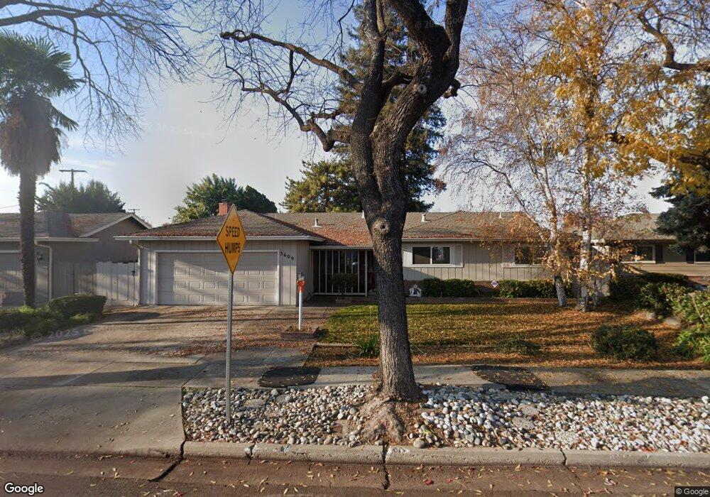
3609 Columbine Dr Modesto, CA 95356
Central Modesto NeighborhoodEstimated Value: $444,487 - $533,000
3
Beds
2
Baths
1,591
Sq Ft
$307/Sq Ft
Est. Value
About This Home
This home is located at 3609 Columbine Dr, Modesto, CA 95356 and is currently estimated at $488,622, approximately $307 per square foot. 3609 Columbine Dr is a home located in Stanislaus County with nearby schools including Woodrow Elementary School, Somerset Middle School, and Grace M. Davis High School.
Ownership History
Date
Name
Owned For
Owner Type
Purchase Details
Closed on
May 14, 2024
Sold by
Santos Stephen M and Santos Marie A
Bought by
Santos Living Trust and Santos
Current Estimated Value
Create a Home Valuation Report for This Property
The Home Valuation Report is an in-depth analysis detailing your home's value as well as a comparison with similar homes in the area
Home Values in the Area
Average Home Value in this Area
Purchase History
| Date | Buyer | Sale Price | Title Company |
|---|---|---|---|
| Santos Living Trust | -- | None Listed On Document |
Source: Public Records
Tax History
| Year | Tax Paid | Tax Assessment Tax Assessment Total Assessment is a certain percentage of the fair market value that is determined by local assessors to be the total taxable value of land and additions on the property. | Land | Improvement |
|---|---|---|---|---|
| 2025 | $1,756 | $165,957 | $44,393 | $121,564 |
| 2024 | $1,723 | $162,704 | $43,523 | $119,181 |
| 2023 | $1,689 | $159,515 | $42,670 | $116,845 |
| 2022 | $1,619 | $156,388 | $41,834 | $114,554 |
| 2021 | $1,589 | $153,322 | $41,014 | $112,308 |
| 2020 | $1,566 | $151,751 | $40,594 | $111,157 |
| 2019 | $1,536 | $148,777 | $39,799 | $108,978 |
| 2018 | $1,504 | $145,861 | $39,019 | $106,842 |
| 2017 | $1,467 | $143,002 | $38,254 | $104,748 |
| 2016 | $1,457 | $140,199 | $37,504 | $102,695 |
| 2015 | $1,434 | $138,094 | $36,941 | $101,153 |
| 2014 | $1,427 | $135,390 | $36,218 | $99,172 |
Source: Public Records
Map
Nearby Homes
- 3600 Columbine Dr Unit 6
- 325 Standiford Ave Unit 29
- 3800 Marigold Ln
- 3809 Marigold Ln
- 3728 Fuchsia Ln
- 3837 Marigold Ln
- 3417 John Lee Ln
- 3312 Whitehorse Ave
- 3325 Sherwood Ave
- 365 Birchwood Ct
- 3432 Colonial Dr
- 1013 Colonial Ct
- 1005 Woodrow Ave
- 3701 Colonial Dr Unit 202
- 3701 Colonial Dr Unit 224
- 3701 Colonial Dr
- 3701 Colonial Dr Unit 98
- 3701 Colonial Dr Unit 164
- 3701 Colonial Dr Unit 89
- 3701 Colonial Dr Unit 197
Your Personal Tour Guide
Ask me questions while you tour the home.