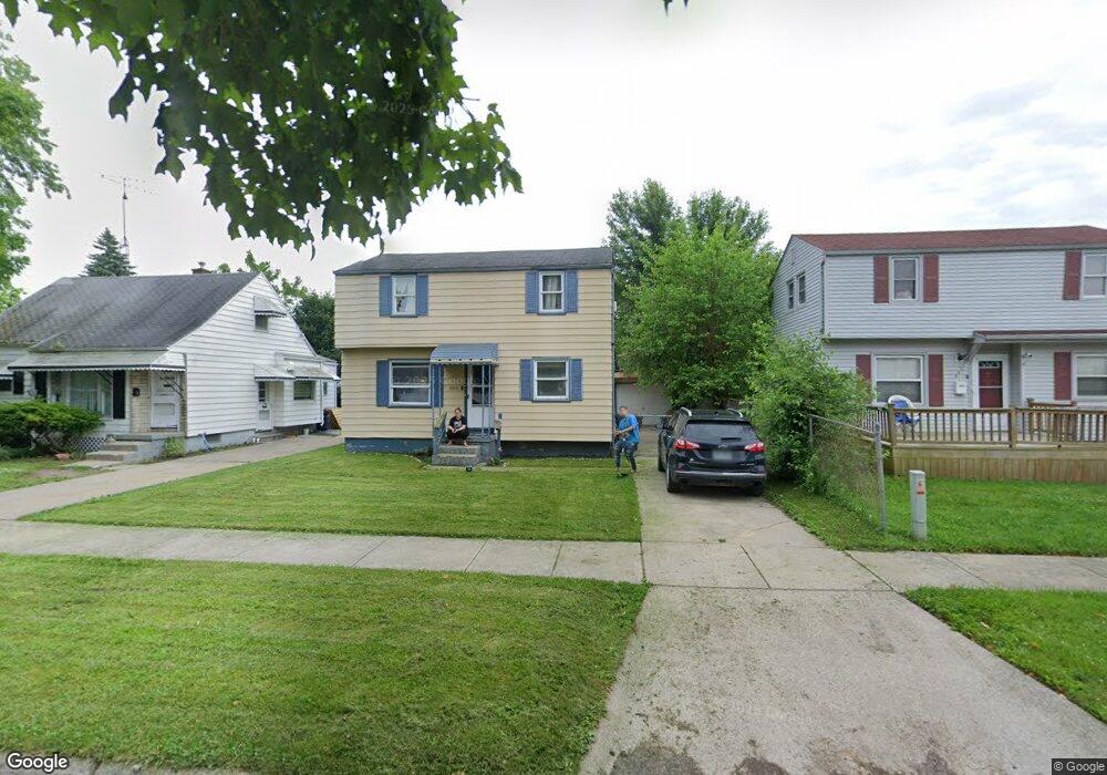
3610 Dale Ave Flint, MI 48506
Potter Longway NeighborhoodEstimated Value: $71,000 - $91,000
3
Beds
1
Bath
964
Sq Ft
$80/Sq Ft
Est. Value
About This Home
This home is located at 3610 Dale Ave, Flint, MI 48506 and is currently estimated at $77,022, approximately $79 per square foot. 3610 Dale Ave is a home located in Genesee County with nearby schools including Potter School, Richfield Public School Academy, and Flex High Burton.
Ownership History
Date
Name
Owned For
Owner Type
Purchase Details
Closed on
Dec 23, 2020
Sold by
Cm Baier Llc
Bought by
Cm Baico Investments Llc
Current Estimated Value
Purchase Details
Closed on
Dec 19, 2007
Sold by
Jackson Alphonso R and Hud
Bought by
Baico Llc
Purchase Details
Closed on
Sep 29, 2006
Sold by
Michigan State Housing Development Autho
Bought by
Hud
Purchase Details
Closed on
May 31, 2006
Sold by
Prast Patrick A
Bought by
Michigan State Housing Development Autho
Purchase Details
Closed on
Jan 26, 2004
Sold by
Farnham Delores and Farnham Delores L
Bought by
Prast Patrick A
Create a Home Valuation Report for This Property
The Home Valuation Report is an in-depth analysis detailing your home's value as well as a comparison with similar homes in the area
Home Values in the Area
Average Home Value in this Area
Purchase History
| Date | Buyer | Sale Price | Title Company |
|---|---|---|---|
| Cm Baico Investments Llc | -- | None Listed On Document | |
| Baico Llc | $10,200 | Wolverton Title Research Co | |
| Hud | -- | None Available | |
| Michigan State Housing Development Autho | $75,532 | None Available | |
| Prast Patrick A | $69,900 | Guaranty Title Company |
Source: Public Records
Tax History Compared to Growth
Tax History
| Year | Tax Paid | Tax Assessment Tax Assessment Total Assessment is a certain percentage of the fair market value that is determined by local assessors to be the total taxable value of land and additions on the property. | Land | Improvement |
|---|---|---|---|---|
| 2025 | $1,575 | $38,800 | $0 | $0 |
| 2024 | $1,450 | $30,500 | $0 | $0 |
| 2023 | $1,409 | $23,700 | $0 | $0 |
| 2022 | $0 | $20,400 | $0 | $0 |
| 2021 | $1,433 | $16,100 | $0 | $0 |
| 2020 | $1,069 | $13,600 | $0 | $0 |
| 2019 | $1,043 | $12,000 | $0 | $0 |
| 2018 | $1,059 | $12,000 | $0 | $0 |
| 2017 | $1,104 | $0 | $0 | $0 |
| 2016 | $1,096 | $0 | $0 | $0 |
| 2015 | -- | $0 | $0 | $0 |
| 2014 | -- | $0 | $0 | $0 |
| 2012 | -- | $15,000 | $0 | $0 |
Source: Public Records
Map
Nearby Homes
- 3617 Churchill Ave
- 3617 Davison Rd
- 3730 Holly Ave
- 3739 Marmion Ave
- 3401 Davison Rd
- 3514 Whittier Ave
- 3740 Ivanhoe Ave
- 3813 Holly Ave
- 3421 Brewster St
- 1414 Earlmoor Blvd
- 1324 Earlmoor Blvd
- 3232 Dale Ave
- 3806 Pitkin Ave
- 3713 Risedorph Ave
- 3205 Holly Ave
- 2146 N Center Rd
- 3149 Whittier Ave
- 3809 Delaware Ave
- 3602 Dakota Ave
- 3214 Maryland Ave
- 3614 Dale Ave
- 3606 Dale Ave
- 3602 Dale Ave Unit Bldg-Unit
- 3602 Dale Ave
- 3609 Churchill Ave
- 3605 Churchill Ave
- 3613 Churchill Ave
- 2017 N Dexter St
- 3526 Dale Ave
- 3525 Churchill Ave
- 3609 Dale Ave
- 3605 Dale Ave
- 3522 Dale Ave
- 3601 Dale Ave
- 3521 Churchill Ave
- 3525 Dale Ave
- 3518 Dale Ave
- 3526 Holly Ave
- 3521 Dale Ave
- 3517 Churchill Ave