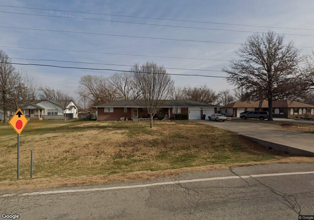
3610 S Tyler Rd Wichita, KS 67215
Oatville NeighborhoodEstimated Value: $260,584 - $382,000
2
Beds
2
Baths
2,293
Sq Ft
$140/Sq Ft
Est. Value
About This Home
This home is located at 3610 S Tyler Rd, Wichita, KS 67215 and is currently estimated at $321,292, approximately $140 per square foot. 3610 S Tyler Rd is a home located in Sedgwick County with nearby schools including Oatville Elementary School, Haysville West Middle School, and Campus High School.
Ownership History
Date
Name
Owned For
Owner Type
Purchase Details
Closed on
Jun 25, 2018
Sold by
Bonat Lee A and Bonat Lori A
Bought by
Bonat Lee A and Bonat Lori A
Current Estimated Value
Home Financials for this Owner
Home Financials are based on the most recent Mortgage that was taken out on this home.
Original Mortgage
$70,000
Interest Rate
4.6%
Mortgage Type
New Conventional
Purchase Details
Closed on
Jun 14, 2000
Sold by
Girrens John M and Girrens Marie T
Bought by
Girrens John J and Girrens Leon F
Create a Home Valuation Report for This Property
The Home Valuation Report is an in-depth analysis detailing your home's value as well as a comparison with similar homes in the area
Home Values in the Area
Average Home Value in this Area
Purchase History
| Date | Buyer | Sale Price | Title Company |
|---|---|---|---|
| Bonat Lee A | -- | None Available | |
| Girrens John J | -- | -- |
Source: Public Records
Mortgage History
| Date | Status | Borrower | Loan Amount |
|---|---|---|---|
| Closed | Bonat Lee A | $70,000 |
Source: Public Records
Tax History Compared to Growth
Tax History
| Year | Tax Paid | Tax Assessment Tax Assessment Total Assessment is a certain percentage of the fair market value that is determined by local assessors to be the total taxable value of land and additions on the property. | Land | Improvement |
|---|---|---|---|---|
| 2025 | $2,738 | $27,704 | $5,727 | $21,977 |
| 2023 | $2,738 | $22,587 | $4,566 | $18,021 |
| 2022 | $2,644 | $22,586 | $4,301 | $18,285 |
| 2021 | $2,512 | $21,103 | $2,576 | $18,527 |
| 2020 | $2,398 | $20,099 | $2,576 | $17,523 |
| 2019 | $2,420 | $20,099 | $2,576 | $17,523 |
| 2018 | $2,212 | $18,596 | $2,185 | $16,411 |
| 2017 | $2,084 | $0 | $0 | $0 |
| 2016 | $2,021 | $0 | $0 | $0 |
| 2015 | $1,902 | $0 | $0 | $0 |
| 2014 | $1,841 | $0 | $0 | $0 |
Source: Public Records
Map
Nearby Homes
- 10404 W 35th St S
- 3750 S Ridge Rd
- 2981 S Maize Rd
- 2921 S Maize Ct
- 2937 S Maize Ct
- 2804 S Maize Ct
- 2800 S Maize Ct
- 11333 W 35th St S
- 11335 W 35th St S
- 11327 W 35th St S
- 2808 S Maize Ct
- 3741 S Fairlawn St
- 2734 S Carrwood Cir
- 2816 S Maize Ct
- 2812 S Maize Ct
- 2868 S Maize Ct
- 2534 S Yellowstone Cir
- 10421 W Basil St
- 2715 S Crestline Ct
- Allison's Plan at Southern Ridge
- 3600 S Tyler Rd
- 3622 S Tyler Rd
- 3502 S Tyler Rd
- 3500 S Tyler Rd
- 3615 S Valleyview St
- 3601 S Valleyview St
- 3644 S Tyler Rd
- 3547 S Valleyview St
- 3629 S Valleyview St
- 3641 S Valleyview St
- 3656 S Tyler Rd
- 3612 S Valleyview St
- 3538 S Valleyview St
- 3664 S Tyler Rd
- 8632 W 36th St S
- 3642 S Valleyview St
- 8618 W 36th St S
- 3652 S Valleyview St
- 3700 S Tyler Rd
- 8701 W 36th St S