Estimated Value: $251,000 - $282,000
3
Beds
2
Baths
1,255
Sq Ft
$216/Sq Ft
Est. Value
About This Home
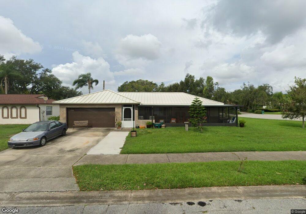
This home is located at 3617 Crossbow Dr, Cocoa, FL 32926 and is currently estimated at $271,356, approximately $216 per square foot. 3617 Crossbow Dr is a home located in Brevard County with nearby schools including Cocoa High School, Saturn Elementary School, and Space Coast Christian Academy.
Ownership History
Date
Name
Owned For
Owner Type
Purchase Details
Closed on
Aug 18, 2009
Sold by
Wilson Marion M and Parrish Sadie Pearl
Bought by
Sprink David C and Sprink Elizabeth A
Current Estimated Value
Home Financials for this Owner
Home Financials are based on the most recent Mortgage that was taken out on this home.
Original Mortgage
$10,000
Outstanding Balance
$6,497
Interest Rate
5.14%
Mortgage Type
Stand Alone Second
Estimated Equity
$264,859
Create a Home Valuation Report for This Property
The Home Valuation Report is an in-depth analysis detailing your home's value as well as a comparison with similar homes in the area
Home Values in the Area
Average Home Value in this Area
Purchase History
| Date | Buyer | Sale Price | Title Company |
|---|---|---|---|
| Sprink David C | $89,000 | Dba Glow Title & Escrow |
Source: Public Records
Mortgage History
| Date | Status | Borrower | Loan Amount |
|---|---|---|---|
| Open | Sprink David C | $10,000 | |
| Open | Sprink David C | $80,382 |
Source: Public Records
Tax History
| Year | Tax Paid | Tax Assessment Tax Assessment Total Assessment is a certain percentage of the fair market value that is determined by local assessors to be the total taxable value of land and additions on the property. | Land | Improvement |
|---|---|---|---|---|
| 2025 | $1,347 | $94,530 | -- | -- |
| 2024 | $1,299 | $91,870 | -- | -- |
| 2023 | $1,299 | $89,200 | $0 | $0 |
| 2022 | $1,176 | $86,610 | $0 | $0 |
| 2021 | $1,152 | $84,090 | $0 | $0 |
| 2020 | $1,115 | $82,930 | $0 | $0 |
| 2019 | $958 | $72,150 | $0 | $0 |
| 2018 | $848 | $70,810 | $0 | $0 |
| 2017 | $852 | $69,360 | $0 | $0 |
| 2016 | $854 | $67,940 | $20,000 | $47,940 |
| 2015 | $865 | $67,470 | $20,000 | $47,470 |
| 2014 | $817 | $66,940 | $15,000 | $51,940 |
Source: Public Records
Map
Nearby Homes
- 3417 Rocky Gap Place
- 3723 W Malory Ct
- 3728 W Malory Ct
- 3119 Ipswich Dr
- 3487 Rocky Gap Place
- 3806 Parapet Dr
- 3802 Arrowsmith Dr
- 3813 Stonemont Dr
- 3816 Parapet Dr
- 3363 Echo Ridge Place
- 3393 Echo Ridge Place
- 3312 Echo Ridge Place
- 3331 Craggy Bluff Place
- 2212 Spring Cir
- 2713 Winchester Dr
- 3125 Winchester Dr
- 3010 Winchester Dr
- 3120 Winchester Dr
- 4005 Pinyon Dr
- 00 N Unknown
- 3621 Crossbow Dr
- 3613 Crossbow Dr
- 3616 Crossbow Dr
- 3609 Crossbow Dr
- 3625 Crossbow Dr
- 3612 Crossbow Dr
- 3620 Crossbow Dr
- 3636 Longbow Rd Unit 6
- 3640 Longbow Rd
- 3604 Crossbow Dr
- 3600 Crossbow Dr
- 3608 Crossbow Dr
- 3605 Crossbow Dr
- 3624 Crossbow Dr
- 3601 Hightower Ct
- 3629 Crossbow Dr
- 3602 Hightower Ct
- 3644 Longbow Rd
- 3632 Longbow Rd
- 3628 Crossbow Dr
Your Personal Tour Guide
Ask me questions while you tour the home.