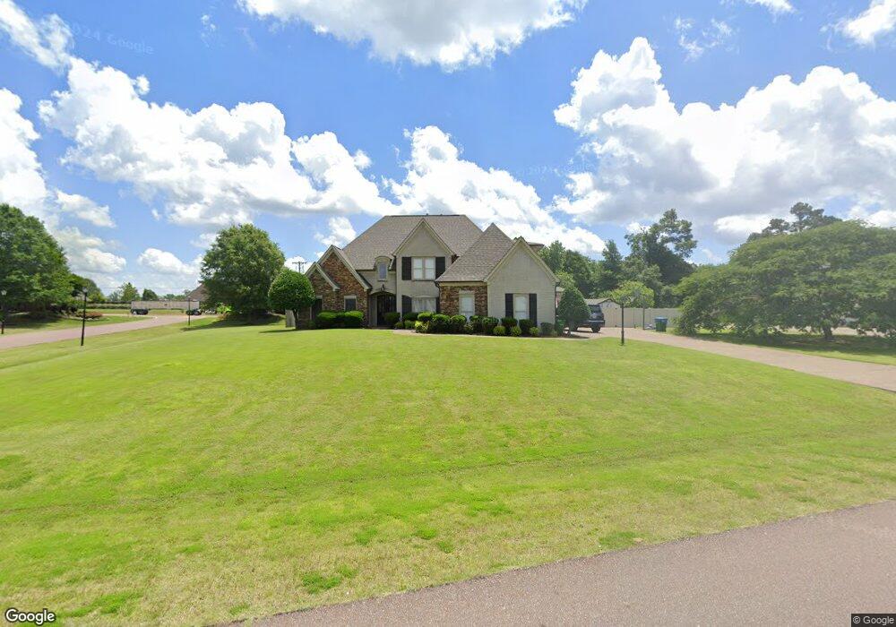
3618 Rutledge Rd Olive Branch, MS 38654
Lewisburg NeighborhoodEstimated Value: $455,000 - $541,000
4
Beds
3
Baths
3,530
Sq Ft
$144/Sq Ft
Est. Value
About This Home
This home is located at 3618 Rutledge Rd, Olive Branch, MS 38654 and is currently estimated at $508,721, approximately $144 per square foot. 3618 Rutledge Rd is a home located in DeSoto County with nearby schools including Lewisburg Primary School, Lewisburg Elementary School, and Lewisburg Middle School.
Ownership History
Date
Name
Owned For
Owner Type
Purchase Details
Closed on
Jun 30, 2016
Sold by
Leeka Scott G
Bought by
Barnett Christopher S and Barnett Candace Bree
Current Estimated Value
Home Financials for this Owner
Home Financials are based on the most recent Mortgage that was taken out on this home.
Original Mortgage
$339,000
Outstanding Balance
$269,138
Interest Rate
3.66%
Mortgage Type
New Conventional
Estimated Equity
$239,583
Create a Home Valuation Report for This Property
The Home Valuation Report is an in-depth analysis detailing your home's value as well as a comparison with similar homes in the area
Home Values in the Area
Average Home Value in this Area
Purchase History
| Date | Buyer | Sale Price | Title Company |
|---|---|---|---|
| Barnett Christopher S | -- | None Available |
Source: Public Records
Mortgage History
| Date | Status | Borrower | Loan Amount |
|---|---|---|---|
| Open | Barnett Christopher S | $339,000 |
Source: Public Records
Tax History
| Year | Tax Paid | Tax Assessment Tax Assessment Total Assessment is a certain percentage of the fair market value that is determined by local assessors to be the total taxable value of land and additions on the property. | Land | Improvement |
|---|---|---|---|---|
| 2025 | $4,554 | $39,331 | $6,000 | $33,331 |
| 2024 | $3,901 | $28,580 | $6,000 | $22,580 |
| 2023 | $3,901 | $28,580 | $0 | $0 |
| 2022 | $3,929 | $28,580 | $6,000 | $22,580 |
| 2021 | $3,929 | $28,580 | $6,000 | $22,580 |
| 2020 | $2,702 | $26,759 | $6,000 | $20,759 |
| 2019 | $2,402 | $26,759 | $6,000 | $20,759 |
| 2017 | $2,337 | $45,856 | $25,928 | $19,928 |
| 2016 | $2,337 | $25,928 | $6,000 | $19,928 |
| 2015 | $2,637 | $45,856 | $25,928 | $19,928 |
| 2014 | $2,337 | $25,928 | $0 | $0 |
| 2013 | $2,283 | $25,928 | $0 | $0 |
Source: Public Records
Map
Nearby Homes
- 9094 Apple Orchard Cove
- 9107 Apple Orchard Cove
- 9159 Mitchells Farm Cove
- 9143 Apple Orchard Cove
- 9142 Cedar Barn Cove
- 9135 Cedar Barn Cove
- 3576 Holly Cove
- 3914 Saddle Bend
- 8465 Belmor Lakes Dr
- 6606 Mississippi 305
- 6279 Mississippi 305
- 8790 Mary McCoy Dr
- 4147 Olivia Cir W
- 4173 Olivia Cir W
- 8433 Lakeview Dr
- 4201 Olivia Cir W
- 9035 Cedar Creek Dr
- 4229 Olivia Cir W
- 3972 Fieldstream Dr
- 8593 Gwin Hollow
- 3590 Rutledge Rd
- 3590 Rutledge Rd Unit 1
- 44 Rutledge Rd
- 3656 Rutledge Rd
- 3609 Rutledge Rd
- 3562 Rutledge Rd
- 3643 Rutledge Rd
- 3687 Rutledge Rd
- 3693 Mitchell''S Corner Rd W
- 3604 Highway 305 N
- 8924 Cameron St
- 8910 Cameron St
- 8900 Dehart Rd
- 3721 Highway 305 N
- 8925 Dehart Dr
- 8925 Dehart Rd
- 3699 Mitchells Corner Rd W
- 9065 Mitchells Corner Rd S
- 8900 Dehart Dr
- 20 Cameron St
Your Personal Tour Guide
Ask me questions while you tour the home.