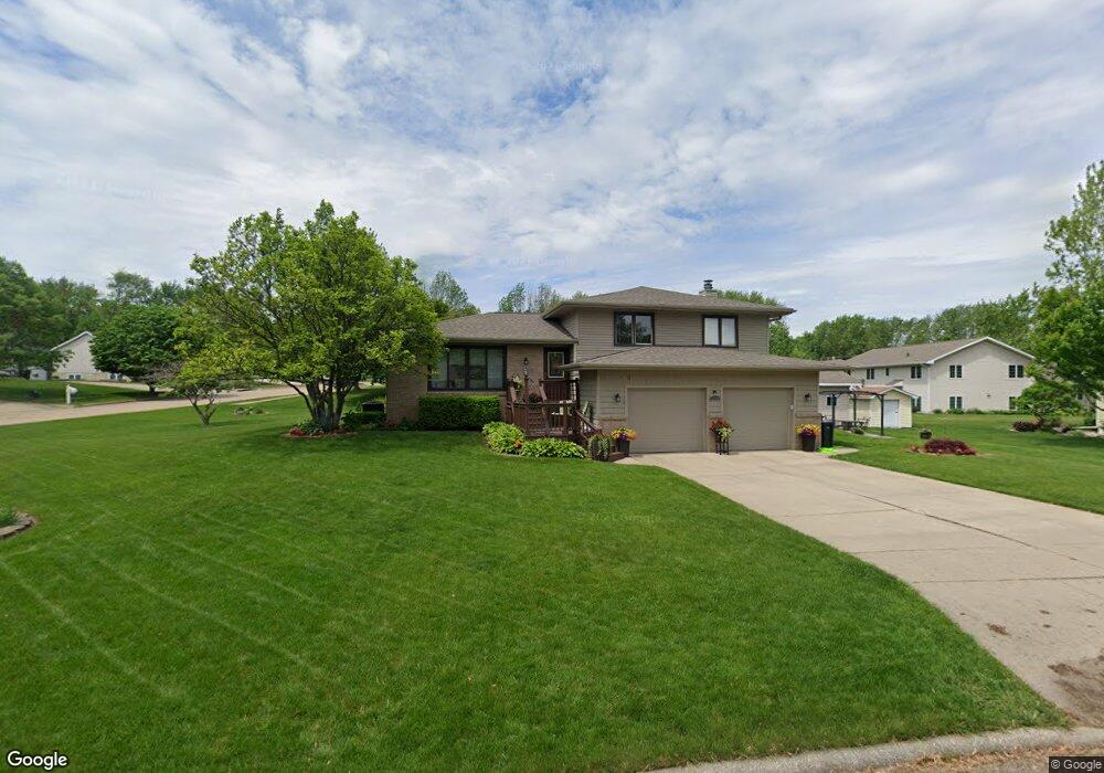
3619 Carlton Dr Cedar Falls, IA 50613
Estimated Value: $262,000 - $326,000
3
Beds
2
Baths
2,460
Sq Ft
$123/Sq Ft
Est. Value
About This Home
This home is located at 3619 Carlton Dr, Cedar Falls, IA 50613 and is currently estimated at $302,563, approximately $122 per square foot. 3619 Carlton Dr is a home located in Black Hawk County with nearby schools including Orchard Hill Elementary School, Peet Junior High School, and Cedar Falls High School.
Ownership History
Date
Name
Owned For
Owner Type
Purchase Details
Closed on
Jun 30, 2011
Sold by
Witt Richard H and Witt Sylvia R
Bought by
Haag James J and Haag Lori L
Current Estimated Value
Home Financials for this Owner
Home Financials are based on the most recent Mortgage that was taken out on this home.
Original Mortgage
$216,000
Outstanding Balance
$148,906
Interest Rate
4.63%
Mortgage Type
New Conventional
Estimated Equity
$153,657
Create a Home Valuation Report for This Property
The Home Valuation Report is an in-depth analysis detailing your home's value as well as a comparison with similar homes in the area
Home Values in the Area
Average Home Value in this Area
Purchase History
| Date | Buyer | Sale Price | Title Company |
|---|---|---|---|
| Haag James J | $240,000 | None Available |
Source: Public Records
Mortgage History
| Date | Status | Borrower | Loan Amount |
|---|---|---|---|
| Open | Haag James J | $216,000 |
Source: Public Records
Tax History Compared to Growth
Tax History
| Year | Tax Paid | Tax Assessment Tax Assessment Total Assessment is a certain percentage of the fair market value that is determined by local assessors to be the total taxable value of land and additions on the property. | Land | Improvement |
|---|---|---|---|---|
| 2025 | $4,298 | $309,100 | $48,690 | $260,410 |
| 2024 | $4,298 | $277,380 | $48,690 | $228,690 |
| 2023 | $3,936 | $277,380 | $48,690 | $228,690 |
| 2022 | $3,982 | $222,060 | $48,690 | $173,370 |
| 2021 | $3,774 | $222,060 | $48,690 | $173,370 |
| 2020 | $3,694 | $211,240 | $37,870 | $173,370 |
| 2019 | $3,694 | $211,240 | $37,870 | $173,370 |
| 2018 | $3,742 | $211,240 | $37,870 | $173,370 |
| 2017 | $3,828 | $211,240 | $37,870 | $173,370 |
| 2016 | $3,578 | $211,240 | $37,870 | $173,370 |
| 2015 | $3,578 | $211,240 | $37,870 | $173,370 |
| 2014 | $3,480 | $203,360 | $37,870 | $165,490 |
Source: Public Records
Map
Nearby Homes
- 3710 Laurinda Dr
- 3709 Laurinda Dr
- 924 Elmridge Dr
- 4206 Knoll Ridge Dr
- 4006 Rownd St
- 612 Melendy Ln
- Lot 2 Faithway Dr
- Lot 3 Faithway Dr
- 4223 Clearview Dr
- 2312 Valley High Dr
- 4201 Stewart Ln
- 2601 Victory Dr
- 2912 Tucson Dr
- 3914 Heritage Rd
- 1.7 Acres Bluegrass Cir
- 4818 Prairie Dock Rd
- 2513 Ashland Ave
- 0.6 Acres Bluegrass Cir
- 1827 Green Creek Rd
- 2.2 Acres Bluegrass Cir
- 1320 Windsor Dr
- 3607 Carlton Dr
- 1319 Orchard Dr
- 1312 Windsor Dr
- 3618 Carlton Dr
- 3707 Carlton Dr
- 3606 Carlton Dr
- 1325 Windsor Dr
- 1311 Orchard Dr
- 3628 Carlton Dr
- 1319 Windsor Dr
- 1304 Windsor Dr
- 1311 Windsor Dr
- 1423 Orchard Dr
- 1406 Orchard Dr
- 3715 Carlton Dr
- 1303 Orchard Dr
- 114 Maryhill Dr
- 1303 Windsor Dr
- 3704 Carlton Dr