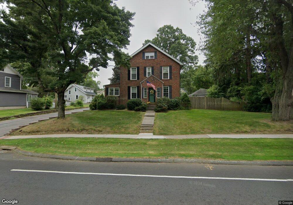
362 Wells Rd Wethersfield, CT 06109
Estimated Value: $426,000 - $493,000
2
Beds
2
Baths
1,811
Sq Ft
$250/Sq Ft
Est. Value
About This Home
This home is located at 362 Wells Rd, Wethersfield, CT 06109 and is currently estimated at $453,344, approximately $250 per square foot. 362 Wells Rd is a home located in Hartford County with nearby schools including Emerson-Williams School, Silas Deane Middle School, and Wethersfield High School.
Ownership History
Date
Name
Owned For
Owner Type
Purchase Details
Closed on
Apr 7, 2025
Sold by
Johnson Edward S
Bought by
Edward S Johnson Ret and Johnson
Current Estimated Value
Purchase Details
Closed on
Jun 28, 2004
Sold by
Ouellette Angela and Ouellette David
Bought by
Johnson Edward S
Purchase Details
Closed on
Jul 1, 1997
Sold by
Citcorp Mtg Inc
Bought by
Kutuzar Shelley A and Kutuzar Dmitri
Purchase Details
Closed on
Jan 4, 1991
Sold by
Lerch Horst A
Bought by
Skorupski Charmane C
Create a Home Valuation Report for This Property
The Home Valuation Report is an in-depth analysis detailing your home's value as well as a comparison with similar homes in the area
Home Values in the Area
Average Home Value in this Area
Purchase History
| Date | Buyer | Sale Price | Title Company |
|---|---|---|---|
| Edward S Johnson Ret | -- | None Available | |
| Johnson Edward S | $225,000 | -- | |
| Kutuzar Shelley A | $85,000 | -- | |
| Skorupski Charmane C | $200,000 | -- |
Source: Public Records
Mortgage History
| Date | Status | Borrower | Loan Amount |
|---|---|---|---|
| Previous Owner | Skorupski Charmane C | $180,000 | |
| Previous Owner | Skorupski Charmane C | $192,000 |
Source: Public Records
Tax History
| Year | Tax Paid | Tax Assessment Tax Assessment Total Assessment is a certain percentage of the fair market value that is determined by local assessors to be the total taxable value of land and additions on the property. | Land | Improvement |
|---|---|---|---|---|
| 2025 | $11,247 | $272,860 | $93,800 | $179,060 |
| 2024 | $7,458 | $172,570 | $65,100 | $107,470 |
| 2023 | $7,210 | $172,570 | $65,100 | $107,470 |
| 2022 | $7,089 | $172,570 | $65,100 | $107,470 |
| 2021 | $7,018 | $172,570 | $65,100 | $107,470 |
| 2020 | $7,022 | $172,570 | $65,100 | $107,470 |
| 2019 | $7,031 | $172,570 | $65,100 | $107,470 |
| 2018 | $6,904 | $169,300 | $61,700 | $107,600 |
| 2017 | $6,733 | $169,300 | $61,700 | $107,600 |
| 2016 | $6,525 | $169,300 | $61,700 | $107,600 |
| 2015 | $6,466 | $169,300 | $61,700 | $107,600 |
| 2014 | $6,220 | $169,300 | $61,700 | $107,600 |
Source: Public Records
Map
Nearby Homes
Your Personal Tour Guide
Ask me questions while you tour the home.