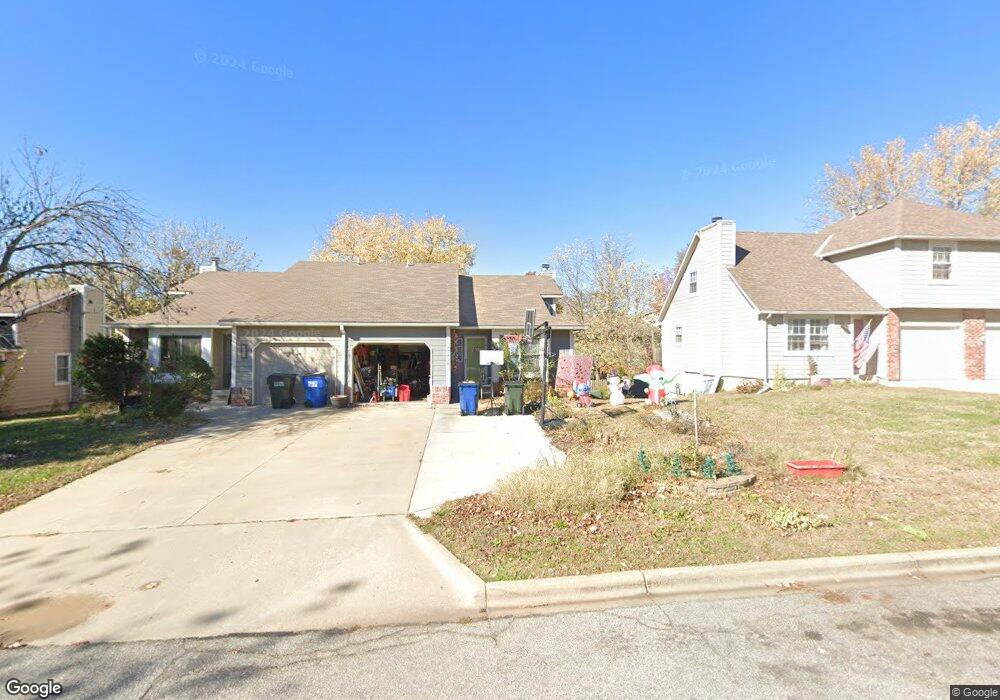
3638 W 10th St Lawrence, KS 66049
Perry Park NeighborhoodEstimated Value: $233,000 - $273,000
3
Beds
2
Baths
1,071
Sq Ft
$232/Sq Ft
Est. Value
About This Home
This home is located at 3638 W 10th St, Lawrence, KS 66049 and is currently estimated at $248,666, approximately $232 per square foot. 3638 W 10th St is a home located in Douglas County with nearby schools including Sunset Hill Elementary School, West Middle School, and Lawrence Free State High School.
Ownership History
Date
Name
Owned For
Owner Type
Purchase Details
Closed on
Feb 7, 2018
Sold by
Axman David and Axman David Anthony
Bought by
Mcglothern Ronald E and Mcglothern Kathleen
Current Estimated Value
Home Financials for this Owner
Home Financials are based on the most recent Mortgage that was taken out on this home.
Original Mortgage
$111,920
Outstanding Balance
$94,786
Interest Rate
3.99%
Mortgage Type
New Conventional
Estimated Equity
$153,880
Purchase Details
Closed on
Oct 31, 2016
Sold by
Axman David and Axman Cynthia
Bought by
Axman David
Purchase Details
Closed on
Apr 7, 2003
Sold by
Martin David E and Martin Virginia
Bought by
Axman David and Axman Cynthia
Home Financials for this Owner
Home Financials are based on the most recent Mortgage that was taken out on this home.
Original Mortgage
$70,000
Interest Rate
5.71%
Mortgage Type
Stand Alone First
Create a Home Valuation Report for This Property
The Home Valuation Report is an in-depth analysis detailing your home's value as well as a comparison with similar homes in the area
Home Values in the Area
Average Home Value in this Area
Purchase History
| Date | Buyer | Sale Price | Title Company |
|---|---|---|---|
| Mcglothern Ronald E | -- | Continental Title | |
| Axman David | -- | None Available | |
| Axman David | -- | Commerce Title |
Source: Public Records
Mortgage History
| Date | Status | Borrower | Loan Amount |
|---|---|---|---|
| Open | Mcglothern Ronald E | $111,920 | |
| Previous Owner | Axman David | $70,000 |
Source: Public Records
Tax History
| Year | Tax Paid | Tax Assessment Tax Assessment Total Assessment is a certain percentage of the fair market value that is determined by local assessors to be the total taxable value of land and additions on the property. | Land | Improvement |
|---|---|---|---|---|
| 2025 | $3,254 | $26,726 | $4,600 | $22,126 |
| 2024 | $3,093 | $25,448 | $4,025 | $21,423 |
| 2023 | $2,848 | $22,460 | $4,025 | $18,435 |
| 2022 | $2,866 | $22,413 | $2,878 | $19,535 |
| 2021 | $2,419 | $18,251 | $2,536 | $15,715 |
| 2020 | $2,224 | $16,894 | $3,164 | $13,730 |
| 2019 | $2,114 | $16,089 | $3,679 | $12,410 |
| 2018 | $2,238 | $16,894 | $3,679 | $13,215 |
| 2017 | $2,181 | $16,284 | $3,679 | $12,605 |
Source: Public Records
Map
Nearby Homes
- 916 Christie Ct
- 1011 Lakecrest Rd
- 904 Christie Ct
- 709 Joseph Dr
- 1039 Lakecrest Rd
- 3922 Willshire Dr
- 3412 W 9th Ct
- 3808 Pinnacle Cir
- 4207 Timberline Ct
- 1036 Holiday Dr
- 1113 Somerset Cir
- 1215 Hacienda Ln
- 3226 Cardinal Dr
- 503 Abilene St
- 819 Crawford Dr
- 317 Tallgrass Ct
- 807 Lawrence Ave
- 3921 Monterey Place
- 1008 Lawrence Ave
- 3415 Trail Rd
- 3640 W 10th St
- 3636 W 10th St
- 3634 W 10th St
- 3642 W 10th St
- 926 Christie Ct
- 935 Christie Ct
- 933 Christie Ct
- 3630 W 10th St
- 3644 W 10th St
- 924 Christie Ct
- 931 Christie Ct
- 922 Christie Ct
- 3632 W 10th St
- 3646 W 10th St
- 3633 W 10th St
- 3631 W 10th St
- 3639 W 10th St
- 3641 W 10th St
- 3635 W 10th St
- 920 Christie Ct
Your Personal Tour Guide
Ask me questions while you tour the home.