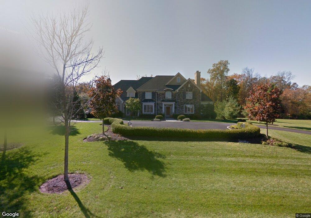
3642 Wellsford Ln Doylestown, PA 18902
Estimated Value: $1,973,061 - $2,419,000
4
Beds
6
Baths
5,833
Sq Ft
$373/Sq Ft
Est. Value
About This Home
This home is located at 3642 Wellsford Ln, Doylestown, PA 18902 and is currently estimated at $2,175,354, approximately $372 per square foot. 3642 Wellsford Ln is a home located in Bucks County with nearby schools including Cold Spring Elementary School, Holicong Middle School, and Central Bucks High School - East.
Ownership History
Date
Name
Owned For
Owner Type
Purchase Details
Closed on
Apr 7, 2006
Sold by
Wells Nancy G
Bought by
Marcino Robert A and Marcino Kathleen M
Current Estimated Value
Purchase Details
Closed on
Apr 28, 2005
Sold by
Wells George H and Wells Nancy G
Bought by
Wells Nancy G
Create a Home Valuation Report for This Property
The Home Valuation Report is an in-depth analysis detailing your home's value as well as a comparison with similar homes in the area
Home Values in the Area
Average Home Value in this Area
Purchase History
| Date | Buyer | Sale Price | Title Company |
|---|---|---|---|
| Marcino Robert A | $425,000 | None Available | |
| Wells Nancy G | -- | -- |
Source: Public Records
Tax History
| Year | Tax Paid | Tax Assessment Tax Assessment Total Assessment is a certain percentage of the fair market value that is determined by local assessors to be the total taxable value of land and additions on the property. | Land | Improvement |
|---|---|---|---|---|
| 2025 | $23,209 | $142,550 | $20,090 | $122,460 |
| 2024 | $23,209 | $142,550 | $20,090 | $122,460 |
| 2023 | $22,422 | $142,550 | $20,090 | $122,460 |
| 2022 | $22,154 | $142,550 | $20,090 | $122,460 |
| 2021 | $21,889 | $142,550 | $20,090 | $122,460 |
| 2020 | $21,889 | $142,550 | $20,090 | $122,460 |
| 2019 | $21,746 | $142,550 | $20,090 | $122,460 |
| 2018 | $21,746 | $142,550 | $20,090 | $122,460 |
| 2017 | $21,568 | $142,550 | $20,090 | $122,460 |
| 2016 | $21,782 | $142,550 | $20,090 | $122,460 |
| 2015 | -- | $142,550 | $20,090 | $122,460 |
| 2014 | -- | $142,550 | $20,090 | $122,460 |
Source: Public Records
Map
Nearby Homes
- 3525 Wellsford Ln
- 5491 Long Ln
- 6185 Mechanicsville Rd
- 3219 Indian Walk
- 5693 Cottageville Ln
- 3468 Holicong Rd
- 5087 Raintree Ct
- 3479 Durham Rd
- 5829 Ridgeview Dr
- 5805 Ridgeview Dr
- 5455 Mcginnis Ct
- 2905 Ash Mill Rd
- 6163 Carversville Rd
- 3805 E Brandon Way
- 5052 Grundy Way
- 21 Woods End Dr
- 29 Juniper Ct
- 4857 Indigo Dr
- 3039 Durham Rd
- 21 Bellinghamshire Place
- 3624 Wellsford Ln
- 3660 Wellsford Ln
- 3669 Wellsford Ln
- 3678 Wellsford Ln
- 3685 Wellsford Ln
- 3588 Wellsford Ln
- 3647 Indian Springs Rd
- 3570 Wellsford Ln
- 3689 Wellsford Ln Wellsford Ln
- 3552 Wellsford Ln
- 3615 Indian Springs Rd
- 5598 Bittersweet Ln
- 3579 Wellsford Ln
- 5588 Bittersweet Ln
- 3561 Indian Springs Rd
- 5591 Bittersweet Ln
- 3534 Wellsford Ln
- 0 Wellsford Ln Unit 1000242451
- 0 Wellsford Ln Unit 1000242517
Your Personal Tour Guide
Ask me questions while you tour the home.