Estimated Value: $292,191 - $452,000
3
Beds
2
Baths
960
Sq Ft
$355/Sq Ft
Est. Value
About This Home
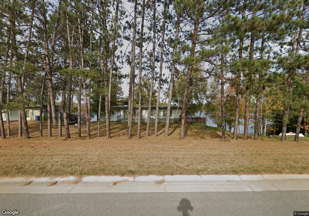
This home is located at 3643 Highway 169, Ely, MN 55731 and is currently estimated at $340,548, approximately $354 per square foot. 3643 Highway 169 is a home located in St. Louis County with nearby schools including Tower-Soudan Elementary School.
Ownership History
Date
Name
Owned For
Owner Type
Purchase Details
Closed on
Sep 17, 2015
Sold by
Embacher Max and Embacher Brandl
Bought by
Huntington Dewayne E and Huntington Margaret
Current Estimated Value
Home Financials for this Owner
Home Financials are based on the most recent Mortgage that was taken out on this home.
Original Mortgage
$148,500
Interest Rate
3.91%
Mortgage Type
New Conventional
Purchase Details
Closed on
Jun 6, 2012
Sold by
Federal National Mortgage Association
Bought by
Embacher Maxwell
Purchase Details
Closed on
Jan 4, 2012
Sold by
Nelson Brian R
Bought by
Wells Fargo Bank N A
Create a Home Valuation Report for This Property
The Home Valuation Report is an in-depth analysis detailing your home's value as well as a comparison with similar homes in the area
Purchase History
| Date | Buyer | Sale Price | Title Company |
|---|---|---|---|
| Huntington Dewayne E | $165,000 | St Andrews Title & Exchange | |
| Embacher Maxwell | $85,000 | None Available | |
| Wells Fargo Bank N A | -- | None Available |
Source: Public Records
Mortgage History
| Date | Status | Borrower | Loan Amount |
|---|---|---|---|
| Previous Owner | Huntington Dewayne E | $148,500 |
Source: Public Records
Tax History
| Year | Tax Paid | Tax Assessment Tax Assessment Total Assessment is a certain percentage of the fair market value that is determined by local assessors to be the total taxable value of land and additions on the property. | Land | Improvement |
|---|---|---|---|---|
| 2024 | $2,058 | $217,400 | $107,800 | $109,600 |
| 2023 | $2,058 | $217,400 | $107,800 | $109,600 |
| 2022 | $2,132 | $212,300 | $107,800 | $104,500 |
| 2021 | $2,078 | $173,700 | $88,600 | $85,100 |
| 2020 | $2,374 | $173,700 | $88,600 | $85,100 |
| 2019 | $2,152 | $199,600 | $89,700 | $109,900 |
| 2018 | $2,212 | $185,200 | $85,300 | $99,900 |
| 2017 | $2,164 | $185,200 | $85,300 | $99,900 |
| 2016 | $2,598 | $185,200 | $85,300 | $99,900 |
| 2015 | $2,640 | $219,200 | $90,200 | $129,000 |
| 2014 | $2,445 | $219,200 | $90,200 | $129,000 |
Source: Public Records
Map
Nearby Homes
- 1859 Bobence Rd
- 3810 Mud Creek Rd
- 1346 Bear Head State Park Rd
- 3055 van Vac Rd
- 3297 NW Burntside Lake
- 2928 Rd
- TBD Waters Island
- X Waters Island
- XXXX Murray Forest Rd
- 2928 Waters Island
- 2928 Waters Island Unit Waters Island and Do
- 2734 Bear Island River Rd
- 2854 Blueberry Island
- 23XX Low Creek Rd
- 2713 Burntside Lake Rd
- XXX Olson Bay Trail
- 5248 Ely Island S
- 5262 Ely Island S
- 8644 Pulkinen Rd
- 24 2nd Ave
- 3643 Highway 169 Unit Clear Lake
- 3634 Wildgate Rd
- 3661 Highway 169
- 3615 Highway 169
- 3663 Highway 169
- 3630 Wildgate Rd
- 1857 Bobence Rd
- 3667 Highway 169
- 1855 Bobence Rd
- 3655 Wildgate Rd
- 3598 Highway 169
- 3612 Wildgate Rd
- 1859 Bobence Rd
- 1910 Grouse Ridge Rd
- 1873 Bobence Rd
- 3660 Highway 169
- 1881 Bobence Rd
- 3679 Highway 169
- 1911 Grouse Ridge Rd
- 1880 Bobence Rd
Your Personal Tour Guide
Ask me questions while you tour the home.