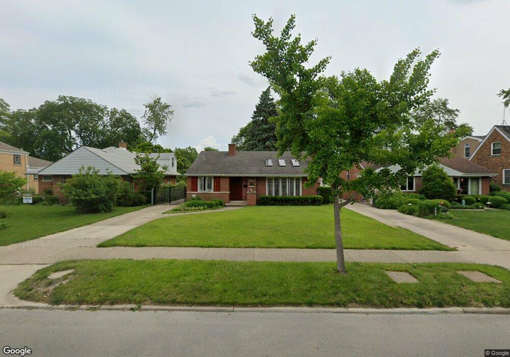
365 Desplaines Ave Riverside, IL 60546
Estimated Value: $319,000 - $411,000
2
Beds
1
Bath
994
Sq Ft
$370/Sq Ft
Est. Value
About This Home
This home is located at 365 Desplaines Ave, Riverside, IL 60546 and is currently estimated at $367,416, approximately $369 per square foot. 365 Desplaines Ave is a home located in Cook County with nearby schools including A F Ames Elementary School, L J Hauser Jr High School, and Riverside Brookfield High School.
Ownership History
Date
Name
Owned For
Owner Type
Purchase Details
Closed on
Jul 29, 1994
Sold by
Friess Boris and Friess Irene S
Bought by
Belice Randy L and Belice Paula I
Current Estimated Value
Home Financials for this Owner
Home Financials are based on the most recent Mortgage that was taken out on this home.
Original Mortgage
$136,000
Interest Rate
8.62%
Create a Home Valuation Report for This Property
The Home Valuation Report is an in-depth analysis detailing your home's value as well as a comparison with similar homes in the area
Home Values in the Area
Average Home Value in this Area
Purchase History
| Date | Buyer | Sale Price | Title Company |
|---|---|---|---|
| Belice Randy L | $160,000 | -- |
Source: Public Records
Mortgage History
| Date | Status | Borrower | Loan Amount |
|---|---|---|---|
| Closed | Belice Randy L | $136,000 |
Source: Public Records
Tax History Compared to Growth
Tax History
| Year | Tax Paid | Tax Assessment Tax Assessment Total Assessment is a certain percentage of the fair market value that is determined by local assessors to be the total taxable value of land and additions on the property. | Land | Improvement |
|---|---|---|---|---|
| 2024 | $8,623 | $30,271 | $8,300 | $21,971 |
| 2023 | $9,646 | $30,271 | $8,300 | $21,971 |
| 2022 | $9,646 | $28,605 | $7,263 | $21,342 |
| 2021 | $9,301 | $28,603 | $7,262 | $21,341 |
| 2020 | $9,763 | $30,526 | $7,262 | $23,264 |
| 2019 | $6,116 | $20,806 | $6,640 | $14,166 |
| 2018 | $5,934 | $20,806 | $6,640 | $14,166 |
| 2017 | $5,762 | $20,806 | $6,640 | $14,166 |
| 2016 | $6,366 | $20,575 | $5,810 | $14,765 |
| 2015 | $6,177 | $20,575 | $5,810 | $14,765 |
| 2014 | $6,090 | $20,575 | $5,810 | $14,765 |
| 2013 | $6,333 | $22,929 | $5,810 | $17,119 |
Source: Public Records
Map
Nearby Homes
- 2527 Keystone Ave
- 2513 Keystone Ave
- 472 Northgate Ct
- 2311 Park Ave
- 2245 Des Plaines Ave Unit B
- 2230 Keystone Ave
- 269 Shenstone Rd
- 339 Eastgrove Rd
- 2252 Northgate Ave
- 56 Forest Ave Unit 1N
- 2337 S 2nd Ave
- 78 Pine Ave
- 562 Byrd Rd
- 727 Selborne Rd
- 475 Shenstone Rd Unit 303
- 2914 Maple Ave
- 198 W Burlington St
- 3032 Wisconsin Ave
- 172 Olmsted Rd
- 2223 S 7th Ave
- 361 Desplaines Ave
- 369 Desplaines Ave
- 357 Desplaines Ave
- 373 Desplaines Ave
- 353 Desplaines Ave
- 377 Desplaines Ave
- 362 Northwood Rd
- 358 Northwood Rd
- 366 Bartram Rd
- 354 Northwood Rd
- 349 Desplaines Ave
- 381 Desplaines Ave
- 370 Bartram Rd
- 350 Northwood Rd
- 374 Bartram Rd
- 346 Northwood Rd
- 345 Desplaines Ave
- 385 Desplaines Ave
- 376 Bartram Rd
- 342 Northwood Rd