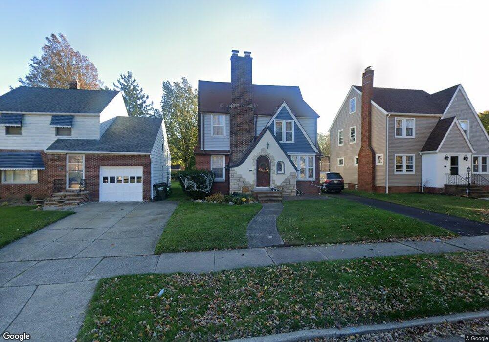
365 E 215th St Euclid, OH 44123
Estimated Value: $128,000 - $193,000
3
Beds
2
Baths
1,428
Sq Ft
$113/Sq Ft
Est. Value
About This Home
This home is located at 365 E 215th St, Euclid, OH 44123 and is currently estimated at $161,163, approximately $112 per square foot. 365 E 215th St is a home located in Cuyahoga County with nearby schools including Arbor Elementary School, Euclid Middle School, and Euclid High School.
Ownership History
Date
Name
Owned For
Owner Type
Purchase Details
Closed on
Nov 30, 1999
Sold by
Hopkins David A and Hopkins Molly
Bought by
Brazytis James C and Brazytis Lisa M
Current Estimated Value
Home Financials for this Owner
Home Financials are based on the most recent Mortgage that was taken out on this home.
Original Mortgage
$111,900
Outstanding Balance
$31,757
Interest Rate
7.97%
Estimated Equity
$129,406
Purchase Details
Closed on
Aug 18, 1995
Sold by
Verba Stephen M
Bought by
Hopkins David A and Hopkins Molly
Home Financials for this Owner
Home Financials are based on the most recent Mortgage that was taken out on this home.
Original Mortgage
$86,900
Interest Rate
7.64%
Mortgage Type
FHA
Purchase Details
Closed on
Nov 26, 1980
Sold by
Wehrle Margaret C
Bought by
Verba Stephen M
Purchase Details
Closed on
Jan 1, 1975
Bought by
Wehrle Margaret C
Create a Home Valuation Report for This Property
The Home Valuation Report is an in-depth analysis detailing your home's value as well as a comparison with similar homes in the area
Home Values in the Area
Average Home Value in this Area
Purchase History
We collect this data history from publicly available records. To have your information removed, we recommend requesting removal directly through your county’s website.
| Date | Buyer | Sale Price | Title Company |
|---|---|---|---|
| Brazytis James C | $118,000 | Standard Title Agency Inc | |
| Hopkins David A | $87,000 | -- | |
| Verba Stephen M | $65,000 | -- | |
| Wehrle Margaret C | -- | -- |
Source: Public Records
Mortgage History
We collect this data history from publicly available records. To have your information removed, we recommend requesting removal directly through your county’s website.
| Date | Status | Borrower | Loan Amount |
|---|---|---|---|
| Open | Brazytis James C | $111,900 | |
| Previous Owner | Hopkins David A | $86,900 |
Source: Public Records
Tax History
| Year | Tax Paid | Tax Assessment Tax Assessment Total Assessment is a certain percentage of the fair market value that is determined by local assessors to be the total taxable value of land and additions on the property. | Land | Improvement |
|---|---|---|---|---|
| 2025 | $3,289 | $49,455 | $9,100 | $40,355 |
| 2024 | $3,390 | $49,455 | $9,100 | $40,355 |
| 2023 | $2,667 | $30,700 | $6,580 | $24,120 |
| 2022 | $2,606 | $30,700 | $6,580 | $24,120 |
| 2021 | $2,905 | $30,700 | $6,580 | $24,120 |
| 2020 | $2,946 | $28,420 | $6,090 | $22,330 |
| 2019 | $2,649 | $81,200 | $17,400 | $63,800 |
| 2018 | $2,636 | $28,420 | $6,090 | $22,330 |
| 2017 | $2,818 | $25,030 | $5,080 | $19,950 |
| 2016 | $2,825 | $25,030 | $5,080 | $19,950 |
| 2015 | $2,571 | $25,030 | $5,080 | $19,950 |
| 2014 | $2,571 | $25,030 | $5,080 | $19,950 |
Source: Public Records
Map
Nearby Homes
- 21731 Maydale Ave
- 21790 Kennison Ave
- 367 E 211th St
- 22000 Kennison Ave
- 414 E 222nd St
- 275 E 210th St
- 285 E 216th St
- 350 E 210th St
- 273 E 208th St
- 422 Clearview Dr Unit J10
- 421 Kenwood Dr Unit G
- 21570 Priday Ave
- 336 E 222nd St
- 21000 Crystal Ave
- 21270 Priday Ave
- 442 Clearview Dr Unit U9
- 20980 Priday Ave
- 461 Kenwood Dr Unit T3
- 174 E 208th St
- 22751 Fox Ave
- 371 E 215th St
- 361 E 215th St
- 21531 Maydale Ave
- 355 E 215th St
- 351 E 215th St
- 381 E 215th St
- 21601 Maydale Ave
- 21520 Roberts Ave
- 366 E 215th St
- 360 E 215th St
- 372 E 215th St
- 21560 Roberts Ave
- 345 E 215th St
- 354 E 215th St
- 385 E 215th St
- 376 E 215th St
- 21631 Maydale Ave
- 21530 Maydale Ave
- 21600 Roberts Ave
- 350 E 215th St
Your Personal Tour Guide
Ask me questions while you tour the home.