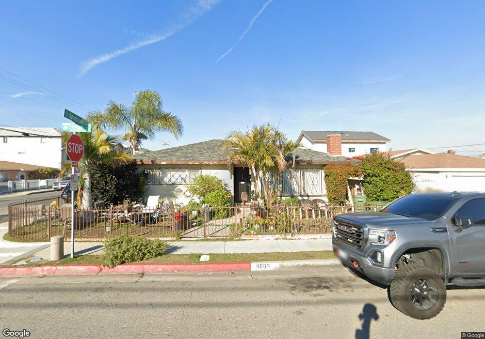
3655 W 132nd St Hawthorne, CA 90250
Estimated Value: $685,809 - $744,000
3
Beds
2
Baths
1,224
Sq Ft
$595/Sq Ft
Est. Value
About This Home
This home is located at 3655 W 132nd St, Hawthorne, CA 90250 and is currently estimated at $727,952, approximately $594 per square foot. 3655 W 132nd St is a home located in Los Angeles County with nearby schools including Kornblum School, Bud Carson Middle School, and Leuzinger High School.
Ownership History
Date
Name
Owned For
Owner Type
Purchase Details
Closed on
May 31, 2011
Sold by
Deutsche Bank National Trust Company
Bought by
Luu Calvin and Luong Linh Thuy
Current Estimated Value
Purchase Details
Closed on
Oct 28, 2010
Sold by
Yuman Alfonso Dejesus
Bought by
Deutsche Bank National Trust Company
Purchase Details
Closed on
Sep 3, 2010
Sold by
Diesel Enterprises Inc
Bought by
Diesel Enterprises Inc
Purchase Details
Closed on
Mar 30, 2010
Sold by
H & S Holdings Company Llc
Bought by
Diesel Enterprises Inc
Purchase Details
Closed on
Dec 3, 2009
Sold by
Yuman Alfonso Dejesus
Bought by
H & S Holdings Company Llc
Purchase Details
Closed on
Mar 3, 2005
Sold by
Hernandez Maria
Bought by
Yuman Alfonso De Jesus and Yuman Erica E
Home Financials for this Owner
Home Financials are based on the most recent Mortgage that was taken out on this home.
Original Mortgage
$391,500
Interest Rate
5.09%
Mortgage Type
Purchase Money Mortgage
Purchase Details
Closed on
Oct 15, 2003
Sold by
Diaz Mireya
Bought by
Hernandez Maria
Home Financials for this Owner
Home Financials are based on the most recent Mortgage that was taken out on this home.
Original Mortgage
$147,000
Interest Rate
6.14%
Mortgage Type
Purchase Money Mortgage
Purchase Details
Closed on
Jul 15, 1998
Sold by
Federal National Mortgage Association
Bought by
Hernandez Maria and Diaz Mireya
Home Financials for this Owner
Home Financials are based on the most recent Mortgage that was taken out on this home.
Original Mortgage
$140,550
Interest Rate
6.95%
Mortgage Type
Seller Take Back
Purchase Details
Closed on
Mar 23, 1998
Sold by
Verances Magnito B and Verances Gloria C
Bought by
Federal National Mortgage Association
Purchase Details
Closed on
Jul 30, 1996
Sold by
Verances Magnito B and Verances Gloria C
Bought by
Pacific Properties Inc
Purchase Details
Closed on
Nov 2, 1994
Sold by
Lopez Raul
Bought by
Lopez Raul and Lopez Paula Gisela
Create a Home Valuation Report for This Property
The Home Valuation Report is an in-depth analysis detailing your home's value as well as a comparison with similar homes in the area
Home Values in the Area
Average Home Value in this Area
Purchase History
| Date | Buyer | Sale Price | Title Company |
|---|---|---|---|
| Luu Calvin | $230,000 | Lsi Title Company Ca | |
| Deutsche Bank National Trust Company | $261,460 | Accommodation | |
| Diesel Enterprises Inc | -- | None Available | |
| Diesel Enterprises Inc | -- | None Available | |
| H & S Holdings Company Llc | -- | None Available | |
| Yuman Alfonso De Jesus | $435,000 | Commonwealth Title | |
| Hernandez Maria | -- | Act | |
| Hernandez Maria | $145,000 | American Title Co | |
| Federal National Mortgage Association | $149,000 | -- | |
| Pacific Properties Inc | -- | -- | |
| Lopez Raul | -- | -- |
Source: Public Records
Mortgage History
| Date | Status | Borrower | Loan Amount |
|---|---|---|---|
| Previous Owner | Yuman Alfonso De Jesus | $391,500 | |
| Previous Owner | Hernandez Maria | $147,000 | |
| Previous Owner | Hernandez Maria | $140,550 |
Source: Public Records
Tax History
| Year | Tax Paid | Tax Assessment Tax Assessment Total Assessment is a certain percentage of the fair market value that is determined by local assessors to be the total taxable value of land and additions on the property. | Land | Improvement |
|---|---|---|---|---|
| 2025 | $3,988 | $294,660 | $256,230 | $38,430 |
| 2024 | $3,988 | $288,883 | $251,206 | $37,677 |
| 2023 | $3,852 | $283,220 | $246,281 | $36,939 |
| 2022 | $3,903 | $277,667 | $241,452 | $36,215 |
| 2021 | $3,849 | $272,223 | $236,718 | $35,505 |
| 2019 | $3,720 | $264,150 | $229,698 | $34,452 |
| 2018 | $3,549 | $258,972 | $225,195 | $33,777 |
| 2016 | $3,386 | $248,917 | $216,451 | $32,466 |
| 2015 | $3,312 | $245,179 | $213,200 | $31,979 |
| 2014 | $3,299 | $240,377 | $209,024 | $31,353 |
Source: Public Records
Map
Nearby Homes
- 3501 W 133rd St
- 12612 Kornblum Ave
- 13025 Roselle Ave
- 3512 W 135th St
- 12940 Prairie Ave
- 3237 W 132nd St
- 14429 Chardon Ave Unit 41
- 4055 W 129th St
- 13717 Chadron Ave
- 14002 Cerise Ave Unit 11
- 14012 Cerise Ave Unit 3
- 12526 Menlo Ave
- 14110 Yukon Ave
- 12618 Freeman Ave
- 4302 W 133rd St
- 13957 Lemoli Ave
- 2915 W 129th Place
- 12115 York Ave Unit 2
- 3225 W Rosecrans Ave
- 4203 W 141st St
- 3651 W 132nd St
- 13120 Kornblum Ave
- 3703 W 132nd St
- 3649 W 132nd St
- 13116 Kornblum Ave
- 3707 W 132nd St
- 3656 W 132nd St
- 13112 Kornblum Ave
- 3641 W 132nd St
- 3650 W 132nd St
- 13201 Kornblum Ave
- 3711 W 132nd St
- 13108 Kornblum Ave
- 3644 W 132nd St
- 3637 W 132nd St
- 13207 Kornblum Ave
- 13106 1/4 Kornblum Ave
- 3640 W 132nd St
- 3715 W 132nd St
- 13104 Kornblum Ave