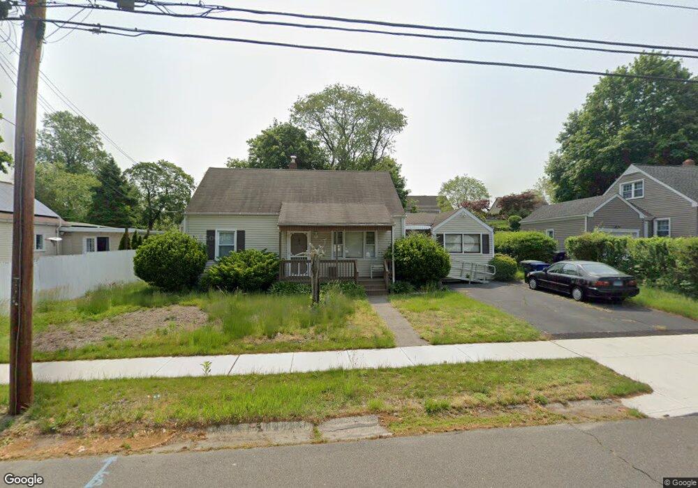
366 Hooker Rd Bridgeport, CT 06610
North Bridgeport NeighborhoodEstimated Value: $326,000 - $420,866
3
Beds
2
Baths
1,563
Sq Ft
$243/Sq Ft
Est. Value
About This Home
This home is located at 366 Hooker Rd, Bridgeport, CT 06610 and is currently estimated at $379,622, approximately $242 per square foot. 366 Hooker Rd is a home located in Fairfield County with nearby schools including Hooker School and Harding High School.
Ownership History
Date
Name
Owned For
Owner Type
Purchase Details
Closed on
Nov 22, 2023
Sold by
Silva Carlos A
Bought by
Silva Carlos A and Silva Iolanda P
Current Estimated Value
Purchase Details
Closed on
Sep 22, 2023
Sold by
Brown Michaeline J
Bought by
Silva Carlos A
Purchase Details
Closed on
Jun 19, 1967
Bought by
Brown Richard A and Brown Michaeline
Create a Home Valuation Report for This Property
The Home Valuation Report is an in-depth analysis detailing your home's value as well as a comparison with similar homes in the area
Home Values in the Area
Average Home Value in this Area
Purchase History
| Date | Buyer | Sale Price | Title Company |
|---|---|---|---|
| Silva Carlos A | -- | None Available | |
| Silva Carlos A | -- | None Available | |
| Silva Carlos A | $100,000 | None Available | |
| Silva Carlos A | $100,000 | None Available | |
| Brown Richard A | -- | -- |
Source: Public Records
Mortgage History
| Date | Status | Borrower | Loan Amount |
|---|---|---|---|
| Previous Owner | Brown Richard A | $10,200 |
Source: Public Records
Tax History
| Year | Tax Paid | Tax Assessment Tax Assessment Total Assessment is a certain percentage of the fair market value that is determined by local assessors to be the total taxable value of land and additions on the property. | Land | Improvement |
|---|---|---|---|---|
| 2025 | $6,177 | $142,160 | $65,700 | $76,460 |
| 2024 | $6,177 | $142,160 | $65,700 | $76,460 |
| 2023 | $6,177 | $142,160 | $65,700 | $76,460 |
| 2022 | $6,177 | $142,160 | $65,700 | $76,460 |
| 2021 | $6,177 | $142,160 | $65,700 | $76,460 |
| 2020 | $6,444 | $119,350 | $53,890 | $65,460 |
| 2019 | $6,444 | $119,350 | $53,890 | $65,460 |
| 2018 | $6,489 | $119,350 | $53,890 | $65,460 |
| 2017 | $6,489 | $119,350 | $53,890 | $65,460 |
| 2016 | $6,489 | $119,350 | $53,890 | $65,460 |
| 2015 | $6,333 | $150,080 | $52,650 | $97,430 |
| 2014 | $6,333 | $150,080 | $52,650 | $97,430 |
Source: Public Records
Map
Nearby Homes
- 3699 Broadbridge Ave Unit 330
- 3699 Broadbridge Ave Unit 101
- 11 Knollcrest Dr
- 119 Jennings Ave
- 120 Huntington Turnpike Unit 202
- 285 Hillcrest Rd
- 250 Dayton Rd
- 132 Virginia Ave Unit 132
- 211 Louisiana Ave Unit D
- 186 Louisiana Ave Unit D
- 207 Hillcrest Rd
- 11 Nob Hill Cir
- 261 Pennsylvania Ave
- 156 Dayton Rd
- 154 Virginia Ave Unit B
- 33 Louisiana Ave Unit 35
- 74 Hollywood Ave
- 60 Quail Trail
- 9 Sunnyridge Pkwy
- 72 Broadmere Rd
- 74 Lynne Place
- 350 Hooker Rd
- 98 Lynne Place
- 338 Hooker Rd
- 371 Hooker Rd
- 355 Hooker Rd
- 349 Roger Williams Rd
- 319 Roger Williams Rd
- 385 Hooker Rd
- 339 Hooker Rd
- 333 Roger Williams Rd
- 322 Hooker Rd
- 410 Hooker Rd
- 89 Lynne Place
- 399 Hooker Rd
- 305 Roger Williams Rd
- 350 Roger Williams Rd
- 329 Hooker Rd
- 105 Lynne Place
- 310 Hooker Rd
Your Personal Tour Guide
Ask me questions while you tour the home.