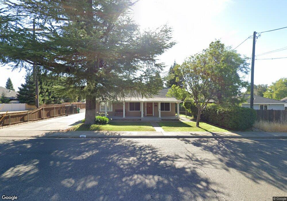
3663 Rhonda Rd Cottonwood, CA 96022
Estimated Value: $366,000 - $432,000
4
Beds
2
Baths
1,986
Sq Ft
$204/Sq Ft
Est. Value
About This Home
This home is located at 3663 Rhonda Rd, Cottonwood, CA 96022 and is currently estimated at $405,201, approximately $204 per square foot. 3663 Rhonda Rd is a home located in Shasta County with nearby schools including North Cottonwood, West Cottonwood Junior High School, and Cottonwood Creek Charter School.
Ownership History
Date
Name
Owned For
Owner Type
Purchase Details
Closed on
Sep 11, 2003
Sold by
Va
Bought by
Drake Richard L and Drake Charlene K
Current Estimated Value
Home Financials for this Owner
Home Financials are based on the most recent Mortgage that was taken out on this home.
Original Mortgage
$125,000
Interest Rate
6.27%
Mortgage Type
Unknown
Create a Home Valuation Report for This Property
The Home Valuation Report is an in-depth analysis detailing your home's value as well as a comparison with similar homes in the area
Home Values in the Area
Average Home Value in this Area
Purchase History
| Date | Buyer | Sale Price | Title Company |
|---|---|---|---|
| Drake Richard L | -- | Chicago Title |
Source: Public Records
Mortgage History
| Date | Status | Borrower | Loan Amount |
|---|---|---|---|
| Closed | Drake Richard L | $125,000 |
Source: Public Records
Tax History Compared to Growth
Tax History
| Year | Tax Paid | Tax Assessment Tax Assessment Total Assessment is a certain percentage of the fair market value that is determined by local assessors to be the total taxable value of land and additions on the property. | Land | Improvement |
|---|---|---|---|---|
| 2025 | $2,744 | $257,489 | $36,937 | $220,552 |
| 2024 | $2,689 | $252,441 | $36,213 | $216,228 |
| 2023 | $2,689 | $247,492 | $35,503 | $211,989 |
| 2022 | $2,629 | $242,640 | $34,807 | $207,833 |
| 2021 | $2,614 | $237,883 | $34,125 | $203,758 |
| 2020 | $2,550 | $235,445 | $33,776 | $201,669 |
| 2019 | $2,519 | $230,829 | $33,114 | $197,715 |
| 2018 | $2,471 | $226,304 | $32,465 | $193,839 |
| 2017 | $2,476 | $221,868 | $31,829 | $190,039 |
| 2016 | $2,266 | $217,518 | $31,205 | $186,313 |
| 2015 | $2,277 | $214,252 | $30,737 | $183,515 |
| 2014 | $2,223 | $210,056 | $30,135 | $179,921 |
Source: Public Records
Map
Nearby Homes
- 3796 Country Estates Dr
- Lot 4 Rhonda Rd
- 20605 Beta Ct
- 20472 Robinson Glen Dr
- 3850 Main St Unit 4
- 3850 Main St Unit 23
- 3850 Main St Unit 17
- 3850 Main St Unit 22
- 0 Main St Unit 25-870
- 0 Main St Unit 25-715
- 20720 2nd St
- 16857 Gas Point Rd
- 20882 3rd St
- Lot 13 Castlewood Ln
- 3382 Willow St
- 3349 Willow St
- 20933 Foster St
- 20960 1st St
- 20280 Trefoil Ln
- 3393 Shirley St
- 20610 Mayfair Ct
- 20610 Mayfair 1weup7mr20t3
- 20630 Mayfair Ct
- 3676 Rhonda Rd
- 20605 Aiden Ct Unit Lot 1
- 20605 Aiden Ct
- 20625 Aiden Ct
- 20636 Mayfair Ct
- 20593 Linda Ln
- 20635 Aiden Ct
- 20625 Mayfair Ct
- 3651 Rhonda Rd
- 15 Aiden Ct
- 13 Aiden Ct
- Lot 17 Aiden Ct
- Lot 13 Aiden Ct
- Lot 7 Aiden Ct
- Lot 16 Aiden Ct
- Lot 1 Aiden Ct
- Lot 2 Aiden Ct