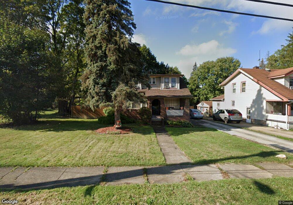
3676 Powers Way Youngstown, OH 44502
Buckeye Plat NeighborhoodEstimated Value: $64,415 - $106,000
2
Beds
1
Bath
1,680
Sq Ft
$47/Sq Ft
Est. Value
About This Home
This home is located at 3676 Powers Way, Youngstown, OH 44502 and is currently estimated at $78,604, approximately $46 per square foot. 3676 Powers Way is a home located in Mahoning County with nearby schools including Paul C. Bunn Elementary School, Chaney High School, and Summit Academy Secondary School - Youngstown.
Ownership History
Date
Name
Owned For
Owner Type
Purchase Details
Closed on
Nov 25, 2020
Sold by
Bartholomew Patricia A and Bartholomew Elmo Anthony
Bought by
Elmo Anthony G
Current Estimated Value
Purchase Details
Closed on
Sep 30, 1999
Sold by
Kish Cynthia L
Bought by
Davis Tina S
Home Financials for this Owner
Home Financials are based on the most recent Mortgage that was taken out on this home.
Original Mortgage
$39,900
Interest Rate
7.93%
Purchase Details
Closed on
Jul 1, 1994
Sold by
Elmo Anthony J
Bought by
Kish Cynthia L
Purchase Details
Closed on
Sep 11, 1987
Bought by
Elmo Anthony J
Create a Home Valuation Report for This Property
The Home Valuation Report is an in-depth analysis detailing your home's value as well as a comparison with similar homes in the area
Home Values in the Area
Average Home Value in this Area
Purchase History
| Date | Buyer | Sale Price | Title Company |
|---|---|---|---|
| Elmo Anthony G | -- | None Available | |
| Davis Tina S | $39,900 | -- | |
| Kish Cynthia L | $32,000 | -- | |
| Elmo Anthony J | $23,600 | -- |
Source: Public Records
Mortgage History
| Date | Status | Borrower | Loan Amount |
|---|---|---|---|
| Previous Owner | Davis Tina S | $39,900 |
Source: Public Records
Tax History Compared to Growth
Tax History
| Year | Tax Paid | Tax Assessment Tax Assessment Total Assessment is a certain percentage of the fair market value that is determined by local assessors to be the total taxable value of land and additions on the property. | Land | Improvement |
|---|---|---|---|---|
| 2024 | $597 | $12,500 | $690 | $11,810 |
| 2023 | $592 | $12,500 | $690 | $11,810 |
| 2022 | $352 | $5,700 | $690 | $5,010 |
| 2021 | $352 | $5,700 | $690 | $5,010 |
| 2020 | $354 | $5,700 | $690 | $5,010 |
| 2019 | $360 | $5,170 | $620 | $4,550 |
| 2018 | $364 | $5,170 | $620 | $4,550 |
| 2017 | $361 | $5,170 | $620 | $4,550 |
| 2016 | $573 | $8,870 | $620 | $8,250 |
| 2015 | $561 | $8,870 | $620 | $8,250 |
| 2014 | $557 | $8,870 | $620 | $8,250 |
| 2013 | $550 | $8,870 | $620 | $8,250 |
Source: Public Records
Map
Nearby Homes
- 2016 Pointview Ave
- 0 Crescent Dr Unit 5124984
- 2007 E Midlothian Blvd
- 1954 Everett Ave
- 2510 E Midlothian Blvd
- 3509 Lenox Ave
- 3448 Neilson Ave
- 2562 Mount Vernon Ave
- 1928 Medford Ave
- 0 Weston Ave
- 2577 E Midlothian Blvd
- 3337 Powers Way
- 2001 Brownlee Ave
- 1646 Weston Ave
- 2743 Mount Vernon Ave
- 1653 Brownlee Ave
- 1654 Wakefield Ave
- 3222 Sheridan Rd
- 440 5th St
- 1633 Wakefield Ave
- 3672 Powers Way
- 3668 Powers Way
- 3677 Neilson Ave
- 3673 Neilson Ave
- 3681 Neilson Ave
- 3658 Powers Way
- 3665 Neilson Ave
- 3685 Neilson Ave
- 3659 Powers Way
- 3661 Neilson Ave
- 3705 Loveland Rd
- 3656 Powers Way
- 3651 Neilson Ave
- 3711 Loveland Rd
- 3654 Powers Way
- 3704 Loveland Rd
- 3649 Powers Way
- 2032 Pointview Ave
- 3706 Loveland Rd
- 2111 Buckeye Cir