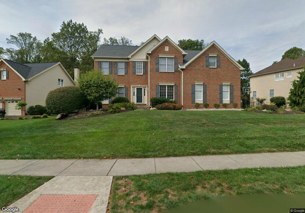
3682 Green Ridge Rd Furlong, PA 18925
Estimated Value: $995,000 - $1,034,000
4
Beds
3
Baths
3,343
Sq Ft
$304/Sq Ft
Est. Value
About This Home
This home is located at 3682 Green Ridge Rd, Furlong, PA 18925 and is currently estimated at $1,016,677, approximately $304 per square foot. 3682 Green Ridge Rd is a home located in Bucks County with nearby schools including Bridge Valley Elementary School, Holicong Middle School, and Central Bucks High School - East.
Ownership History
Date
Name
Owned For
Owner Type
Purchase Details
Closed on
Feb 14, 2002
Sold by
Toll Pa Lp
Bought by
Blady Andrew J and Blady Heather M
Current Estimated Value
Home Financials for this Owner
Home Financials are based on the most recent Mortgage that was taken out on this home.
Original Mortgage
$150,000
Outstanding Balance
$61,102
Interest Rate
6.85%
Estimated Equity
$955,575
Create a Home Valuation Report for This Property
The Home Valuation Report is an in-depth analysis detailing your home's value as well as a comparison with similar homes in the area
Home Values in the Area
Average Home Value in this Area
Purchase History
| Date | Buyer | Sale Price | Title Company |
|---|---|---|---|
| Blady Andrew J | $424,062 | -- |
Source: Public Records
Mortgage History
| Date | Status | Borrower | Loan Amount |
|---|---|---|---|
| Open | Blady Andrew J | $150,000 |
Source: Public Records
Tax History Compared to Growth
Tax History
| Year | Tax Paid | Tax Assessment Tax Assessment Total Assessment is a certain percentage of the fair market value that is determined by local assessors to be the total taxable value of land and additions on the property. | Land | Improvement |
|---|---|---|---|---|
| 2025 | $9,938 | $61,040 | $12,680 | $48,360 |
| 2024 | $9,938 | $61,040 | $12,680 | $48,360 |
| 2023 | $9,601 | $61,040 | $12,680 | $48,360 |
| 2022 | $9,486 | $61,040 | $12,680 | $48,360 |
| 2021 | $9,373 | $61,040 | $12,680 | $48,360 |
| 2020 | $9,373 | $61,040 | $12,680 | $48,360 |
| 2019 | $9,312 | $61,040 | $12,680 | $48,360 |
| 2018 | $9,312 | $61,040 | $12,680 | $48,360 |
| 2017 | $9,235 | $61,040 | $12,680 | $48,360 |
| 2016 | $9,327 | $61,040 | $12,680 | $48,360 |
| 2015 | -- | $61,040 | $12,680 | $48,360 |
| 2014 | -- | $61,040 | $12,680 | $48,360 |
Source: Public Records
Map
Nearby Homes
- 3772 Powder Horn Dr
- 3657 Powder Horn Dr
- lot #3 next to 3739 York Rd
- 2209 Swamp Rd
- 1948 Forest Grove Rd
- 2479 Wheatfield Ln
- 2080 Bedfordshire Rd
- 0 Old York Rd Unit PABU2103356
- 4549 Lower Mountain Rd
- 3889 Robin Rd
- 106 Saddle Dr
- 2372 Dorchester St W Unit W
- 2728 Red Gate Dr
- 3060 Cloverly Dr
- 3017 Dorchester St E Unit 125
- 1908 Durham Rd
- 4448 Lower Mountain Rd
- 2443 Sugar Bottom Rd
- 547 Mccarty Dr
- 3775 Buckingham Dr
- 3686 Green Ridge Rd
- 3678 Green Ridge Rd
- 3690 Green Ridge Rd
- 3674 Green Ridge Rd
- 2280 Red Barn Dr
- 3797 Forest Hill Dr
- 2275 Red Barn Dr
- 3670 Green Ridge Rd
- 3796 Forest Hill Dr
- 3801 Forest Hill Dr
- 3696 Green Ridge Rd
- 2263 Red Barn Dr
- 3791 Powder Horn Dr
- 3787 Powder Horn Dr
- 3802 Forest Hill Dr
- 3693 Green Ridge Rd
- 2265 Hedgerow Ln
- 3671 Hedgerow Ln
- 3781 Powder Horn Dr
- 2256 Red Barn Dr